Subject: North America
Period: 1721 (circa)
Publication: Osborne's Voyages
Color: Black & White
Size:
9.7 x 7 inches
24.6 x 17.8 cm
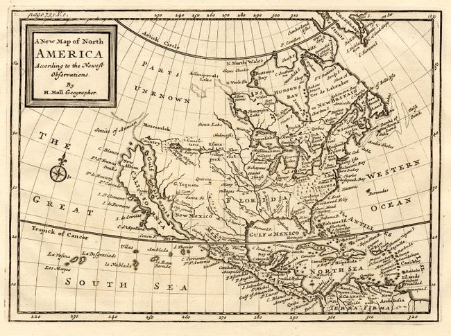
Rarely seen copper engraved map extending to include the West Indies and northern South America. The island of California dominates the west coast with the Straits of Anian, Mozeemlek Country, and Parts Unknown shown above the island. The British Colonies are confined east of the Mississippi River with Florida occupying all of the present southern U.S. Lake Superior is simply named Upper Lake. Lahontan's mythical Longue River stretches between two lakes in the west, with a notation of "Many villages on the islands" in the most western lake. Compass rose in the Great South Sea.
References: cf McLaughlin #200 (Dutch edition).
Condition: A+
Beautiful impression on thick hand-laid paper with wide margins.