Catalog Archive
Auction 108, Lot 584

"Japan, reduced from a Japanese Map.", Weller, E.
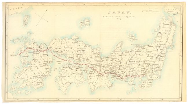
Subject: Japan

Period: 1862 (circa)

Publication:

Color: Hand Color

Size:
14.5 x 8 inches
36.8 x 20.3 cm
Download High Resolution Image
(or just click on image to launch the Zoom viewer)

A simple but quite accurate map of Japan showing the boundaries of the provinces, roads, fortresses and the Capitals of the Daimios. The route from Nagasaki to the court of the shogun in Yedo is shown in red.

References:

Condition: B

Issued folded with close trimmed top and bottom margins. Backed with archival tissue.

Estimate: $80 - $100

Sold for: $50

Closed on 9/29/2004

Archived