Subject: Asia
Period: 1787 (circa)
Publication: Raynal’s Atlas de Toutes les Parties Connues du Globe Terrestre
Color: Hand Color
Size:
12.7 x 8.2 inches
32.3 x 20.8 cm
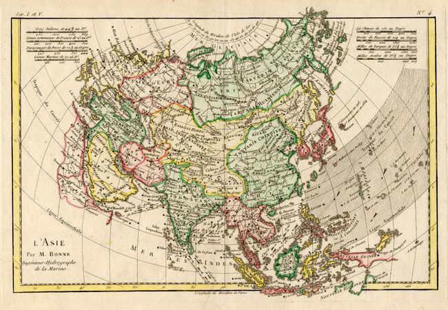
Nice map of Asia with detail of the countries from Nova Zemla and the Bering Strait in the north to Madagascar and Australia in the south. The outline of Asia is typical of the period with a few revisions and innovations. A group of islands due east of Japan is noted as being discovered in 1664 and 1716. Another group of islands off the east coast of Kamchatka is identified as the Archipel du Nord, noted as discovered by the Russians in 1740. Though their position is too far west these are probably part of the Aleutian Islands. The Carolines, or Nouvelle Philippines, are also misplaced too far to the west. Arrows indicate the monsoon winds in the Indian Ocean and South China Sea. Distance scales records a variety of different measurements: the Indian coss; the French lieue; the Persian parasange; the Chinese li; Russian verst; and Turkish and Arab miles.
References: Yeo, #180.
Condition: A