Subject: Scotland
Period: 1654 (circa)
Publication: Theatrum Orbis Terrarum, V
Color: Hand Color
Size:
20.5 x 16 inches
52.1 x 40.6 cm
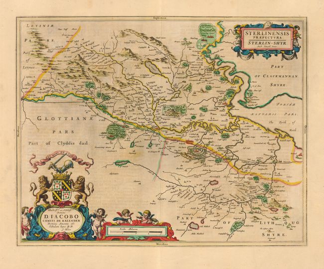
Splendid example of Blaeu's copper engraving from his atlas devoted to Scotland after surveys by Timothy Pont. The map covers Stirling County and provides information on the rivers, mountains, forests, cities, villages and numerous castles and abbeys. Dominating the upper part of the map are the town of Stirling (Starling), with its bridge over the Forth, and Stirling Castle (Starling Castel), surrounded by its park. A royal burgh from 1124, Stirling was both royal residence and center of government in the 15th and 16th centuries. The map is richly embellished with title and dedication cartouches, and scale of miles featuring the royal coat of arms and numerous cherubs.
References:
Condition: B
Very fine old color. Slight uneven toning, else very good.