Catalog Archive
Auction 108, Lot 306

"Tab. I. Europae, Continens Albion, Britanniam, et Hiberniam", Ptolemy/Mercator
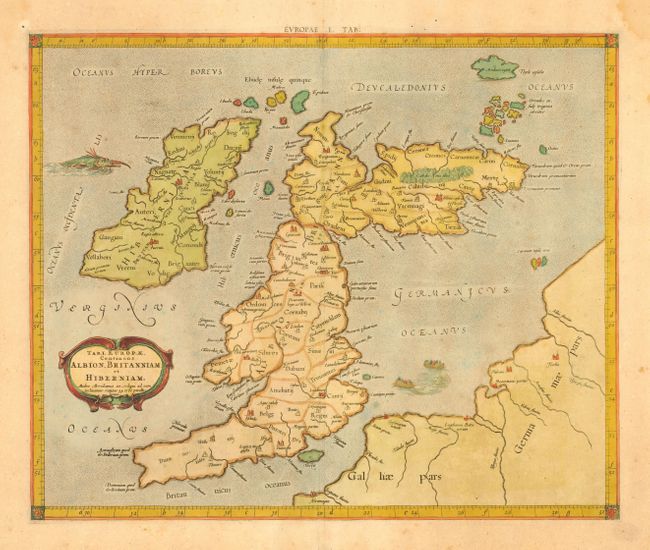
Subject: Britain

Period: 1695 (circa)

Publication: Claudii Ptolemaei Tabulae Geographicae Orbis Terrarum

Color: Hand Color

Size:
16 x 13.2 inches
40.6 x 33.5 cm
Download High Resolution Image
(or just click on image to launch the Zoom viewer)

A fine Ptolemaic map of the British Isles showing ancient place names and divisions. Scotland is shown with its distinctive east-west orientation. The map is decorated with a strapwork title cartouche, sea monster and a fishing scene in the North Sea.

References: Shirley, (BI) #123.

Condition: B

Lightly toned with a bit of minor foxing. Light damp stains in blank margins, not affecting map.

Estimate: $550 - $650

Sold for: $450

Closed on 9/29/2004

Archived