Subject: English Channel
Period: 1725 (circa)
Publication:
Color: Hand Color
Size:
22.2 x 18.8 inches
56.4 x 47.8 cm
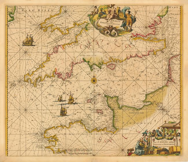
Magnificent chart of the channel and portions of England and France. Filled with rhumb lines and soundings, anchorage locations, hazards, etc. Embellished with a number of very fine sailing vessels, two large and elaborate cartouches and a compass rose. The Latin title is in a cartouche decorated by a figure of Neptune and other mythological figures. The Dutch title is in a cartouche decorated with a merchant and his wares, and a winemaking scene. This map was originally made and published by Frederick de Wit. The plate was acquired by the Ottens brothers after the death of De Wit's son in 1706. Following the general custom of the time, the Ottens erased the De Wit imprint, replacing it with their own.
References:
Condition: B
Lightly toned with slight oxidation of fine original color and a few faint spots. Light mat burn and a couple of tiny repairs in blank margins.