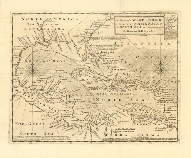
Subject: Gulf of Mexico and Caribbean
Period: 1740 (circa)
Publication:
Color: Black & White
Size:
14 x 11 inches
35.6 x 27.9 cm
Very uncommon map covering the present-day southern U.S., Central America, the Caribbean and northern South America with an inset of Vera Cruz. The map is filled with fascinating notations concerning the movements of Spain's wealthy galleons, such as "The Gallions & Flota usually joining at the Havana, ye whole Armada sails forth for Spain through this Gulf." This route took them into British waters off the coast of Carolina. Directions of trade winds, two compass roses, and rhumb lines make this a very attractive map.
This is the later edition that was issued to show the theater for the War of Jenkins's Ear. Relations deteriorated between Spain and England over logging issues in Honduras and the perception by the English that the Spanish were restricting their access to the slave trade in the West Indies. This friction was aggravated by a continuing dispute over the border between Spanish Florida and Georgia. Prime Minister Walpole declared war on Spain in October, 1739.
References:
Condition: A
On fine hand-laid paper with wide margins.