Subject: Texas & New Mexico
Period: 1854-56 (dated)
Publication: U.S. Pacific Railroad Surveys
Color: Black & White
Size:
57.5 x 28 inches
146.1 x 71.1 cm
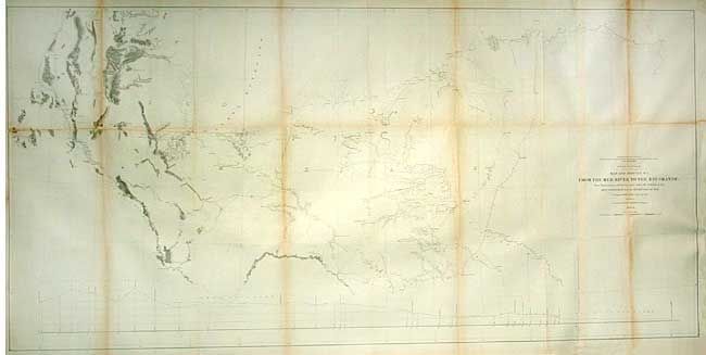
During the 1850s, the U.S. government sponsored an extensive series of expeditions designed to gather information on the vast new territories that had been acquired in western North America. The discovery of gold in California further stimulated westward traffic and heightened the need for a faster and more convenient way to bring the far-flung parts of the country together. In 1853 Congress commissioned the Army's Topographic Bureau to conduct a series of surveys to find a suitable route for a transcontinental railroad. There were six major expeditions; five of them covered the area between the Great Plains and west coast, and the sixth explored the coastal states of California and Oregon. All of these expeditions were accompanied by naturalists and artists to document the landscape, flora and fauna along the route.
The reports, maps and lithographs were published in the 13 volume report "Explorations and Surveys to ascertain the most practicable and economical route for a Railroad from the Mississippi river to the Pacific Ocean."
Map detailing West Texas and the Panhandle region from the route near the 32nd parallel portion of the railroad surveys. Includes the region from San Antonio de Bexar, Austin and Dallas in the east and well into New Mexico Territory to show Las Cruces and Forts Thorn and Craig. Excellent topographical and watershed detail along Pope's exploration routes with camps shown. Locates numerous forts, ruins, springs, river crossings, mines, etc. For several years following this expedition Pope attempted to develop artesian wells in the Staked Plains.
References: Wheat (TMW) #898.
Condition: B
Toned along some folds. Issued folding now tissue backed. Two fold intersections with small areas of loss. Binding side close with paper laid in and neatline professionally done in facsimile along lower half of left side.