Subject: World and Continents
Period: 1705-17 (dated)
Publication:
Color: Hand Color
Size:
13.4 x 9 inches
34 x 22.9 cm
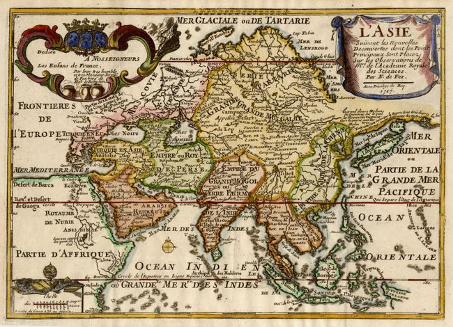
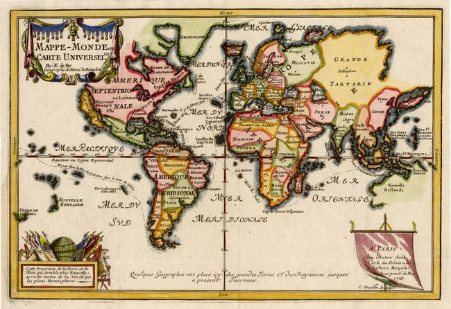
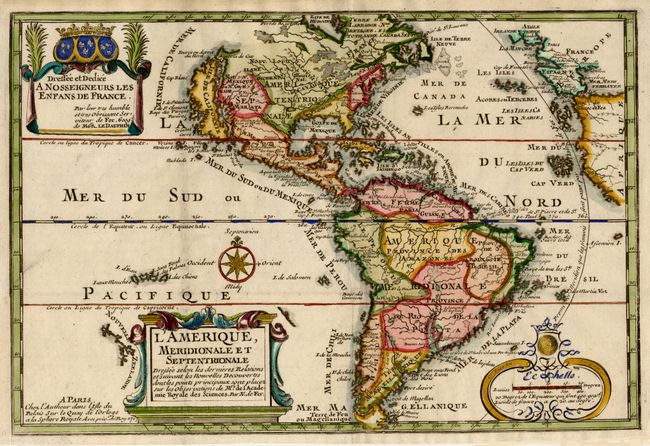
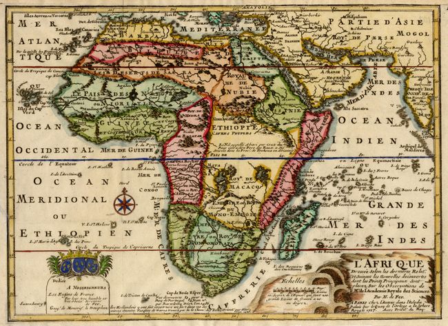
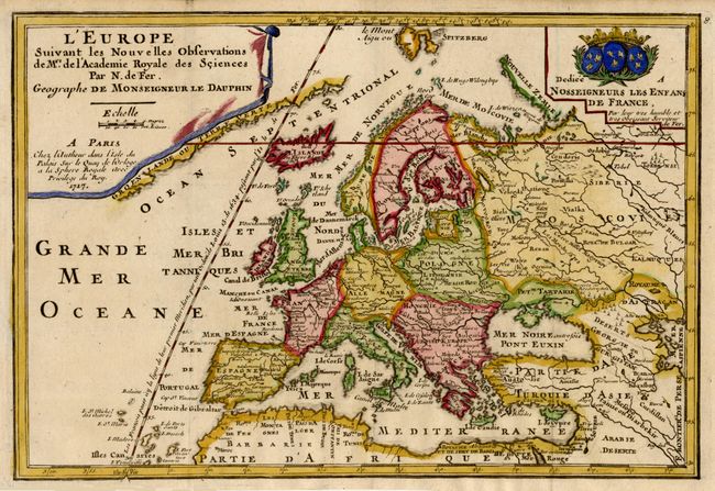
An appealing set of maps each richly embellished with title, scale and dedication cartouches. The world map is on Mercator's projection with the Island of California. Only part of the coastline of Australia appears, as well as parts of Tasmania and New Zealand. The Americas map also features an insular California with an indented northern coast with Agubela de Cato just to the north of the island. The map of Africa shows the correct source of the Nile but retains the two large twin lakes south of the Equator. The map of Europe extends north to include Spitzbergen and shows the prime meridian through the Isle de Fer. The map of Asia depicts a continuous land bridge extending from northern Korea and eastern Siberia across to the American Northwest. A fine matched set of interesting maps.
References: America - McLaughlin #135; Africa - Norwich #64.
Condition: A
Fine impressions and later color. Professional extension of margins where they were trimmed by the binder with repair of a couple of tiny binding tears.