Subject: Central Asia
Period: 1698 (published)
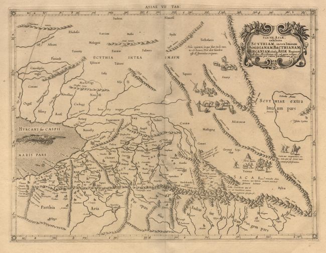
Publication: Claudii Ptolemaei's Atlas Tabulae geographicae Orbis Terrarum
Color: Black & White
Size:
17.7 x 13.4 inches
45 x 34 cm
This fine copper engraved map covers Central Asia east of the Caspian Sea and what is now Turkestan, the Steppes, Afghanistan and beyond. The Himalayas and Northern India run across the bottom of the map. Mercator originally published this map in his 1578 edition of Ptolemy's great Geography. Although he is most renowned today for the projection he popularized and for first using the term Atlas for a collection of maps, he devoted much of his life to his Ptolemaic maps. The maps were beautifully engraved as nearly as possible to their original form and embellished with fine cartouches and cultural scenes. The map includes scenes of shepherds and their flocks and a great sea monster. This map is from an 1698 edition. The ornamental border of the map first appeared in this edition.
References:
Condition: A+