Catalog Archive
Auction 103, Lot 133

"Map Showing the Lands assigned to Emigrant Indians West of Arkansas & Missouri", U.S. War Dept.

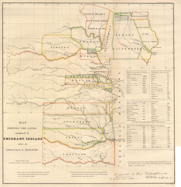
Subject: Central United States

Period: 1860 (published)

Publication: ASP Military Affairs, Vol. VI, No 654-A

Color: Hand Color

Size:
17.7 x 18.7 inches
45 x 47.5 cm
Download High Resolution Image
(or just click on image to launch the Zoom viewer)

This map originally appeared in 1836 in the "Report of the Dragoons under command of Colonel Henry Dodge to the Rocky Mts. during the Summer of 1835." While it shows the Santa Fe Road, the route of Col. Dodge is not depicted. The map covers the region of present day Iowa, Nebraska, Kansas and Oklahoma. The tribal lands are outlined in color. An inset provides tabulations of the numbers of Indians and a listing of estimated acres of land assigned to these Tribes.

References: Wheat [TMW] #418 (1836 ed.).

Condition: A

Nice example now backed with archival tissue. A little faint offsetting that is not distracting.

Estimate: $325 - $375

Sold for: $325

Closed on 6/11/2003

Archived