Catalog Archive
Auction 102, Lot 310

"Nieuwe Paskaart, van de Geheele, Oosterize en Noortze Schip-Vaart…", Keulen, Johannes van

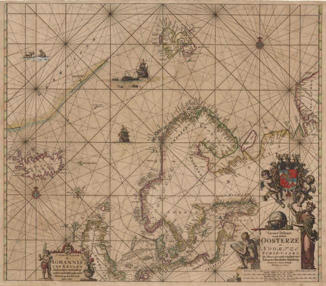
Subject: North Atlantic & Arctic Oceans

Period: 1680 (circa)

Publication:

Color: Hand Color

Size:
23.1 x 20.2 inches
58.7 x 51.3 cm
Download High Resolution Image
(or just click on image to launch the Zoom viewer)

Magnificent, scarce sea chart covering the east coast of Greenland, Iceland, Spitzbergen, Nova Zembla, Northern Scotland, Scandinavia and the Baltic. The coastlines are well delineated in all regions except Greenland. The chart is beautifully adorned with a two cartouches, coat of arms, compass roses, sailing ships, a whaling scene, and polar bears.

References:

Condition: A

Fine original color, slightly oxidized and good margins. Slight uneven toning, still very good.

Estimate: $2,300 - $2,500

Unsold

Closed on 3/5/2003

Archived