Catalog Archive
Auction 102, Lot 247

"Carte du Lac de Mexico, et de ses Environs Lors de la Conqueste des Espagnols…", Bellin, Jacques Nicolas
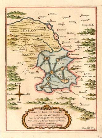
Subject: Mexico

Period: 1758 (circa)

Publication: l'Histoire Generale des Voyages

Color: Hand Color

Size:
6 x 8.3 inches
15.2 x 21.1 cm
Download High Resolution Image
(or just click on image to launch the Zoom viewer)

Copper engraved map showing Mexico City located in a large lake. A series of causeways link the main city and other islands in the Lac d'Eau Salee with the mainland. Locates numerous towns including Tacuba, Capistlan, Xicolopa, and Curtaleco. Decorative rococo-style cartouche and compass rose grace the map.

References:

Condition: A

Very crisp impression with attractive color. Stain on verso with faint show through, still very good.

Estimate: $130 - $160

Sold for: $90

Closed on 3/5/2003

Archived