Catalog Archive
Auction 100, Lot 49

"Regionum Circum Polarium Lapponiae Islandiae et Groenlandiae Novae et Veteris Nova Descriptio Geographica", Scherer, Heinrich
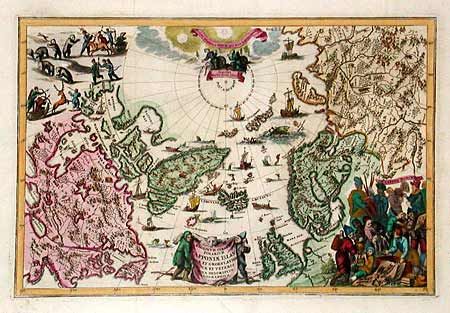
Subject: North Pole

Period: 1701 (dated)

Publication:

Color: Hand Color

Size:
13.7 x 9.1 inches
34.8 x 23.1 cm
Download High Resolution Image
(or just click on image to launch the Zoom viewer)

This fascinating map of the North Pole is a visual delight. The map itself presents typical cartography for the period, leaving open the possibility of both a Northeast and Northwest Passage to the Far East. The map is literally filled with images of sea monsters, whaling, hunting and exploration. The title cartouche is engraved onto the hide of a polar bear with two hunters, and at right is a vignette of the people of Lapland.

References:

Condition: A

Minor printer's crease in bottom cartouche and a repaired tear in margin, well away from map.

Estimate: $850 - $900

Sold for: $950

Closed on 9/12/2002

Archived