Subject: Africa
Period: 1720 (circa)
Publication:
Color: Hand Color
Size:
22.8 x 18 inches
57.9 x 45.7 cm
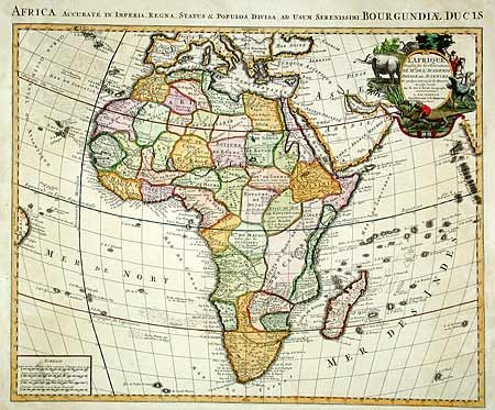
This map is one of the landmarks in the history of mapping Africa. It was first issued by Delisle in 1700 and is distinguished by his scientific approach to cartography. Most of the maps of Africa issued in the eighteenth century were based on this map or his revision in 1722. The Nile is correctly shown with its origins in Abyssinia. The Congo or River Zaire, R. du Saint Esprit and the Zambeze appear in the south, along with the Portuguese settlements of Sean, Tete and Chicora. Several native kingdoms are named, as well as the site of various mining districts. The title cartouche is beautifully decorated with elephants, an ostrich, natives and a crocodile.
References: Norwich #59.
Condition: B
Clean and crisp except for a couple of insignificant spots, with expert restoration of paper in margins.