Subject: Texas
Period: 1840-41 (dated)
Publication: Sen. Doc 119, 27th Cong. 2nd Sess.
Color: Black & White
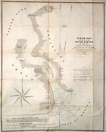
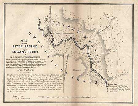
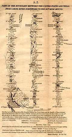
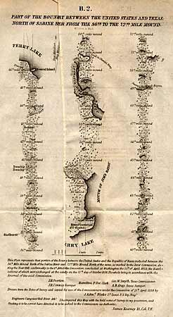
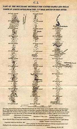
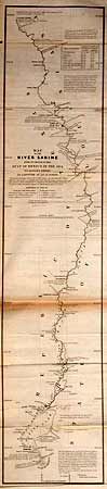
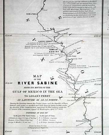
Streeter states that "these six maps are most important in Texas history in that they show the final boundary between Texas and the United States from the Gulf of Mexico to the Red River." In 1840, a Joint US-Texas Boundary Commission surveyed the Sabine River portion and produced the first two maps. In 1841, personnel changed and the remaining four maps were produced. This important set is considered scarce.
1) "Sabine Pass and Mouth of the River Sabine in the Sea", 1840, 17.5 x 22"; 2) "Map of the River Sabine From Its Mouth on the Gulf of Mexico In the Sea…", 1840, 7.2 x 33.6"; 3) "C.2. Part of the Boundary Between the United States and Texas; North of Sabine River from the 72nd Mile Mound to Red River", n.d., 7 x 11"; 4) "A-2. Part of the Boundary Between the United States and Texas; From Sabine River, Northward to the 36th Mile Mound", n.d., 6.3 x 11.2"; 5) "B-2. Part of the Boundary Between the United States and Texas; North of Sabine River from the 36th to the 72nd Mile Mound", n.d., 7 x 11"; and 6) "Map of the River Sabine from Logan's Ferry to 32nd Degree of North Latitude", n.d., 8.3 x 6.5".
References: Day, J.M. 952, 952A, B, C, D, E.
Condition: B
All with toning along folds, generally light.