Subject: Michigan
Period: 1847 (circa)
Publication:
Color: Hand Color
Size:
39 x 25.7 inches
99.1 x 65.3 cm
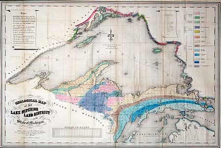
A striking and early hand colored map showing the geology of Upper Michigan Peninsula, Isle Royale and the north shore of Lake Superior. Indicates copper, iron, silver, marble furnaces, iron forages and active/inactive mines. Prepared by J.W. Foster & J.D. Whitney pursuant to an Act of Congress approved March 1, 1847 entitled "Act to establish a new land District for the sale of mineral lands in the State of Michigan." Color code explanation upper right. A handsome map that is rarely offered.
References:
Condition: B
Lovely coloring and dark impression. Backed with archival tissue. Some offsetting from title, lower border close trimmed on binding side, and a little fold toning, else very good.