Current Auction
728 lots
Page 1 of 15
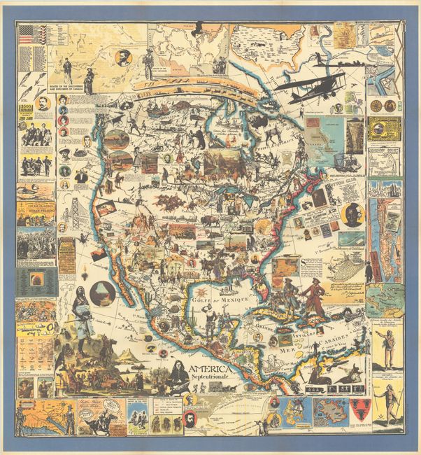
Lot 1
Subject: World & Continents
[Lot of 6] Le Mappe Blu dell' Avventura, 1986
Size: 7.5 x 9.3 inches (19.1 x 23.6 cm)
Estimate: $475 - $600
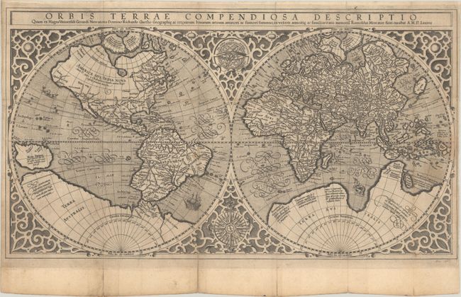
Lot 2
Subject: World
Mercator, Rumold
Orbis Terrae Compendiosa Descriptio quam ex Magna Universali Gerardi Mercatoris..., 1587
Size: 20.3 x 11.3 inches (51.6 x 28.7 cm)
Estimate: $4,500 - $5,500
Mercator's Double-Hemisphere World Map - A Rare Anonymous Variant
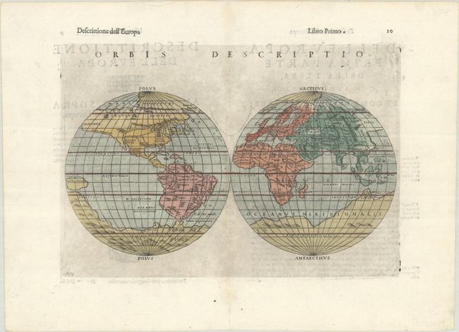
Lot 3
Subject: World
Ruscelli, Girolamo
Orbis Descriptio, 1598
Size: 10 x 6.3 inches (25.4 x 16 cm)
Estimate: $900 - $1,100
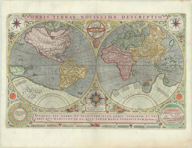
Lot 4
Subject: World
Hondius/Le Clerc
Orbis Terrae Novissima Descriptio, 1602
Size: 20.4 x 13.2 inches (51.8 x 33.5 cm)
Estimate: $4,750 - $6,000
Le Clerc's Decorative World Map Engraved by Hondius
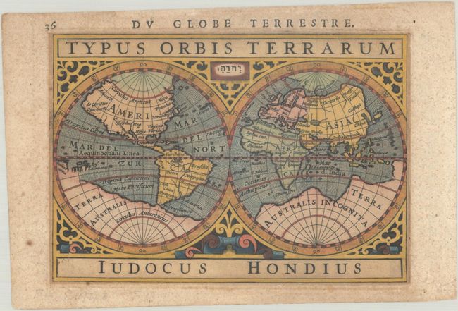
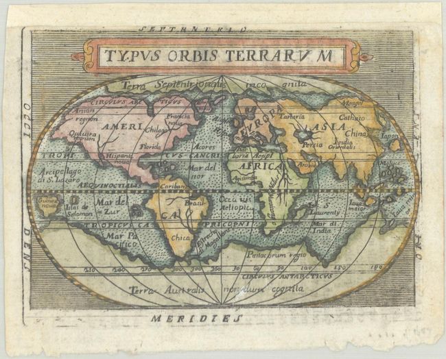
Lot 5
Subject: World
Hondius/Bertius
Typus Orbis Terrarum, 1618
Size: 5.3 x 3.8 inches (13.5 x 9.7 cm)
Estimate: $375 - $450
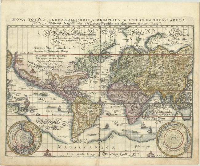
Lot 6
Subject: World
Merian, Matthaus
Nova Totius Terrarum Orbis Geographica ac Hydrographica Tabula, 1638
Size: 14 x 9.9 inches (35.6 x 25.1 cm)
Estimate: $1,000 - $1,300
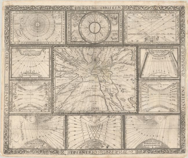
Lot 7
Subject: World
Ritter, Franz
[Untitled - World and Horological Diagrams], 1640
Size: 13.4 x 10.9 inches (34 x 27.7 cm)
Estimate: $2,750 - $3,500
Ritter's Unusual Sun-Dial World Map with Horological Diagrams
Lot 8
Subject: World
Galle, Cornelis
[Untitled - World], 1640
Size: 5.5 x 4.1 inches (14 x 10.4 cm)
Estimate: $300 - $375
Lot 9
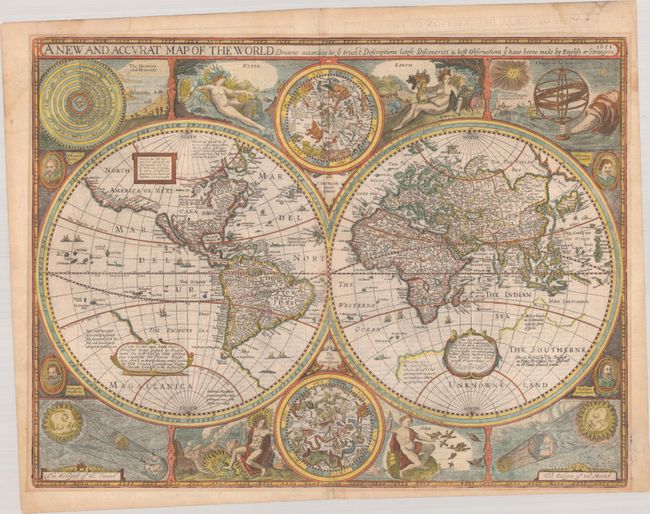
Subject: World
Speed, John
A New and Accurat Map of the World Drawne According to ye Truest Descriptions Latest Discoveries & Best Observations yt Have Beene Made by English or Strangers, 1651
Size: 20.6 x 15.6 inches (52.3 x 39.6 cm)
Estimate: $14,000 - $17,000
Speed's Double-Hemisphere World Map
Lot 10
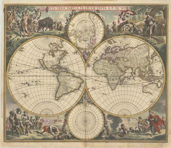
Subject: World
Wit, Frederick de
Nova Orbis Tabula, in Lucem Edita, 1680
Size: 22.3 x 18.9 inches (56.6 x 48 cm)
Estimate: $4,500 - $5,500
De Wit's Stunning Double-Hemisphere Map in Full Contemporary Color
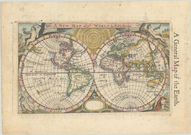
Lot 11
Subject: World
Morden, Robert
A New Map of ye World, 1680
Size: 6.3 x 3.6 inches (16 x 9.1 cm)
Estimate: $400 - $475
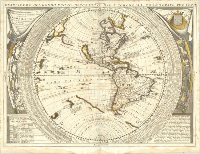
Lot 12
Subject: World
Coronelli, Vincenzo Maria
[Lot of 2] Planisfero del Mondo Nuovo... [and] Planisfero del Mondo Vecchio..., 1690
Size: 24.2 x 18 inches (61.5 x 45.7 cm)
Estimate: $3,000 - $3,750
Coronelli's Splendid Two-Sheet World Map
Lot 13
Subject: World
Lovisa, Domenico
Typus Orbis Terrarum, 1697
Size: 4.2 x 3 inches (10.7 x 7.6 cm)
Estimate: $350 - $425
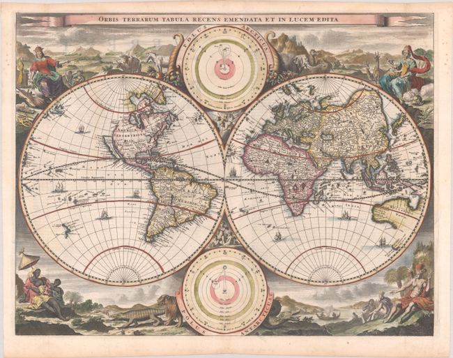
Lot 14
Subject: World
Stoopendaal, Daniel
Orbis Terrarum Tabula Recens Emendata et in Lucem Edita, 1702
Size: 18.1 x 14 inches (46 x 35.6 cm)
Estimate: $1,500 - $1,800
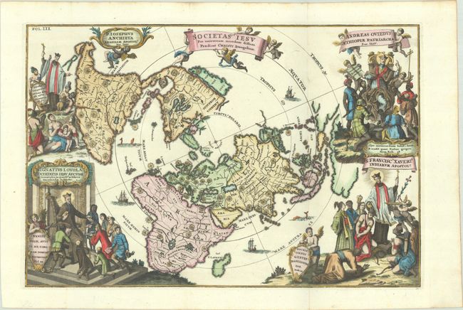
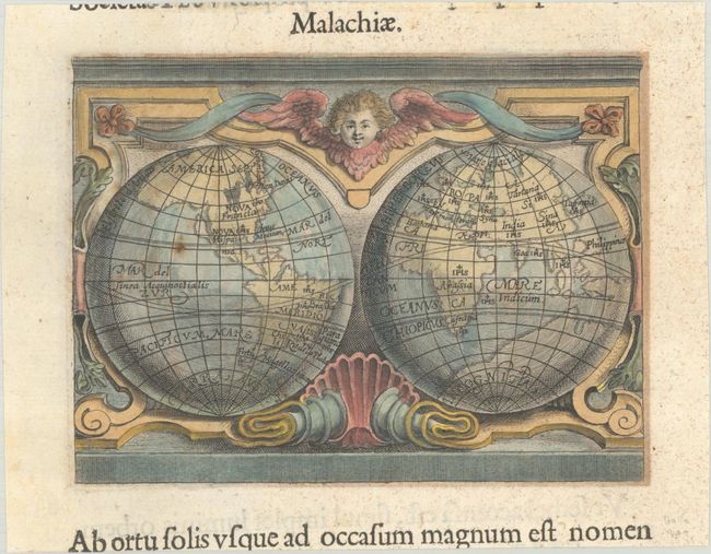
Lot 15
Subject: World, North Pole
Scherer, Heinrich
Societas Iesu per Universum Mundum Diffusa Praedicat Christi Evangelium, 1702
Size: 13.9 x 9.3 inches (35.3 x 23.6 cm)
Estimate: $1,100 - $1,400
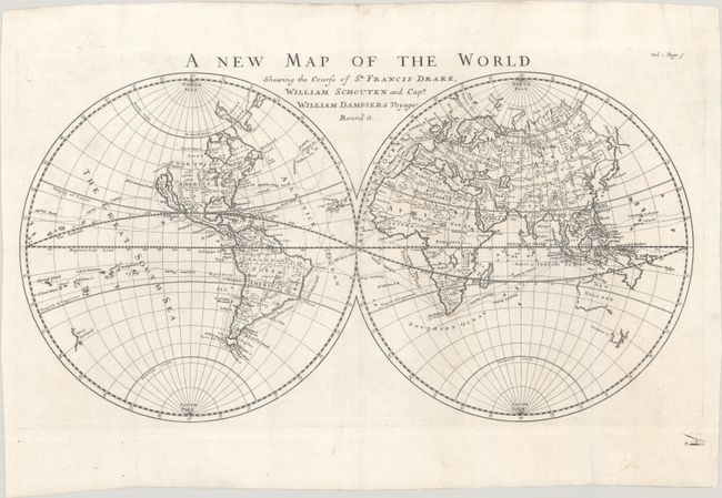
Lot 16
Subject: World
Moll, Herman
A New Map of the World Shewing the Course of Sr. Francis Drake, William Schouten and Capt. William Dampiers Voyages Round It, 1705
Size: 21.2 x 11.6 inches (53.8 x 29.5 cm)
Estimate: $1,100 - $1,400
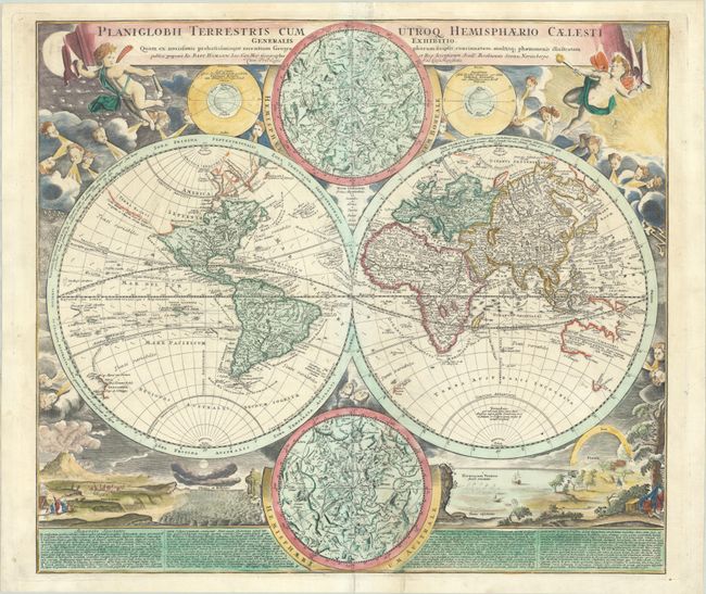
Lot 17
Subject: World
Homann, Johann Baptist
Planiglobii Terrestris cum Utroq Hemisphaerio Caelesti Generalis Exhibitio..., 1720
Size: 21.6 x 19 inches (54.9 x 48.3 cm)
Estimate: $1,500 - $1,800
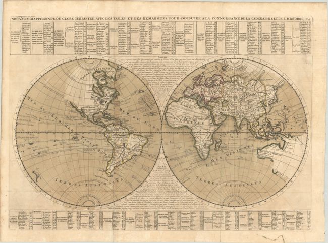
Lot 18
Subject: World
Chatelain, Henry Abraham
Nouveaux Mappemonde ou Globe Terrestre avec des Tables et des Remarques pour Conduire a la Connoissance de la Geographie et de l'Histoire, 1721
Size: 26.4 x 18.8 inches (67.1 x 47.8 cm)
Estimate: $550 - $700
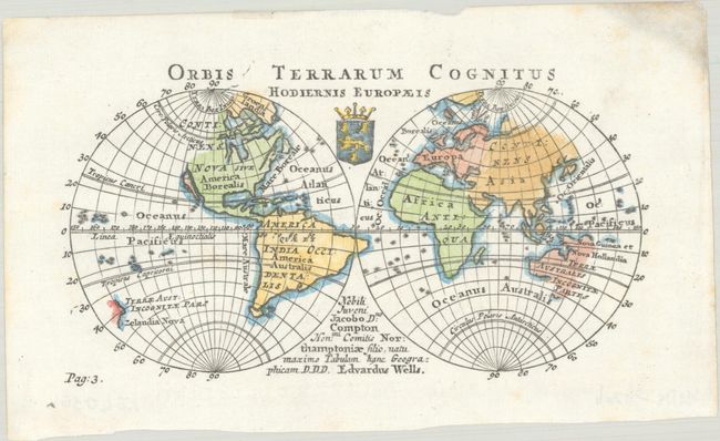
Lot 19
Subject: World
Wells, Edward
Orbis Terrarum Cognitus Hodiernis Europaeis, 1726
Size: 6.4 x 3.5 inches (16.3 x 8.9 cm)
Estimate: $240 - $300
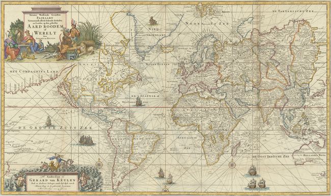
Lot 20
Subject: World
Keulen, Gerard van
Nieuwe Wassende Graaden Paskaart Vertoonende alle de Bekende Zeekusten en Landen op den Geheelen Aard Boodem of Werelt, 1728
Size: 39.4 x 23.4 inches (100.1 x 59.4 cm)
Estimate: $12,000 - $15,000
Spectacular Chart of the World Featuring California as an Island
Lot 21
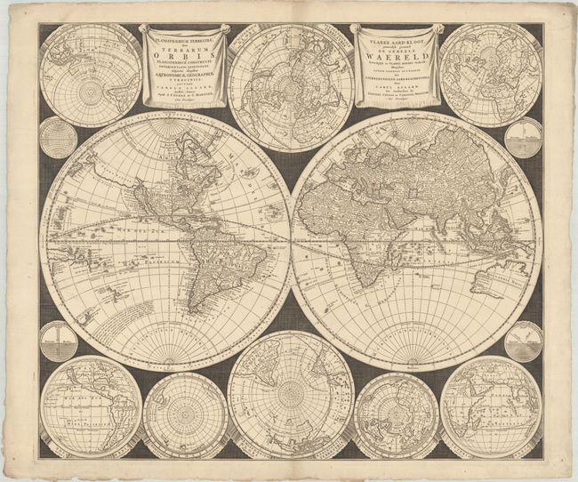
Subject: World
Allard/Covens & Mortier
Planisphaerium Terrestre, sive Terrarum Orbis... / Vlakke Aard-Kloot, Gemeenlyk Genaamd de Geheele Waereld..., 1730
Size: 23.6 x 20.4 inches (59.9 x 51.8 cm)
Estimate: $3,750 - $4,500
A Dramatically-Styled Map with a Focus on Scientific Information
Lot 22
Subject: World
Fisher, Joshua
[Untitled - World], 1765
Size: 5.5 x 2.8 inches (14 x 7.1 cm)
Estimate: $120 - $150
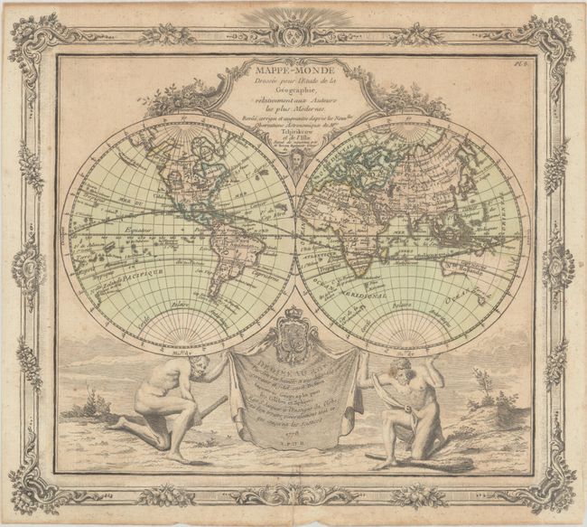
Lot 23
Subject: World
Brion de la Tour/Desnos
Mappe-Monde Dressee pour l'Etude de la Geographie, Relativement aux Auteurs les Plus Modernes..., 1778
Size: 12.4 x 11.1 inches (31.5 x 28.2 cm)
Estimate: $240 - $300
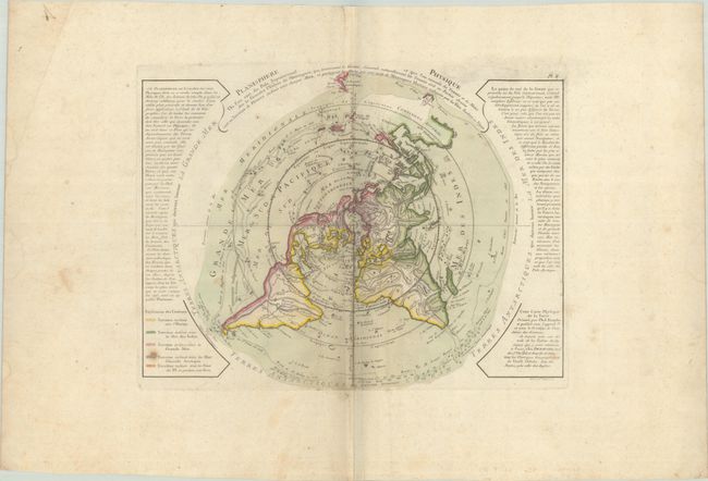
Lot 24
Subject: World
Buache/Dezauche
Planisphere Physique ou l'on voit du Pole Septentrional ce que l'on Connoit de Terres et de Mers..., 1780
Size: 17.4 x 13.3 inches (44.2 x 33.8 cm)
Estimate: $275 - $350
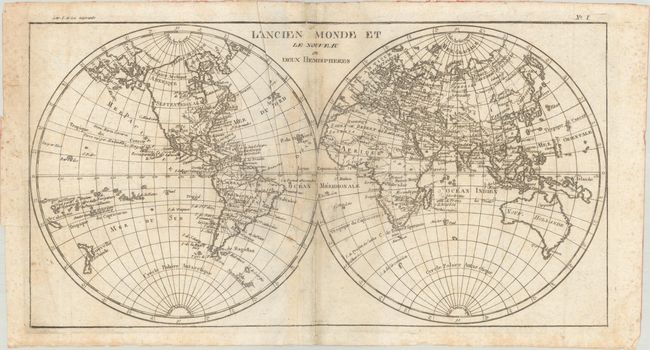
Lot 25
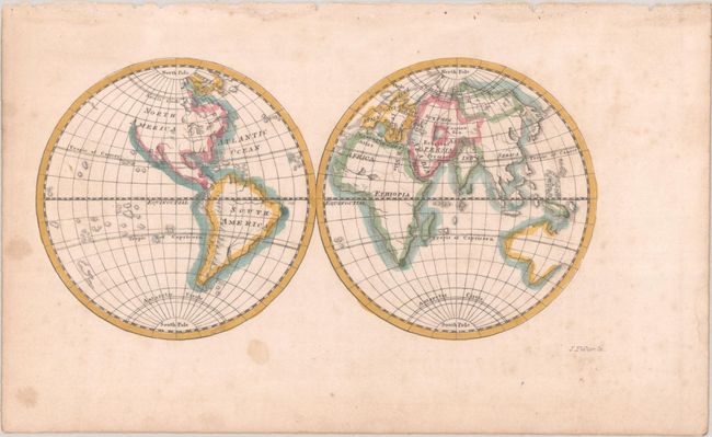
Subject: World
Bonne, Rigobert
L'Ancien Monde et le Nouveau en Deux Hemispheres, 1785
Size: 15.9 x 8.5 inches (40.4 x 21.6 cm)
Estimate: $90 - $110
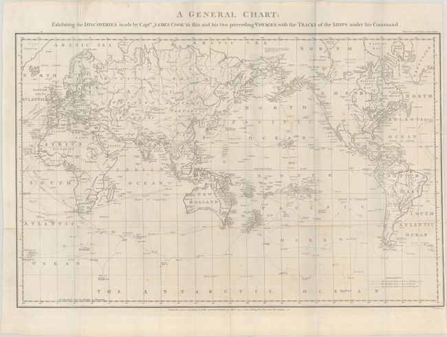
Lot 26
Subject: World
Stockdale, John
A General Chart: Exhibiting the Discoveries Made by Captn. James Cook in This and His Two Preceeding Voyages; with the Tracks of the Ships Under His Command, 1785
Size: 22.9 x 14.8 inches (58.2 x 37.6 cm)
Estimate: $800 - $950
Uncommon Map of Cook's Voyages
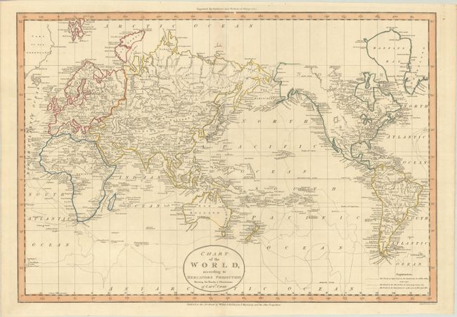
Lot 27
Subject: World
Guthrie, William
Chart of the World, According to Mercators Projection Shewing the Tracks & Discoveries of Captn. Cook, 1799
Size: 18.7 x 13 inches (47.5 x 33 cm)
Estimate: $475 - $600
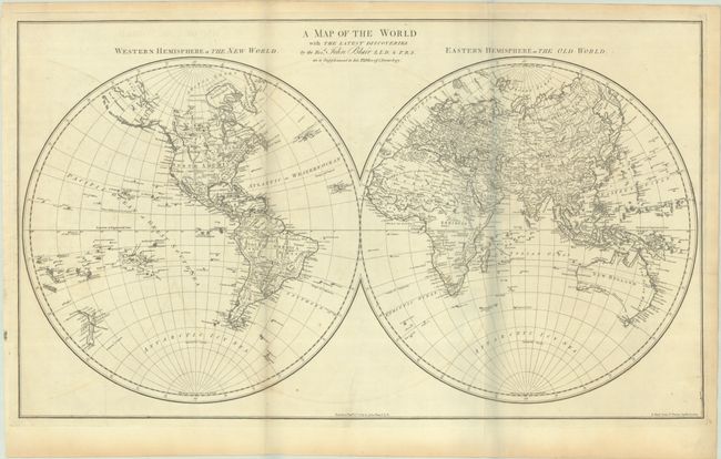
Lot 28
Subject: World
Blair, Rev. John
A Map of the World with the Latest Discoveries, 1803
Size: 27.7 x 16.1 inches (70.4 x 40.9 cm)
Estimate: $375 - $450
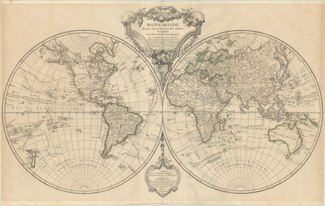
Lot 29
Subject: World
Robert de Vaugondy/Delamarche
Mappe-Monde Dressee Suivant les Nouvelles Relations et Assujettie aux Observations Astronomiques, 1804
Size: 28.7 x 17.2 inches (72.9 x 43.7 cm)
Estimate: $700 - $850
Interesting Conflation of Rivers in the Pacific Northwest
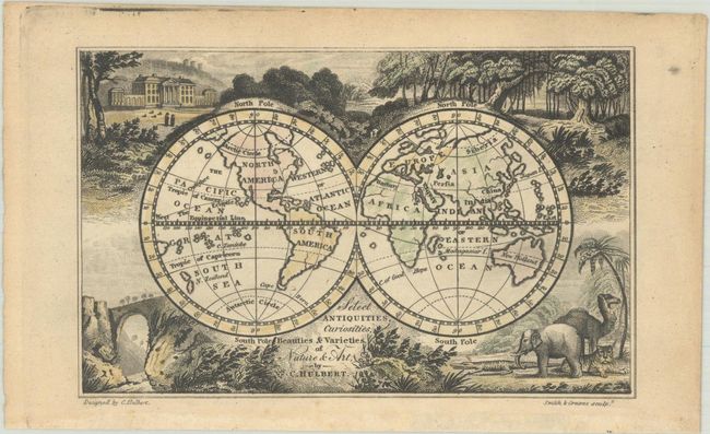
Lot 30
Subject: World
Select Antiquities, Curiosities, Beauties & Varieties of Nature & Art, 1822
Size: 4.8 x 3 inches (12.2 x 7.6 cm)
Estimate: $120 - $150
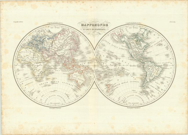
Lot 31
Subject: World
Malte-Brun, Conrad
Mappemonde en Deux Hemispheres, 1833
Size: 18.6 x 10.5 inches (47.2 x 26.7 cm)
Estimate: $120 - $150
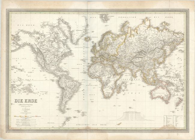
Lot 32
Subject: World
Weiland, Carl Ferdinand
Die Erde in Mercator's Projection, 1838
Size: 28 x 19 inches (71.1 x 48.3 cm)
Estimate: $150 - $180
NO RESERVE
Lot 33
Subject: World
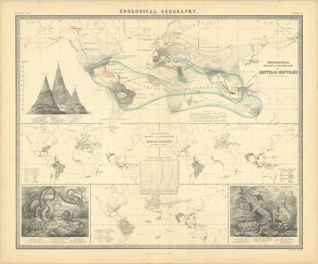
Johnston, W. & A.K.
Geographical Division and Distribution of Reptilia (Reptiles) [on sheet with] Geographical Division and Distribution of Ophidia (Serpents) According to Schlegel, 1856
Size: 23.8 x 19.4 inches (60.5 x 49.3 cm)
Estimate: $120 - $150
Lot 34
Subject: World
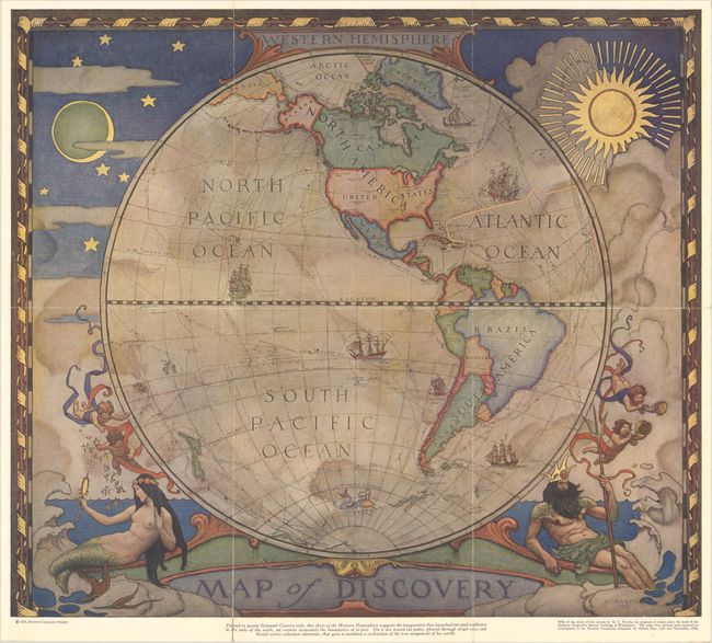
National Geographic Magazine
[Lot of 2] Western Hemisphere - Map of Discovery [and] Eastern Hemisphere - Map of Discovery, 1928
Size: 18.1 x 15.9 inches (46 x 40.4 cm)
Estimate: $180 - $220
Lot 35
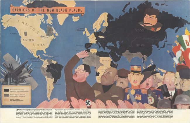
Subject: World
Carriers of the New Black Plague, 1938
Size: 20.8 x 11.9 inches (52.8 x 30.2 cm)
Estimate: $140 - $170
Lot 36
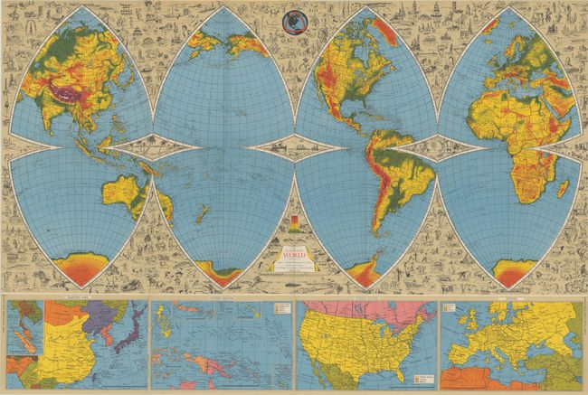
Subject: World
The Illustrated World Octovue Projection, 1944
Size: 39.5 x 26.2 inches (100.3 x 66.5 cm)
Estimate: $200 - $250
New Method for Depicting the Earth on a Flat Surface
Lot 37
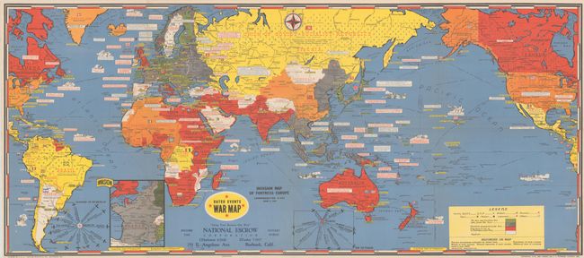
Subject: World, World War II
Turner, Stanley
Dated Events War Map [19th Edition], 1944
Size: 38.5 x 16.9 inches (97.8 x 42.9 cm)
Estimate: $140 - $170
Lot 38
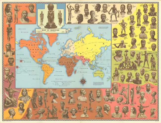
Subject: World
Hammond, C. S.
[Map in Booklet] Map of Mankind [in] The Races of Mankind, 1946
Size: 30 x 22.9 inches (76.2 x 58.2 cm)
Estimate: $250 - $325
Controversial Map with Complete Booklet
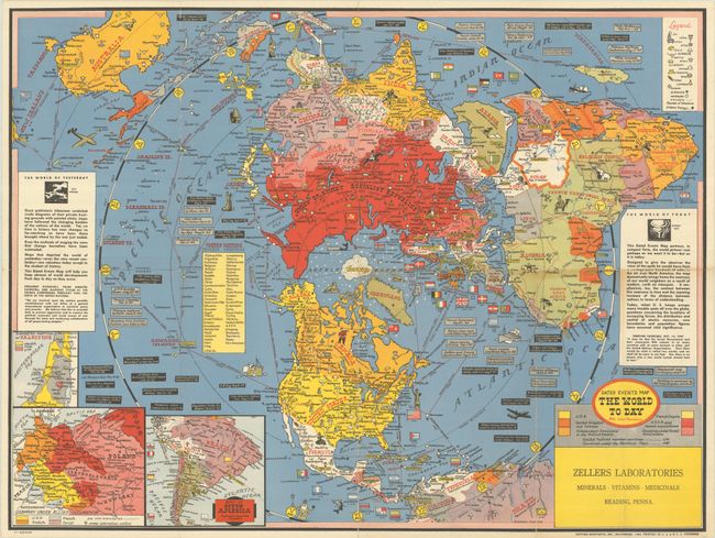
Lot 39
Subject: World
Turner, Stanley
Dated Events Map - The World To Day with Latest Boundaries [2nd Edition], 1948
Size: 26 x 19.5 inches (66 x 49.5 cm)
Estimate: $200 - $230
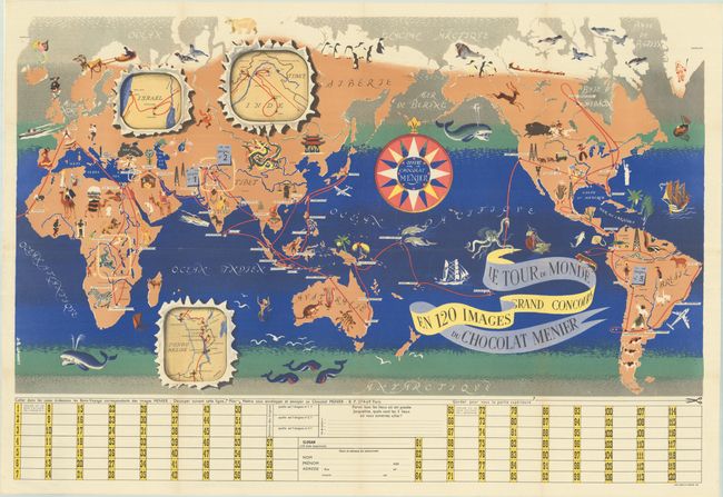
Lot 40
Subject: World
Le Tour du Monde en 120 Images Grand Concours du Chocolat Menier, 1956
Size: 42.1 x 23.3 inches (106.9 x 59.2 cm)
Estimate: $150 - $180
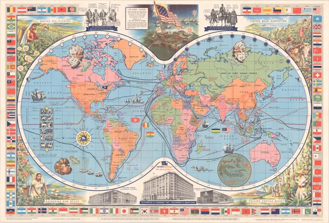
Lot 41
Subject: World
[Title on Verso] McCormick's Map of the World, 1960
Size: 33.4 x 22.9 inches (84.8 x 58.2 cm)
Estimate: $140 - $170
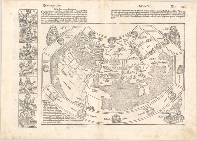
Lot 42
Subject: Ancient World
Schedel, Hartmann
Das Ander Alter der Werlt, 1493
Size: 20.1 x 14.3 inches (51.1 x 36.3 cm)
Estimate: $14,000 - $17,000
Schedel's Ancient World Map
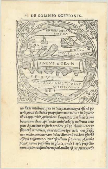
Lot 43
Subject: Ancient World
Macrobius, Ambrosius Aurelius Theodo
[Untitled - Ancient World], 1515
Size: 2.8 x 2.9 inches (7.1 x 7.4 cm)
Estimate: $800 - $950
Only Macrobius Map with Britain Attached to Europe
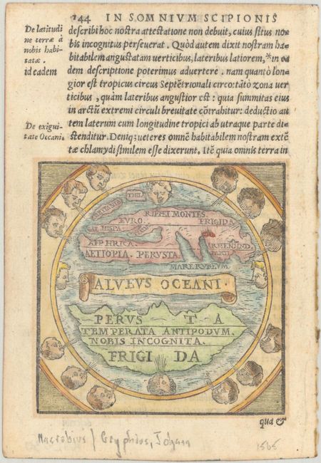
Lot 44
Subject: Ancient World
Macrobius, Ambrosius Aurelius Theodo
[Untitled - Ancient World], 1565
Size: 3.2 x 3.3 inches (8.1 x 8.4 cm)
Estimate: $700 - $850
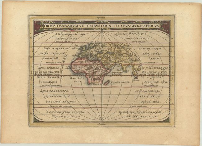
Lot 45
Subject: Ancient World
Cluver/Jansson
Orbis Terrarum Veteribus Cogniti Typus Geographicus, 1676
Size: 8.1 x 6.3 inches (20.6 x 16 cm)
Estimate: $160 - $190
Lot 46
Subject: Northern Hemisphere
Delisle/Covens & Mortier
L'Hemisphere Septentrional pour Voir Plus Distinctement les Terres Arctiques, 1740
Size: 20.3 x 18.2 inches (51.6 x 46.2 cm)
Estimate: $400 - $475
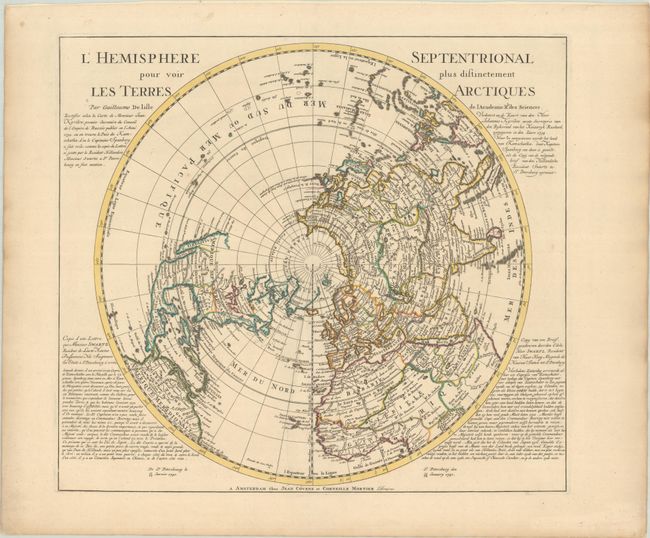
Lot 47
Subject: North Pole
Duval, Pierre
Terres Arctiques Dites Autrement Septemtrionales et Boreales, 1682
Size: 4.9 x 3.9 inches (12.4 x 9.9 cm)
Estimate: $180 - $210
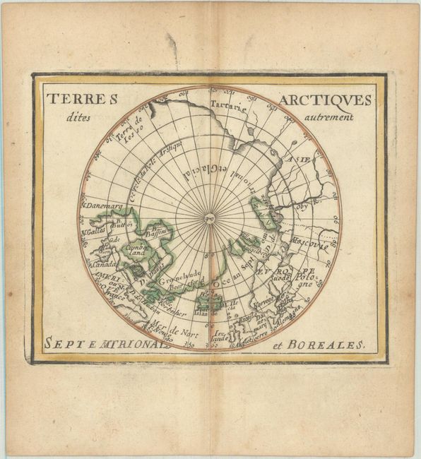
Lot 48
Subject: North Pole & North Atlantic
Scherer, Heinrich
Regionum Circum Polarium Lapponiae Islandiae et Groenlandiae Novae et Veteris Nova Descriptio Geographica, 1701
Size: 13.8 x 9.2 inches (35.1 x 23.4 cm)
Estimate: $800 - $950
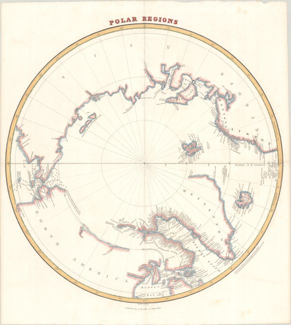
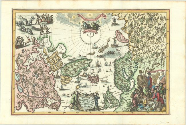
Lot 49
Subject: North Pole
Lizars, William Home
Polar Regions, 1822
Size: 14.9 x 15 inches (37.8 x 38.1 cm)
Estimate: $150 - $180
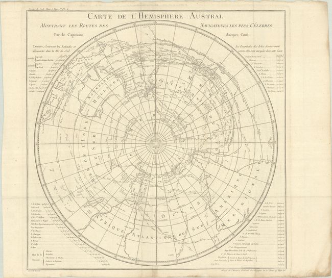
Lot 50
Subject: South Pole
Cook/Benard
Carte de l'Hemisphere Austral Montrant les Routes des Navigateurs Plus Celebres par le Capitaine Jacques Cook, 1774
Size: 21.2 x 21.1 inches (53.8 x 53.6 cm)
Estimate: $275 - $350
728 lots
Page 1 of 15