Showing Featured Lots(remove filter)
Filtered by Category:World, Polar, Celestial, Globes(Show All Categories)
Showing results for:Auction 172
Catalog Archive
11 lots
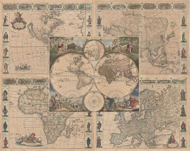
Auction 172, Lot 11
Subject: World & Continents
Wit, Frederick de
[Lot of 5] Nova Orbis Tabula, in Lucem Edita [and] Nova Totius Americae Descriptio [and] Asiae Nova Descriptio [and] Nova Africa Descriptio [and] Nova Europae Descriptio, 1660-70
Size: See Description
Estimate: $11,000 - $13,000
A Stunning Set of Carte-a-Figures Maps
Sold for: $6,500
Closed on 4/17/2019
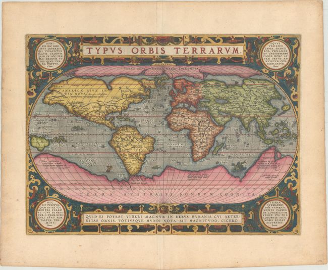
Auction 172, Lot 15
Subject: World
Ortelius, Abraham
Typus Orbis Terrarum, 1587
Size: 19.2 x 14 inches (48.8 x 35.6 cm)
Estimate: $6,000 - $7,500
Ortelius' Third World Map in an Oval Projection
Sold for: $4,500
Closed on 4/17/2019
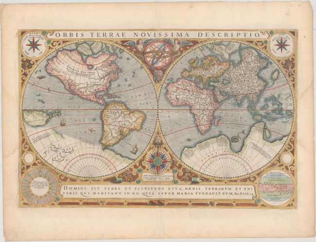
Auction 172, Lot 16
Subject: World
Hondius/Le Clerc
Orbis Terrae Novissima Descriptio, 1633
Size: 19.9 x 12.9 inches (50.5 x 32.8 cm)
Estimate: $5,500 - $6,500
Le Clerc's Decorative World Map Engraved by Hondius
Unsold
Closed on 4/17/2019
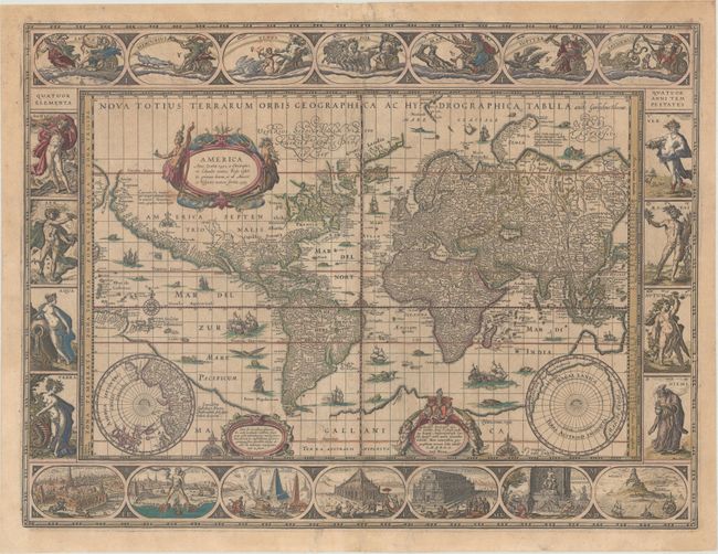
Auction 172, Lot 17
Subject: World
Blaeu, Willem
Nova Totius Terrarum Orbis Geographica ac Hydrographica Tabula, 1635
Size: 21.4 x 16.1 inches (54.4 x 40.9 cm)
Estimate: $9,500 - $11,000
Blaeu's Magnificent Carte-a-Figures World Map in Full Contemporary Color
Sold for: $7,000
Closed on 4/17/2019
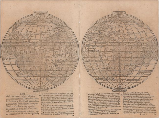
Auction 172, Lot 18
Subject: World
Camoens, Luis de
[Untitled - World], 1639
Size: 15.4 x 7.8 inches (39.1 x 19.8 cm)
Estimate: $4,750 - $6,000
A Scarce Spanish World Map
Unsold
Closed on 4/17/2019
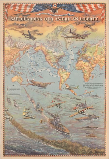
Auction 172, Lot 35
Subject: World, World War II
Hammond, C. S.
Safeguarding Our American Liberty, 1941
Size: 21 x 30.9 inches (53.3 x 78.5 cm)
Estimate: $1,900 - $2,200
Superb WWII Map Demonstrating the United States' Military Reach
Sold for: $3,750
Closed on 4/17/2019
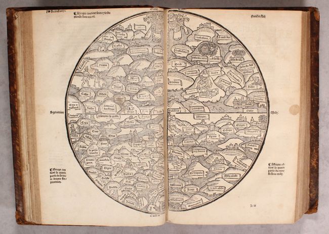
Auction 172, Lot 37
Subject: Ancient World & Holy Land
[Ancient World & Palestine Maps in book] La Mer des Histoires..., 1543
Size: 13.5 x 9.3 inches (34.3 x 23.6 cm)
Estimate: $28,000 - $35,000
Rare Medieval Maps of the World and Palestine
Unsold
Closed on 4/17/2019
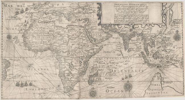
Auction 172, Lot 39
Subject: Eastern Hemisphere
Bry, Theodore de
Descriptio Hydrographica Accommodata ad Battavorum Navagatione in Javam Insulam Indiae Orientalis... / Eygentliche und Ausfuhrliche Mappa de Orientallischen Indien Darinen auch mit Puntten Angezeichnet di hin und wider um Reise der Hollander..., 1599
Size: 26.1 x 14.1 inches (66.3 x 35.8 cm)
Estimate: $7,000 - $8,500
Elaborate Map Depicting Cornelis de Houtman First Voyage to the East Indies
Sold for: $3,800
Closed on 4/17/2019
Auction 172, Lot 42
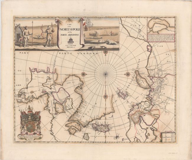
Subject: North Pole
Pitt, Moses
A Map of the North-Pole and the Parts Adioining, 1680
Size: 23.1 x 18 inches (58.7 x 45.7 cm)
Estimate: $3,000 - $3,750
Beautiful English Map of the North Pole
Sold for: $2,200
Closed on 4/17/2019
Auction 172, Lot 50
Subject: Cartographic Miscellany, Earth
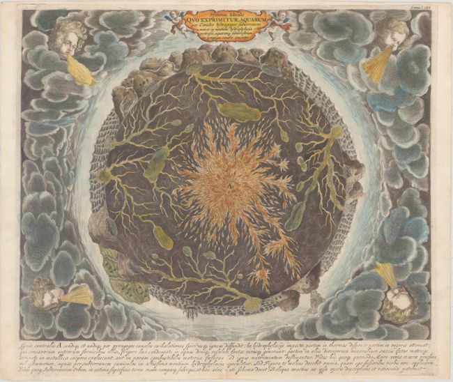
Kircher, Athanasius
Systema Ideale quo Exprimitur, Aquarum per Canales Hydragogos Subterraneos ex Mari et in Montium Hydrophylacia..., 1682
Size: 16 x 12.9 inches (40.6 x 32.8 cm)
Estimate: $1,500 - $1,800
Fascinating Cross-Section of the Earth
Sold for: $1,000
Closed on 4/17/2019
Auction 172, Lot 51
Subject: Cartographic Miscellany
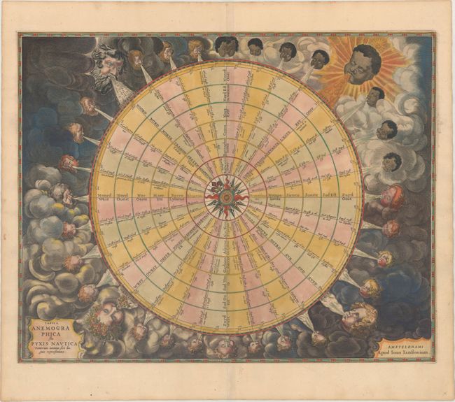
Jansson, Jan
Tabula Anemographica seu Pyxis Nautica Ventorum Nomina Sex Linguis Repraesentans, 1684
Size: 21.4 x 17 inches (54.4 x 43.2 cm)
Estimate: $2,000 - $2,500
Dramatic 32-Point Wind Rose
Sold for: $1,200
Closed on 4/17/2019
11 lots