Subject: World, World War II
Period: 1941 (dated)
Publication:
Color: Printed Color
Size:
21 x 30.9 inches
53.3 x 78.5 cm
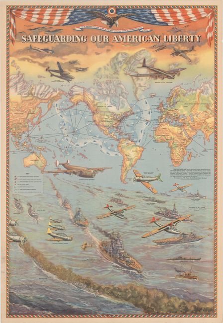
This superb, WWII propaganda map was created by Lambert Guenther to glorify the power and international reach of the United States military. The protective boundary of the air and sea forces are shown surrounding the United States, while the US military bases and British naval bases are identified throughout the world. By presenting the map on a Mercator projection, the US appears to be protected from its enemies by vast oceans, a myth that would be shattered months later with the surprise attack on Pearl Harbor. The majority of the sheet illustrates the Naval, Air, and Coast defenses of the US, with dozens of planes and ships patrolling the skies and waters. The number of various types of ships and planes in the US military are noted, along with the number currently under production. The stars and stripes are draped across the top of the map along with an eagle and a quote from George Washington: "To be prepared for war is one of the most effectual means of preserving peace." Lithographed by C. S. Hammond and prepared for the Thom McAn Shoe Co.
References: Curtis & Pederson (War Map) pp. 134-35; Hornsby, pp. 225-26 & 232; Rumsey #02033:000.
Condition: A
An attractive example with a minor edge tear and tiny hole that are both confined to the lower left blank margin and repaired on verso with archival tissue.


