Showing Featured Lots(remove filter)
Filtered by Category:United States(Show All Categories)
Showing results for:Auction 178
Catalog Archive
10 lots
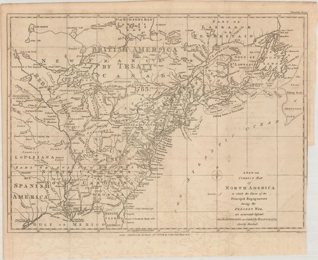
Auction 178, Lot 89
Subject: Eastern United States & Canada
Lodge, John
A New and Correct Map of North America in Which the Places of the Principal Engagements During the Present War, Are Accurately Inserted..., 1783
Size: 14.8 x 10.9 inches (37.6 x 27.7 cm)
Estimate: $3,000 - $4,000
Rare Map Presenting the "Rebel Colonies now the United States of America"
Sold for: $3,750
Closed on 6/10/2020
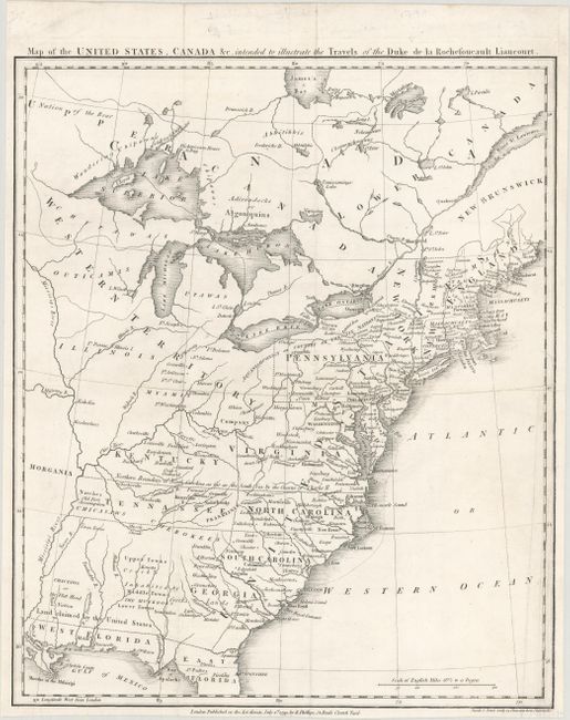
Auction 178, Lot 91
Subject: Eastern United States & Canada, Franklin
Rochefoucald Liancourt, Francois Alexander
Map of the United States, Canada &c. Intended to Illustrate the Travels of the Duke de la Rochefoucault Liancourt, 1799
Size: 13.3 x 15.9 inches (33.8 x 40.4 cm)
Estimate: $1,400 - $1,700
Features the Short-Lived Franklinia and Morgania
Sold for: $1,200
Closed on 6/10/2020
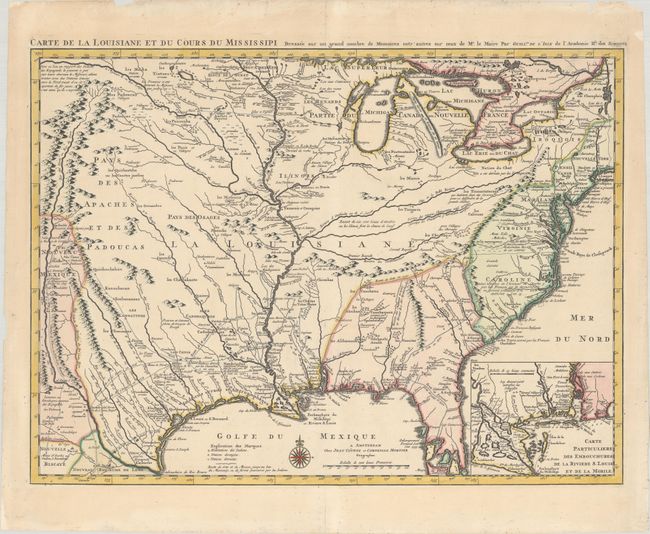
Auction 178, Lot 105
Subject: Colonial Eastern United States, Louisiana Territory
Delisle/Covens & Mortier
Carte de la Louisiane et du Cours du Mississipi Dressee sur un Grand Nombre de Memoires Entr'autres sur ceux de Mr. le Maire, 1730
Size: 23.4 x 17.3 inches (59.4 x 43.9 cm)
Estimate: $1,600 - $1,900
Delisle's Influential Map of the Louisiana Territory
Sold for: $1,400
Closed on 6/10/2020
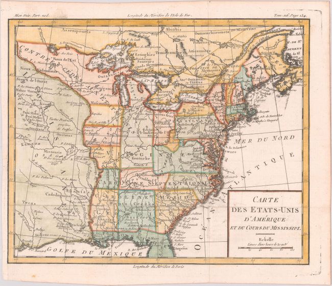
Auction 178, Lot 107
Subject: Eastern United States, Franklin
Brion de la Tour, Louis
Carte des Etats-Unis d'Amerique et du Cours du Mississipi, 1783
Size: 10.6 x 8.7 inches (26.9 x 22.1 cm)
Estimate: $900 - $1,100
One of the Earliest Maps to Feature the State of Franklin
Sold for: $1,100
Closed on 6/10/2020
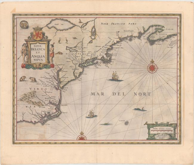
Auction 178, Lot 113
Subject: Colonial New England & Mid-Atlantic United States
Jansson, Jan
Nova Belgica et Anglia Nova, 1644
Size: 19.7 x 15.2 inches (50 x 38.6 cm)
Estimate: $1,600 - $1,900
Jansson's Influential Map of the East Coast - in Contemporary Color
Sold for: $800
Closed on 6/10/2020
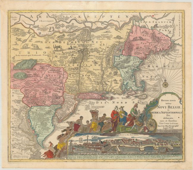
Auction 178, Lot 114
Subject: Colonial New England & Mid-Atlantic United States
Seutter/Lotter
Recens Edita Totius Novi Belgii, in America Septentrionali Siti, Delineatio Cura et Sumtibus, 1760
Size: 22.9 x 19.6 inches (58.2 x 49.8 cm)
Estimate: $2,750 - $3,500
Decorative Edition from Jansson-Visscher Series with View of Manhattan
Sold for: $2,000
Closed on 6/10/2020
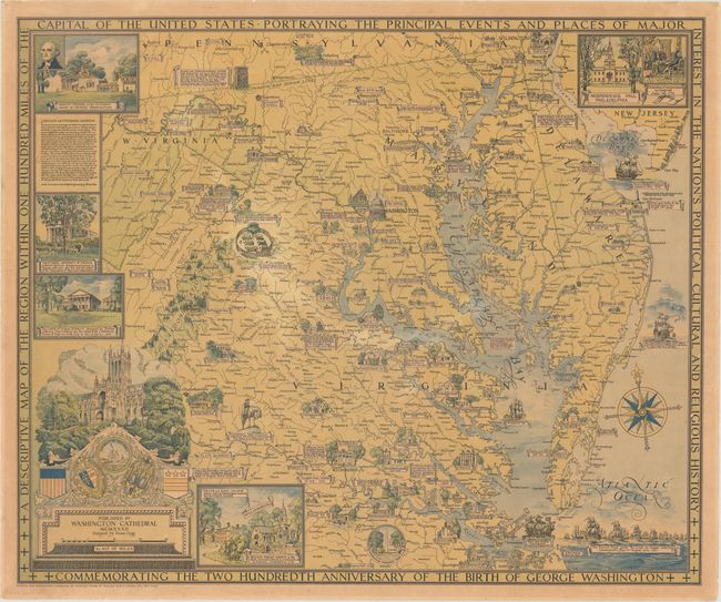
Auction 178, Lot 122
Subject: Mid-Atlantic United States
A Descriptive Map of the Region Within One Hundred Miles of the Capital of the United States..., 1932
Size: 33.3 x 27.6 inches (84.6 x 70.1 cm)
Estimate: $800 - $1,000
Ernest Clegg's Map Commemorating George Washington
Sold for: $500
Closed on 6/10/2020
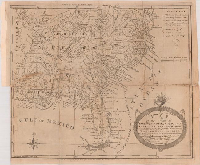
Auction 178, Lot 125
Subject: Southern United States, Franklin
Purcell, Joseph
A Map of the States of Virginia North Carolina South Carolina and Georgia Comprehending the Spanish Provinces of East and West Florida..., 1793
Size: 14.8 x 12.6 inches (37.6 x 32 cm)
Estimate: $700 - $900
Second State of Purcell's Map Locating the Proposed State of Frankland
Sold for: $550
Closed on 6/10/2020
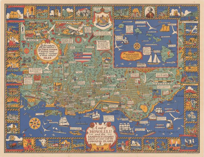
Auction 178, Lot 163
Subject: Honolulu, Hawaii
A Map of Honolulu and the Sandwich Islands Which We Now Call the Hawaiian Islands, 1927
Size: 35.5 x 27.1 inches (90.2 x 68.8 cm)
Estimate: $1,200 - $1,600
Uncommon Pictorial Map of Honolulu Celebrating the Culture and History of the Hawaiian Isles
Sold for: $1,000
Closed on 6/10/2020
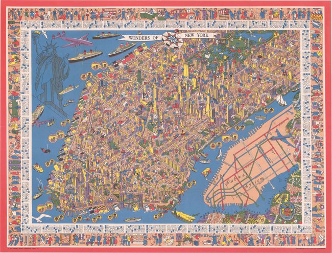
Auction 178, Lot 184
Subject: New York City, New York
Wonders of New York, 1953
Size: 31.8 x 24 inches (80.8 x 61 cm)
Estimate: $700 - $850
Superb Pictorial Map of Manhattan
Sold for: $650
Closed on 6/10/2020
10 lots