Subject: Honolulu, Hawaii
Period: 1927 (dated)
Publication:
Color: Printed Color
Size:
35.5 x 27.1 inches
90.2 x 68.8 cm
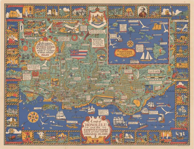
This superb pictorial map by Alexander Samuel MacLeod focuses on Honolulu with a large inset of the Hawaiian Islands. Streets are named, buildings are depicted in miniature form, and the "history, landmarks & customs of these colorful isles" are identified, as noted in a large cartouche at top left. The decorative border is composed of vignettes further illustrating historical events, flora & fauna, an important locations. Interspersed throughout the map are scrolls with quotes about Hawaii from famous writers, including Jack London, Mark Twain, and Clifford Gessler. Published by Henry M. Snyder in New York.
Born on Prince Edward Island, Canada, Alexander Samuel MacLeod (1888–1956) trained at the California School of Design under Frank Van Sloun. He spent many years in Hawaii creating graphic art for magazines, newspapers, and even the United States Army in the Pacific.
References: Rumsey #7983.
Condition: A
Clean and bright, issued folding and now flattened with professional repairs to several short fold separations and tiny holes at fold intersections.