Showing Featured Lots(remove filter)
Filtered by Category:United States(Show All Categories)
Showing results for:Auction 175
Catalog Archive
12 lots
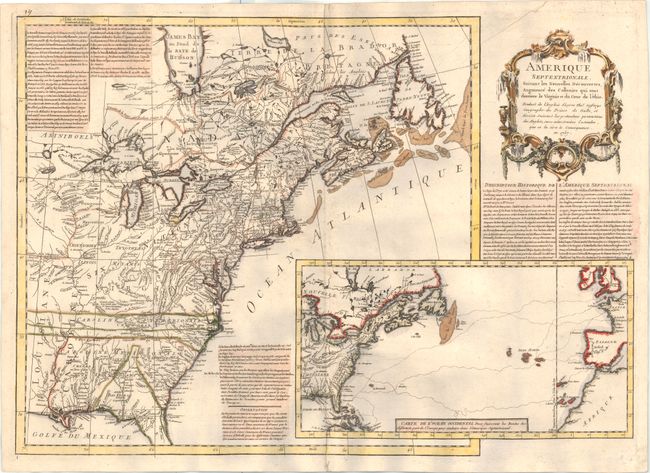
Auction 175, Lot 91
Subject: Colonial Eastern United States & Canada
Anon.
Amerique Septentrionale, Suivant les Nouvelles Decouvertes, Augmente des Collonies qui sont Derriere la Virginie et du Cour de l'Ohio..., 1757
Size: 27.1 x 19.1 inches (68.8 x 48.5 cm)
Estimate: $2,750 - $3,500
A Rare French Map Countering Jefferys' French & Indian War Map
Sold for: $2,500
Closed on 11/13/2019
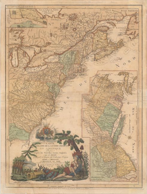
Auction 175, Lot 95
Subject: Colonial Eastern United States & Canada
Denis, Louis
Carte du Theatre de la Guerre Presente en Amerique Dressee d'Apres les Nouvelles Cartes Anglaises, 1782
Size: 19.6 x 26.3 inches (49.8 x 66.8 cm)
Estimate: $3,000 - $3,750
Scarce American Revolutionary War Map
Sold for: $1,800
Closed on 11/13/2019
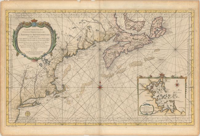
Auction 175, Lot 100
Subject: Colonial Northeastern United States & Canada
Bellin, Jacques Nicolas
Carte Reduite des Costes Orientales de l'Amerique Septentrionale 1re Feuille Contenant l'Isle Royale, l'Accadie, la Baye Francoise, la Nouvelle Angleterre et la Nouvelle Yorc..., 1757
Size: 34.9 x 21.5 inches (88.6 x 54.6 cm)
Estimate: $1,900 - $2,200
Scarce Large-Scale Chart of the Coast of New England
Unsold
Closed on 11/13/2019
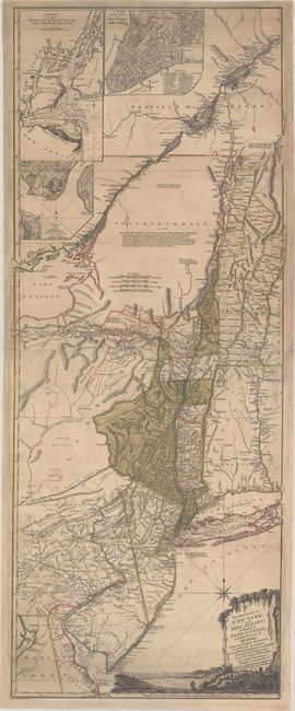
Auction 175, Lot 101
Subject: Colonial Northeast United States & Quebec
Holland/Pownal
The Provinces of New York, and New Jersey; with Part of Pensilvania, and the Province of Quebec..., 1777
Size: 20.3 x 52 inches (51.6 x 132.1 cm)
Estimate: $3,500 - $4,500
Rare German Edition of an Important Revolutionary War Period Map
Sold for: $2,300
Closed on 11/13/2019
Auction 175, Lot 115
Subject: Eastern United States
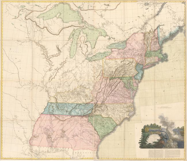
Arrowsmith, Aaron, Sr.
[On 4 Sheets] A Map of the United States of North America Drawn from a Number of Critical Researches, 1802
Size: 27.8 x 24.3 inches (70.6 x 61.7 cm)
Estimate: $8,000 - $10,000
Arrowsmith's Large-Format Map Used by Lewis & Clark
Sold for: $5,500
Closed on 11/13/2019
Auction 175, Lot 126
Subject: Colonial Mid-Atlantic United States
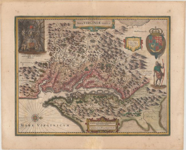
Hondius, Henricus
Nova Virginiae Tabula, 1647
Size: 19.4 x 15 inches (49.3 x 38.1 cm)
Estimate: $1,400 - $1,700
One of the Most Important 17th Century Maps of the Chesapeake Bay in Full Contemporary Color
Sold for: $900
Closed on 11/13/2019
Auction 175, Lot 134
Subject: Colonial Southeast United States, Bahamas & Greater Antilles
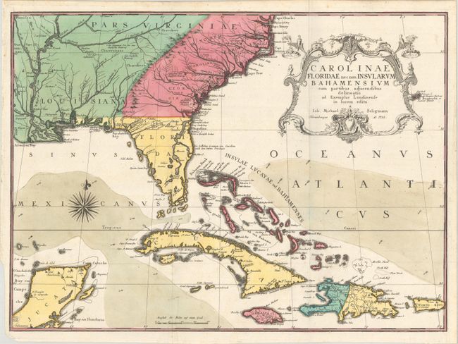
Seligmann, Johann Michael
Carolinae Floridae nec non Insularum Bahamensium cum Partibus Adjacendibus Delineatio ad Exemplar Londinense in Lucem Edita, 1755
Size: 23.1 x 16.8 inches (58.7 x 42.7 cm)
Estimate: $4,000 - $5,000
German Edition of Catesby's Scarce and Important Map of the Southeastern United States
Sold for: $2,600
Closed on 11/13/2019
Auction 175, Lot 135
Subject: Colonial Southeast United States
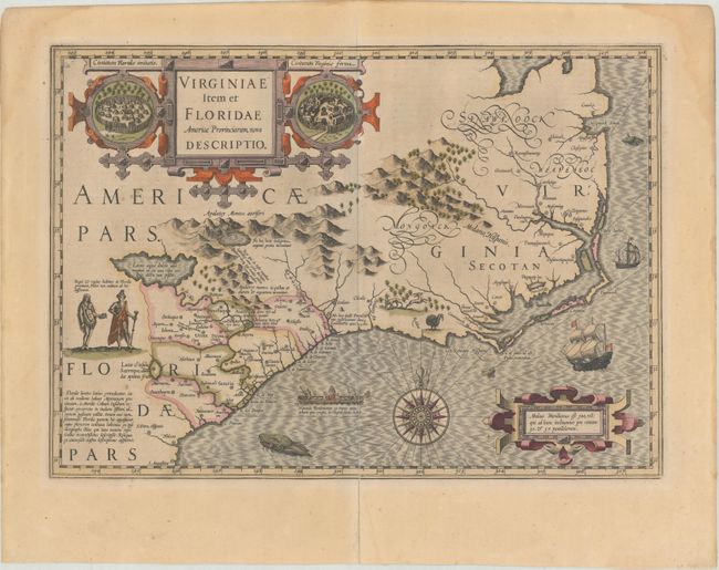
Hondius, Jodocus
Virginiae Item et Floridae Americae Provinciarum, Nova Descriptio, 1623
Size: 19 x 13.4 inches (48.3 x 34 cm)
Estimate: $1,700 - $2,000
A Seminal Map of the Southeast and Early American Cartography
Sold for: $1,200
Closed on 11/13/2019
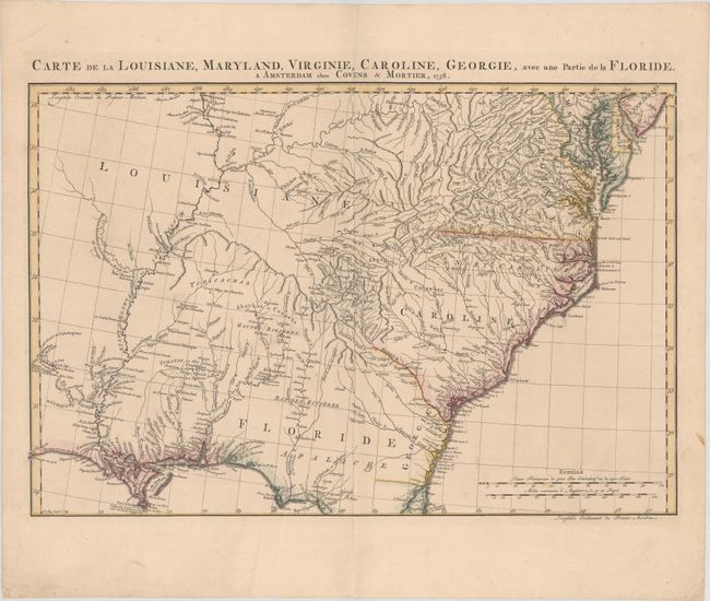
Auction 175, Lot 139
Subject: Colonial Southeast United States
Covens & Mortier
Carte de la Louisiane, Maryland, Virginie, Caroline, Georgie, avec une Partie de la Floride, 1758
Size: 23.1 x 15.4 inches (58.7 x 39.1 cm)
Estimate: $1,200 - $1,500
Covens & Mortier's Map of the Southeast Issued During the French and Indian War
Unsold
Closed on 11/13/2019
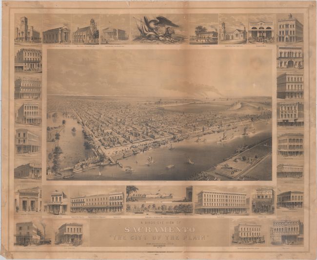
Auction 175, Lot 173
Subject: Sacramento, California
Britton & Rey
A Birds-Eye of Sacramento "The City of the Plain", 1857
Size: 35 x 28.5 inches (88.9 x 72.4 cm)
Estimate: $1,400 - $2,000
Rare View of Sacramento Just After Gold Rush
Sold for: $1,300
Closed on 11/13/2019
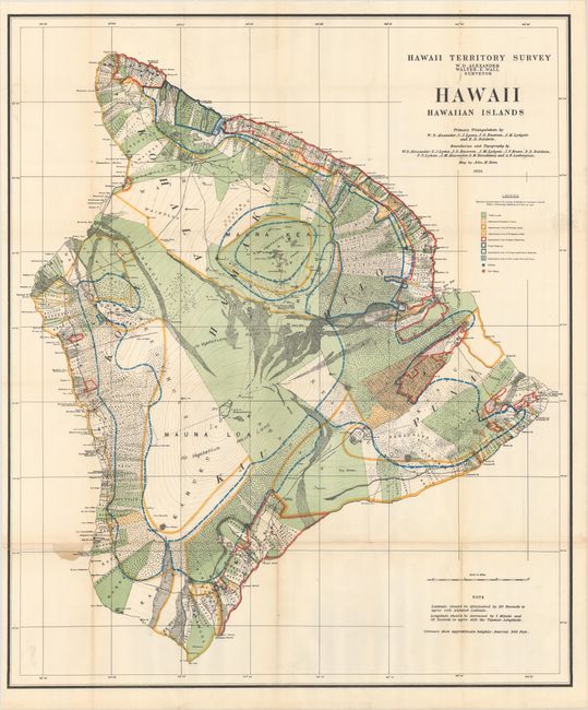
Auction 175, Lot 195
Subject: Hawaii
Hawaii Territorial Surveys
[Lot of 9 - Hawaii Territorial Surveys Maps], 1897-1906
Size: See Description
Estimate: $1,200 - $1,500
Complete Set of Hawaii Territory Maps
Sold for: $1,600
Closed on 11/13/2019
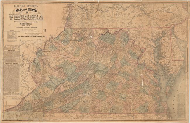
Auction 175, Lot 250
Subject: Virginia & West Virginia, Civil War
Lloyd, James T.
Lloyd's Official Map of the State of Virginia from Original Surveys by Order of the Executive 1828 & 1859..., 1861
Size: 47.3 x 30.3 inches (120.1 x 77 cm)
Estimate: $3,500 - $4,250
First Edition of Lloyd's Civil War Map of Virginia
Unsold
Closed on 11/13/2019
12 lots