Showing No Reserve Lots(remove filter)
Filtered by Category:United States(Show All Categories)
Showing results for:Auction 169
Catalog Archive
8 lots
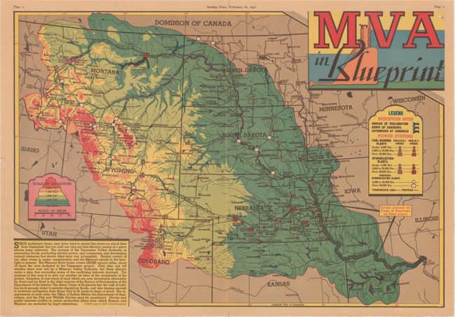
Auction 169, Lot 205
Subject: Central United States
MVA in Blueprint, 1945
Size: 20.5 x 14.1 inches (52.1 x 35.8 cm)
Estimate: $80 - $100
NO RESERVE
Sold for: $21
Closed on 9/12/2018
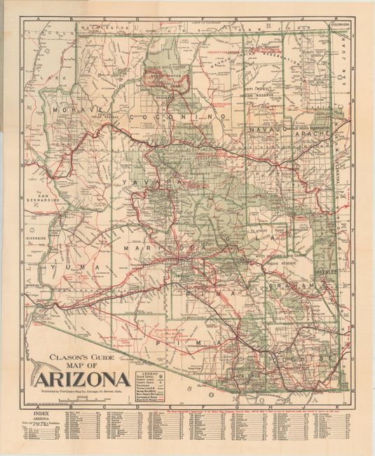
Auction 169, Lot 227
Subject: Arizona
Clason Map Company
Clason's Guide Map of Arizona, 1920
Size: 15 x 17.6 inches (38.1 x 44.7 cm)
Estimate: $60 - $80
NO RESERVE
Sold for: $36
Closed on 9/12/2018
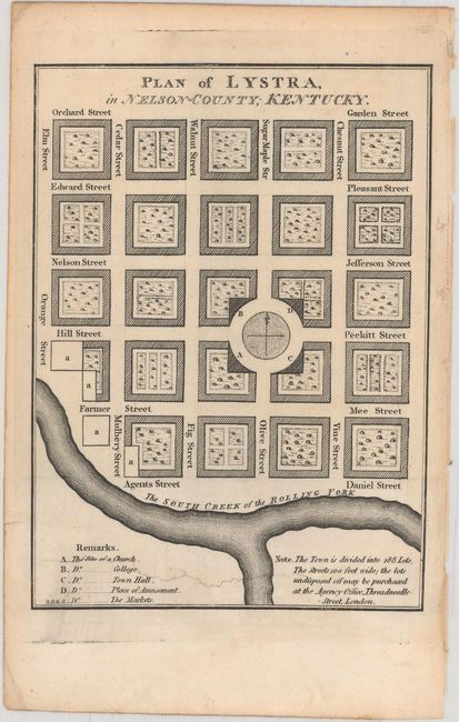
Auction 169, Lot 250
Subject: Kentucky
[Lot of 2] Plan of Franklinville, in Mason County, Kentucky [and] Plan of Lystra, in Nelson-County; Kentucky, 1795
Size: 4.6 x 6.4 inches (11.7 x 16.3 cm)
Estimate: $60 - $80
NO RESERVE
Sold for: $15
Closed on 9/12/2018
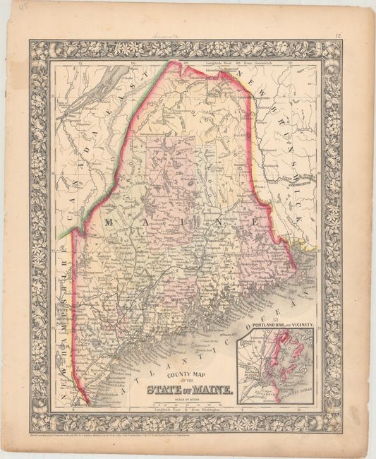
Auction 169, Lot 255
Subject: Maine
Mitchell, Samuel Augustus
County Map of the State of Maine, 1860
Size: 10.7 x 13.3 inches (27.2 x 33.8 cm)
Estimate: $30 - $40
NO RESERVE
Sold for: $27
Closed on 9/12/2018
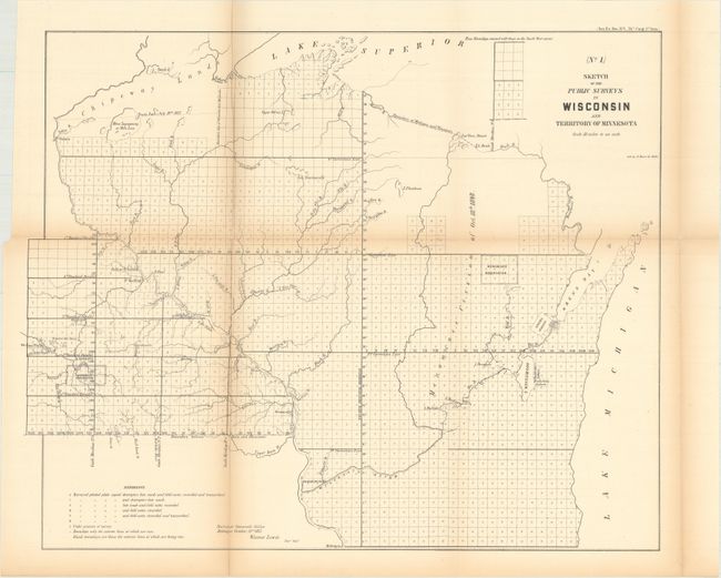
Auction 169, Lot 264
Subject: Minnesota & Wisconsin
General Land Office
[Lot of 7 - Minnesota & Wisconsin Surveys], 1855-1879
Size: See Description
Estimate: $100 - $140
NO RESERVE
Sold for: $160
Closed on 9/12/2018
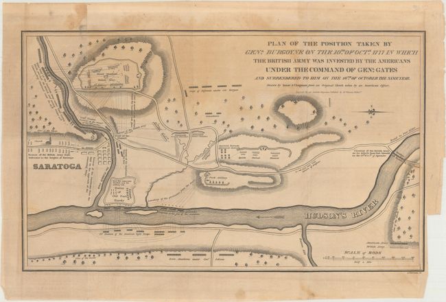
Auction 169, Lot 277
Subject: Saratoga, New York
Plan of the Position Taken by Genl. Burgoyne on the 10th of Octr. 1777 in Which the British Army Was Invested by the Americans Under the Command of Genl. Gates..., 1818
Size: 14.3 x 8.6 inches (36.3 x 21.8 cm)
Estimate: $80 - $100
NO RESERVE
Sold for: $80
Closed on 9/12/2018
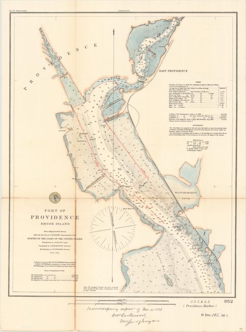
Auction 169, Lot 289
Subject: Providence, Rhode Island
U.S. Coast & Geodetic Survey
Port of Providence Rhode Island from a Trigonometrical Survey Under the Direction of A.D. Bache Superintendent of the Survey of the Coast of the United States..., 1899
Size: 15.4 x 19.2 inches (39.1 x 48.8 cm)
Estimate: $60 - $80
NO RESERVE
Sold for: $6
Closed on 9/12/2018
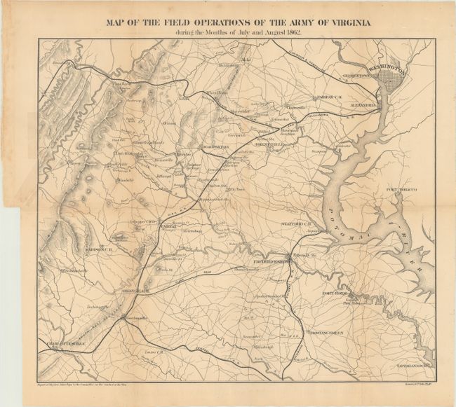
Auction 169, Lot 301
Subject: Virginia
Pope, John
Map of the Field Operations of the Army of Virginia During the Months of July and August 1862, 1866
Size: 16.7 x 14.3 inches (42.4 x 36.3 cm)
Estimate: $60 - $80
NO RESERVE
Sold for: $46
Closed on 9/12/2018
8 lots