Showing Featured Lots(remove filter)
Filtered by Category:Pacific Ocean, New Zealand, Australia(Show All Categories)
Showing results for:Auction 137
Catalog Archive
3 lots
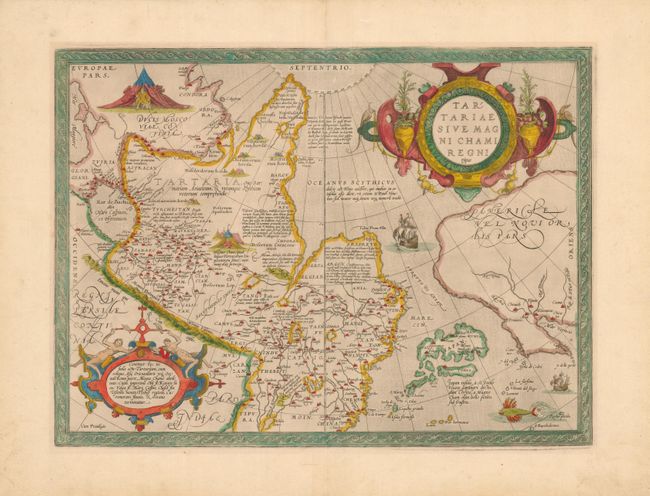
Auction 137, Lot 830
Subject: North Pacific, Northern Asia and Northwestern North America
Ortelius, Abraham
Tartariae sive Magni Chami Regni Typus, 1570-71
Size: 18.6 x 13.8 inches (47.2 x 35.1 cm)
Estimate: $1,600 - $2,000
The Earliest Printed Map to Focus on the North Pacific
Sold for: $1,200
Closed on 9/14/2011
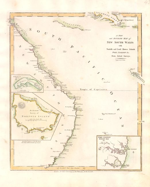
Auction 137, Lot 844
Subject: Australia
Wilkinson, Robert
A New and Accurate Map of New South Wales with Norfolk and Lord Howes Islands Port Jackson &c. from Actual Surveys, 1794
Size: 9 x 10.8 inches (22.9 x 27.4 cm)
Estimate: $200 - $275
One of the First Maps to Illustrate the British Colonization of New South Wales
Sold for: $350
Closed on 9/14/2011
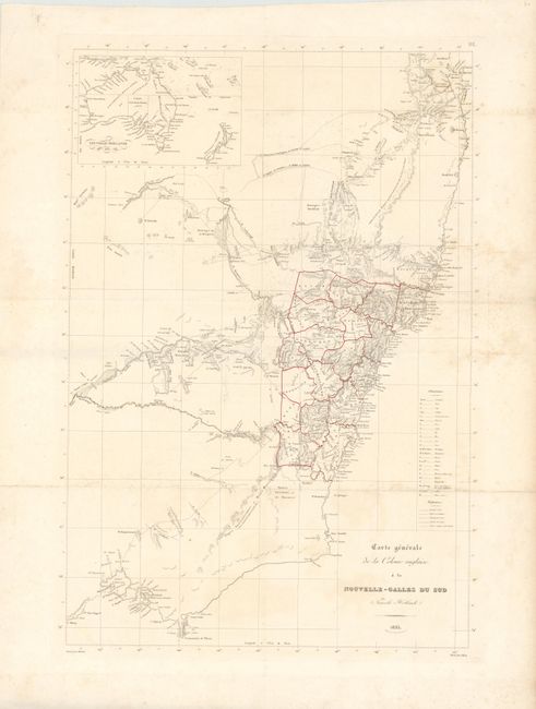
Auction 137, Lot 845
Subject: Australia
Freycinet, Louis Claude Desaules de
Carte Generale de la Colonie Anglaise a la Nouvelle-Galles du Sud (Nouvelle Hollande), 1835
Size: 14.3 x 21 inches (36.3 x 53.3 cm)
Estimate: $800 - $1,200
Rare Freycinet Map of Southeastern Australia
Sold for: $2,000
Closed on 9/14/2011
3 lots