Subject: Australia
Period: 1794 (published)
Publication: General Atlas
Color: Hand Color
Size:
9 x 10.8 inches
22.9 x 27.4 cm
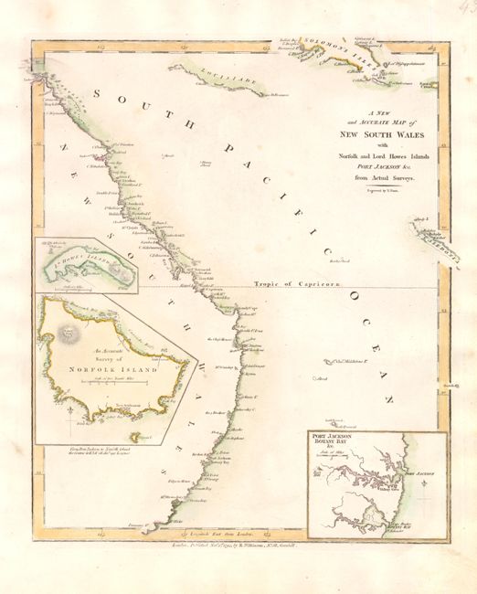
This is one of the first maps of New South Wales to illustrate the British colonization of Australia. It covers the eastern coastline from the Endeavor Straits to Furneaux Is. with place names from Captain Cook’s explorations of 1770. The inset of Botany Bay and Port Jackson illustrates the locations of the first British settlements. Cape Banks is where Sir Joseph Banks recommended the settlement be located, and Sidney Cove shows where Admiral Authur Phillip and his cadre of marines and convicts established the first colony. The inset detailing Norfolk Island, a Pacific island northeast of Sydney, shows the New Settlement that was established as an alternative food source for the colony at Port Jackson and to protect the island from the French. The third inset shows the small Lord Howes Island, which was a provisioning point between the two colonies. The map was engraved by Thomas Foot.
References:
Condition: B+
Nice bright image. There is a small chip at the lower right corner not affecting the image and some minor sporadic soiling, else very good.