Showing Featured Lots(remove filter)
Filtered by Category:North America(Show All Categories)
Showing results for:Auction 136
Catalog Archive
4 lots
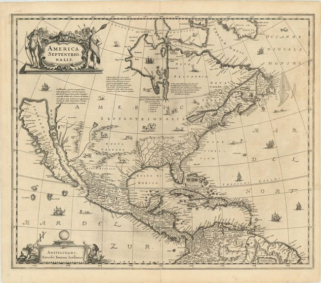
Auction 136, Lot 88
Subject: North America
Hondius/Jansson
America Septentrionalis, 1644
Size: 22 x 18 inches (55.9 x 45.7 cm)
Estimate: $3,000 - $4,000
Influential map showing the Island of California
Sold for: $3,250
Closed on 6/1/2011
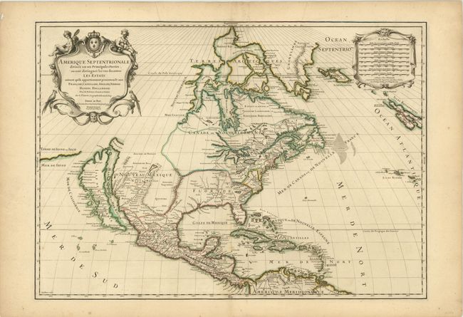
Auction 136, Lot 90
Subject: North America
Sanson/Jaillot
Amerique Septentrionale Divisee en ses Principales Parties…, 1698
Size: 25.5 x 18 inches (64.8 x 45.7 cm)
Estimate: $2,500 - $3,000
A superb map showing the Island of California
Unsold
Closed on 6/1/2011
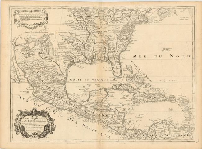
Auction 136, Lot 104
Subject: Colonial North America and Caribbean
Delisle, Guillaume
Carte du Mexique et de la Floride des Terres Angloises et des Isles Antilles du Cours et des Environs de la Riviere de Mississipi…, 1703
Size: 26 x 19 inches (66 x 48.3 cm)
Estimate: $1,700 - $2,000
A Landmark in American Cartography - The first printed map to accurately depict the mouth of the Mississippi River
Sold for: $1,300
Closed on 6/1/2011
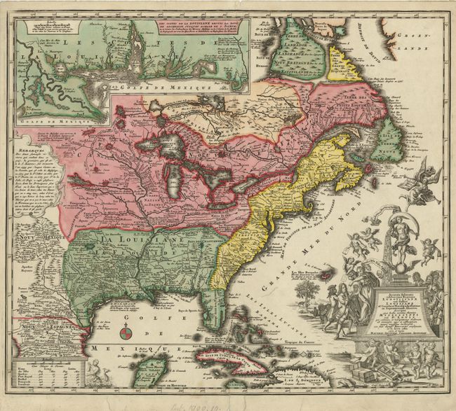
Auction 136, Lot 108
Subject: Colonial North America and Caribbean
Seutter, Matthias
Accurata delineatio celeberrimae Regionis Ludovicianae vel Gallice Louisiane ol Canadae et Floridae adpellatione in Septemtrionali America descripta quae hodie nomine fluminis Mississippi vel St. Louis…, 1740
Size: 22.5 x 19.5 inches (57.2 x 49.5 cm)
Estimate: $2,300 - $3,000
Sold for: $1,700
Closed on 6/1/2011
4 lots