Showing Featured Lots(remove filter)
Filtered by Category:Europe & Mediterranean(Show All Categories)
Showing results for:Auction 171
Catalog Archive
11 lots
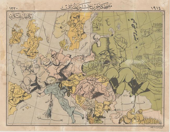
Auction 171, Lot 431
Subject: Europe, World War I
[Arabic Map - Cartoon Map of the War in Europe], 1914
Size: 17.9 x 13.3 inches (45.5 x 33.8 cm)
Estimate: $2,200 - $3,000
Rare Arabic Serio-Comic Map at the Outset of WWI
Sold for: $1,600
Closed on 2/6/2019
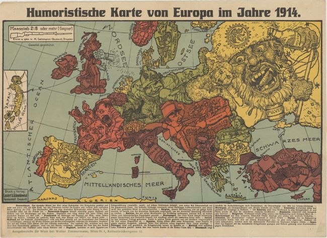
Auction 171, Lot 432
Subject: Europe, World War I
Leutert & Schneiderwind
Humoristische Karte von Europa im Jahre 1914, 1914
Size: 19.1 x 10.9 inches (48.5 x 27.7 cm)
Estimate: $800 - $1,000
Rare Satirical Map of Europe at Start of World War I
Sold for: $400
Closed on 2/6/2019
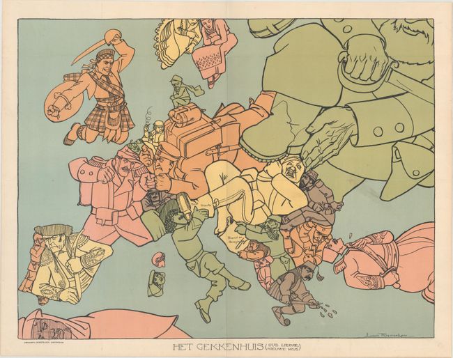
Auction 171, Lot 433
Subject: Europe, World War I
Het Gekkenhuis (Oud Liedje, Nieuwe Wijs), 1915
Size: 20.3 x 15.7 inches (51.6 x 39.9 cm)
Estimate: $1,600 - $1,900
Rare Dutch Satirical Map of World War I
Unsold
Closed on 2/6/2019
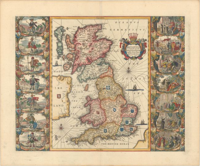
Auction 171, Lot 435
Subject: Britain
Jansson, Jan
Britannia Prout Divisa suit Temporibus Anglo-Saxonum, Praesertim Durante Illorum Heptarchia, 1741
Size: 20.4 x 16.4 inches (51.8 x 41.7 cm)
Estimate: $2,200 - $2,500
Jansson's Splendid Heptarchy Map
Sold for: $1,100
Closed on 2/6/2019
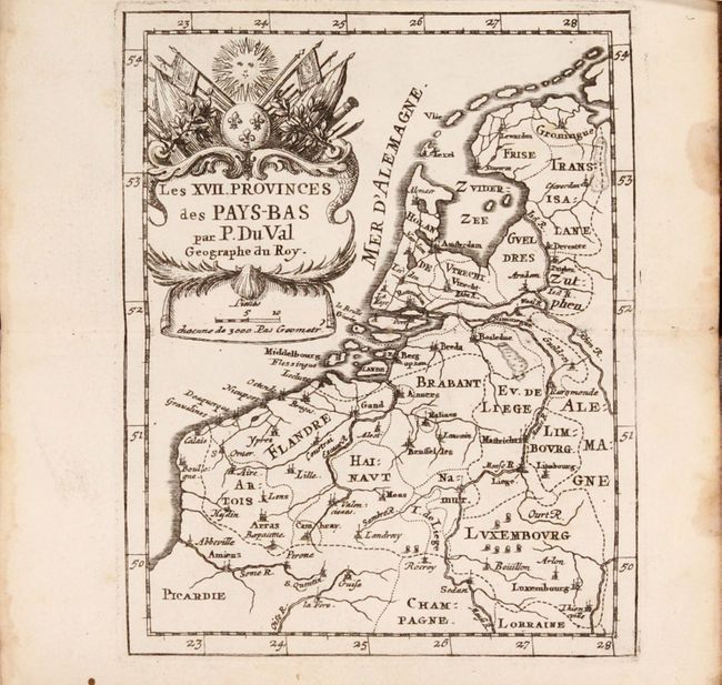
Auction 171, Lot 492
Subject: Low Countries
Duval, Pierre
[Two Atlases in One Book] Cartes et Tables de Geographie, des Provinces Eschues a la Reine Tres-Chretiene [and] Les XII. Provinces. Ou sont les Conquestes du Roy en Holande, et en Flandres, 1672
Size: 3.6 x 6 inches (9.1 x 15.2 cm)
Estimate: $1,600 - $1,900
Two Miniature Atlases of Louis XIV's Attempts to Conquer the Spanish Netherlands
Sold for: $1,000
Closed on 2/6/2019
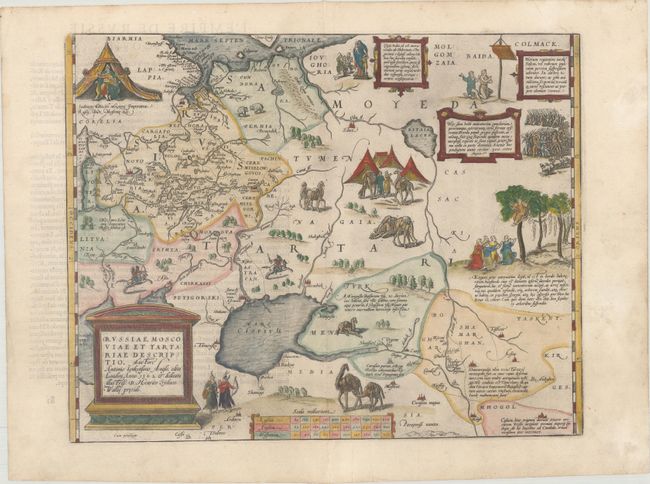
Auction 171, Lot 544
Subject: Russia, Eastern Europe & Central Asia
Ortelius, Abraham
Russiae, Moscoviae et Tartariae Descriptio. Auctore Antonio Ienkensono Anglo..., 1581
Size: 17.6 x 13.9 inches (44.7 x 35.3 cm)
Estimate: $2,000 - $2,300
Ortelius' Map of Russia with a Vignette of Ivan the Terrible
Unsold
Closed on 2/6/2019
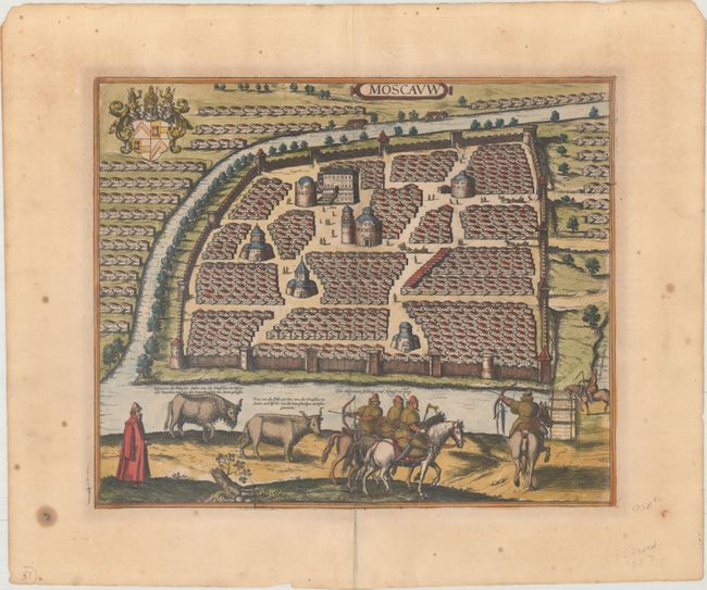
Auction 171, Lot 550
Subject: Moscow, Russia
Jansson, Jan
Moscauw, 1657
Size: 16.6 x 13.7 inches (42.2 x 34.8 cm)
Estimate: $2,000 - $2,300
Rare Jansson Edition of Early Braun & Hogenberg View of Moscow Before the Great Fire
Unsold
Closed on 2/6/2019
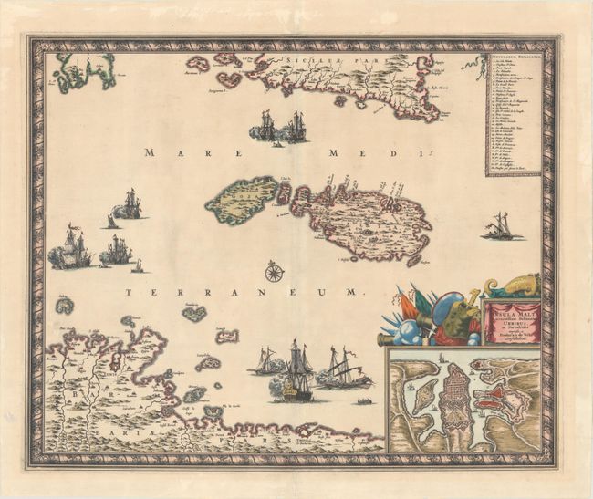
Auction 171, Lot 603
Subject: Malta
Wit, Frederick de
Insula Malta Accuratissime Delineata, Urbibus, et Fortalitiis, 1680
Size: 21.3 x 17.3 inches (54.1 x 43.9 cm)
Estimate: $1,100 - $1,400
One of the Most Decorative 17th Century Maps of Malta
Sold for: $550
Closed on 2/6/2019
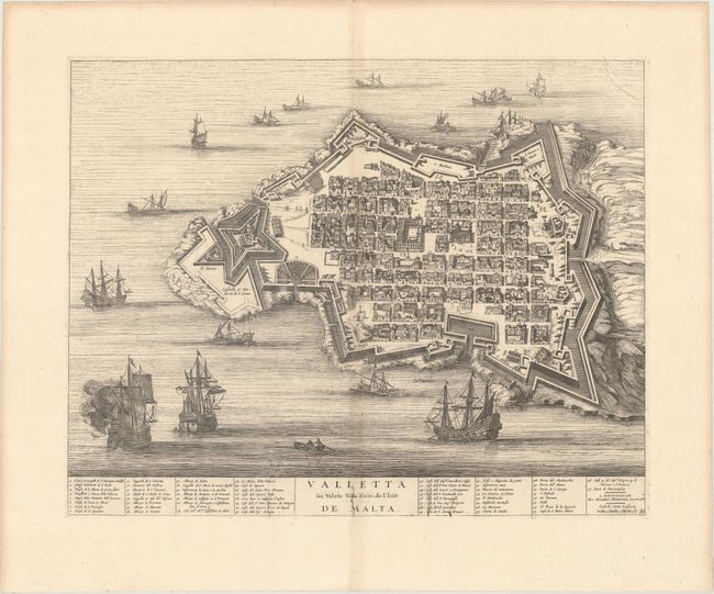
Auction 171, Lot 605
Subject: Valletta, Malta
Mortier, Pierre
Valletta ou Valete Ville Forte, de l'Isle de Malta, 1700
Size: 19.9 x 15.8 inches (50.5 x 40.1 cm)
Estimate: $1,000 - $1,300
Striking Bird's-Eye Plan of Valletta
Sold for: $680
Closed on 2/6/2019
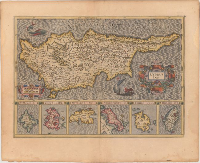
Auction 171, Lot 608
Subject: Cyprus
Hondius, Jodocus
Cyprus Ins:, 1619
Size: 19.5 x 13.9 inches (49.5 x 35.3 cm)
Estimate: $1,100 - $1,400
Hondius' Elegant Map of Cyprus
Unsold
Closed on 2/6/2019
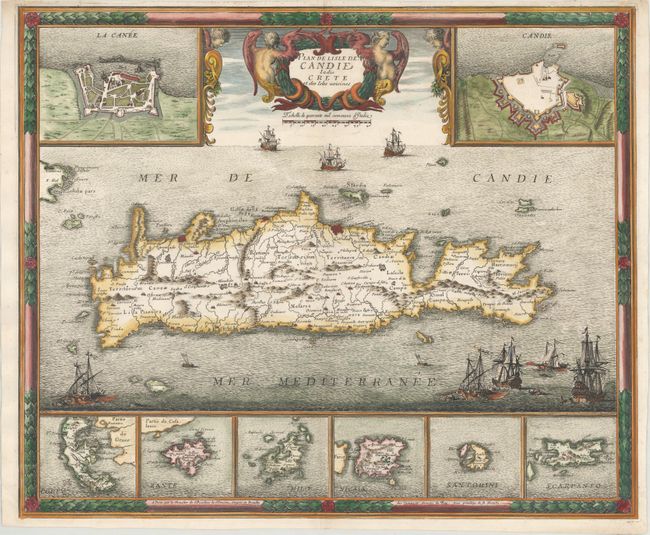
Auction 171, Lot 612
Subject: Crete
Beaulieu, Sebastian de Pontault
Plan de Lisle de Candie Iadis Crete et des Isles Voisines, 1680
Size: 21.1 x 17.6 inches (53.6 x 44.7 cm)
Estimate: $1,000 - $1,400
Beaulieu's Rare Map of Crete After the Siege of Candia
Unsold
Closed on 2/6/2019
11 lots