Showing Featured Lots(remove filter)
Filtered by Category:Canada(Show All Categories)
Showing results for:Auction 175
Catalog Archive
5 lots
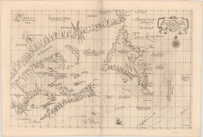
Auction 175, Lot 81
Subject: Eastern Canada
Dudley, Robert (Sir)
Carta Particolare della Terra Nuova con la Gran Baia et il Fiume Grande della Canida ... D'America Car.a Prima, 1647
Size: 29.3 x 19.1 inches (74.4 x 48.5 cm)
Estimate: $3,500 - $4,500
First Printed Sea Chart of the Gulf of St. Lawrence
Sold for: $2,500
Closed on 11/13/2019
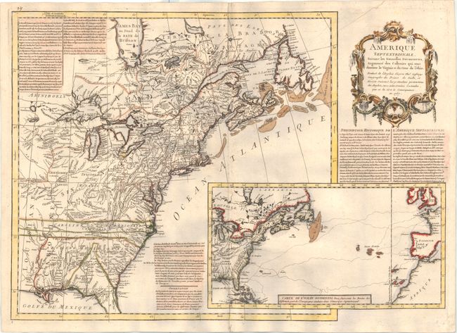
Auction 175, Lot 91
Subject: Colonial Eastern United States & Canada
Anon.
Amerique Septentrionale, Suivant les Nouvelles Decouvertes, Augmente des Collonies qui sont Derriere la Virginie et du Cour de l'Ohio..., 1757
Size: 27.1 x 19.1 inches (68.8 x 48.5 cm)
Estimate: $2,750 - $3,500
A Rare French Map Countering Jefferys' French & Indian War Map
Sold for: $2,500
Closed on 11/13/2019
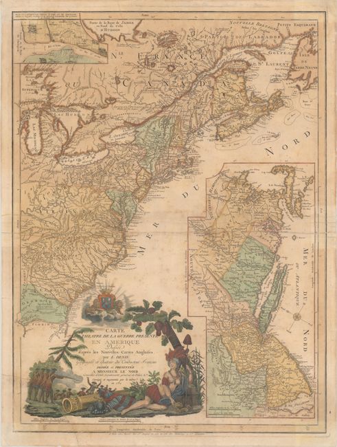
Auction 175, Lot 95
Subject: Colonial Eastern United States & Canada
Denis, Louis
Carte du Theatre de la Guerre Presente en Amerique Dressee d'Apres les Nouvelles Cartes Anglaises, 1782
Size: 19.6 x 26.3 inches (49.8 x 66.8 cm)
Estimate: $3,000 - $3,750
Scarce American Revolutionary War Map
Sold for: $1,800
Closed on 11/13/2019
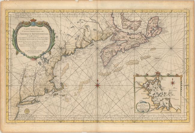
Auction 175, Lot 100
Subject: Colonial Northeastern United States & Canada
Bellin, Jacques Nicolas
Carte Reduite des Costes Orientales de l'Amerique Septentrionale 1re Feuille Contenant l'Isle Royale, l'Accadie, la Baye Francoise, la Nouvelle Angleterre et la Nouvelle Yorc..., 1757
Size: 34.9 x 21.5 inches (88.6 x 54.6 cm)
Estimate: $1,900 - $2,200
Scarce Large-Scale Chart of the Coast of New England
Unsold
Closed on 11/13/2019
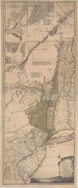
Auction 175, Lot 101
Subject: Colonial Northeast United States & Quebec
Holland/Pownal
The Provinces of New York, and New Jersey; with Part of Pensilvania, and the Province of Quebec..., 1777
Size: 20.3 x 52 inches (51.6 x 132.1 cm)
Estimate: $3,500 - $4,500
Rare German Edition of an Important Revolutionary War Period Map
Sold for: $2,300
Closed on 11/13/2019
5 lots