Showing Featured Lots(remove filter)
Filtered by Category:Canada(Show All Categories)
Showing results for:Auction 165
Catalog Archive
4 lots
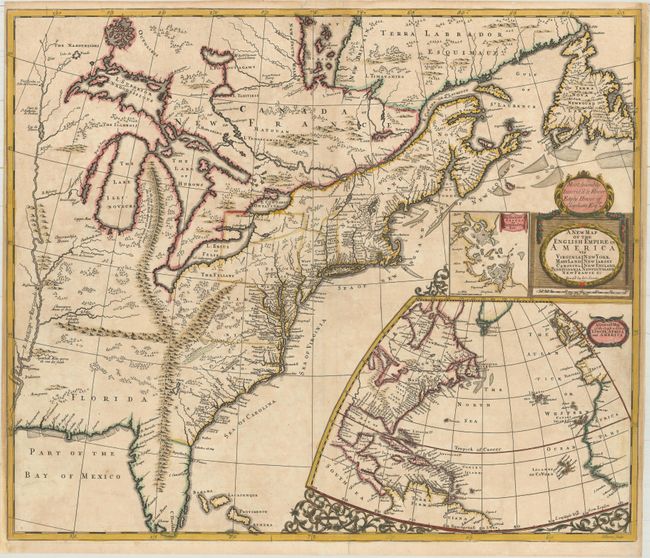
Auction 165, Lot 83
Subject: Colonial Eastern United States & Canada
Senex, John
A New Map of the English Empire in America viz Virginia New York Maryland New Iarsey Carolina New England Pennsylvania Newfoundland New France &c, 1719
Size: 23.6 x 19.9 inches (59.9 x 50.5 cm)
Estimate: $2,400 - $3,000
Important Map of the American Colonies
Unsold
Closed on 11/15/2017
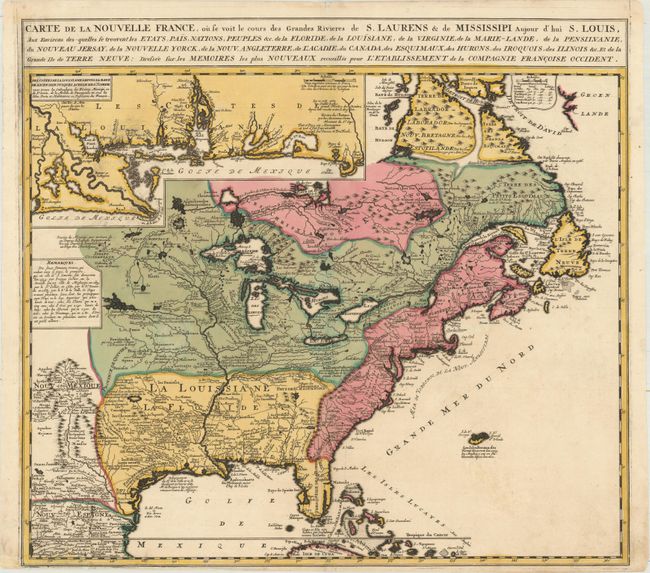
Auction 165, Lot 84
Subject: Colonial Eastern United States & Canada
Ottens/De Fer
Carte de la Nouvelle France, ou se voit le Cours des Grandes Rivieres de S. Laurens & de Mississipi Aujour d'hui S. Louis, aux Environs des Quelles se Trouvent les Etats, Pais, Nations, Peuples &c..., 1745
Size: 21.7 x 19.6 inches (55.1 x 49.8 cm)
Estimate: $2,000 - $2,300
Reduced Version of De Fer's Influential Map of French Possessions in North America
Sold for: $1,400
Closed on 11/15/2017
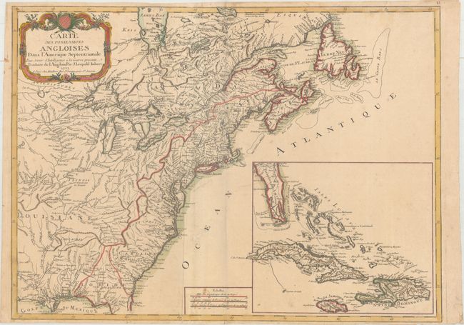
Auction 165, Lot 86
Subject: Colonial Eastern United States & Canada
Imbert, J. Leopold
Carte des Possessions Angloises dans l'Amerique Septentrionale pour Servir d'Intelligence a la Guerre Presente Traduite de l Angloise, 1777
Size: 28.9 x 21.3 inches (73.4 x 54.1 cm)
Estimate: $1,800 - $2,200
First Edition of Important Revolutionary War Map
Sold for: $1,100
Closed on 11/15/2017
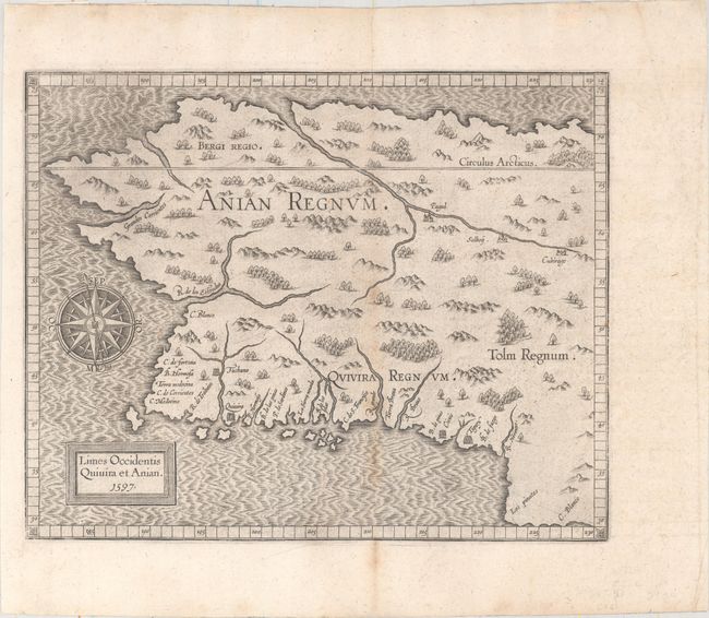
Auction 165, Lot 98
Subject: Alaska & Western Canada
Wytfliet, Cornelis
Limes Occidentis Quivira et Anian, 1597
Size: 11.4 x 9.1 inches (29 x 23.1 cm)
Estimate: $1,800 - $2,100
Early and Imaginary Map of Alaska and the Northwest Passage
Sold for: $1,300
Closed on 11/15/2017
4 lots