Showing Featured Lots(remove filter)
Filtered by Category:Canada(Show All Categories)
Showing results for:Auction 156
Catalog Archive
5 lots
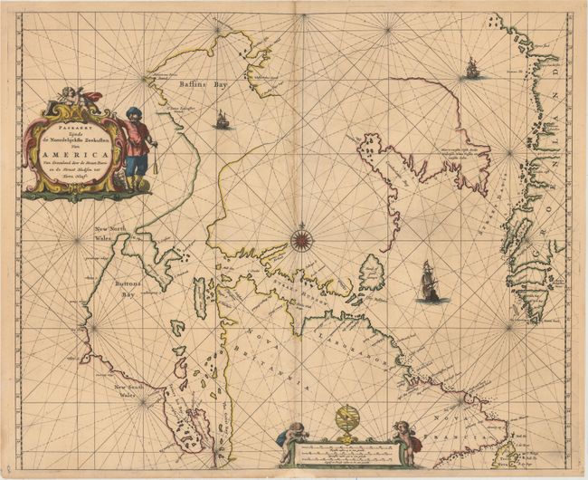
Auction 156, Lot 108
Subject: Eastern Canada and Greenland
Goos, Pieter
Paskaert Zynde de Noordelijckste Zeekusten van America van Groenland door de Straet Davis en de Straet Hudson tot Terra Neuf, 1666
Size: 21.4 x 17.5 inches (54.4 x 44.5 cm)
Estimate: $950 - $1,200
Goos' Uncommon Sea Chart Centered on Hudson Strait
Unsold
Closed on 2/17/2016
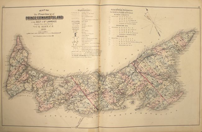
Auction 156, Lot 116
Subject: Prince Edward Island, Atlases
Illustrated Historical Atlas of the Province of Prince Edward Island..., 1880
Size: 14.7 x 17.8 inches (37.3 x 45.2 cm)
Estimate: $2,000 - $2,500
Highly Detailed Atlas of Prince Edward Island
Unsold
Closed on 2/17/2016
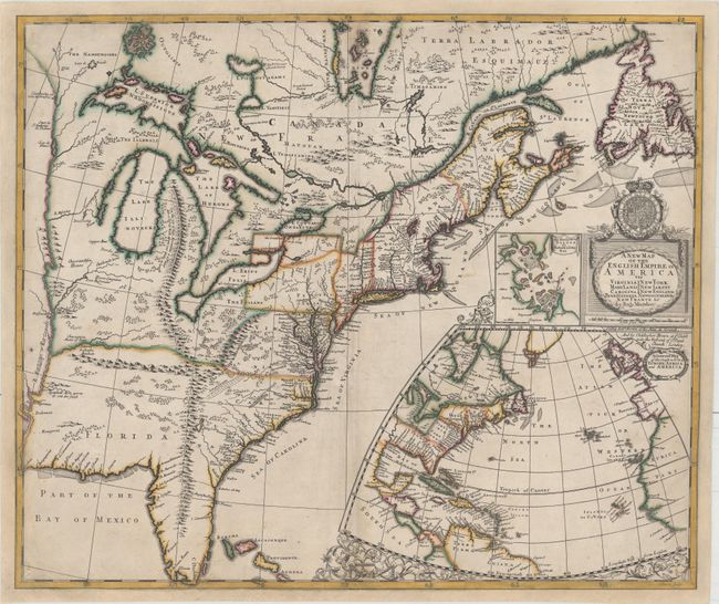
Auction 156, Lot 122
Subject: Colonial Eastern United States & Canada
Morden, Robert
A New Map of the English Empire in America viz Virginia Maryland Carolina Pennsylvania New York New Iarsey New England Newfoundland New France &c., 1695
Size: 23.4 x 19.8 inches (59.4 x 50.3 cm)
Estimate: $14,000 - $16,000
First State of Morden's Rare Map of the American Colonies
Unsold
Closed on 2/17/2016
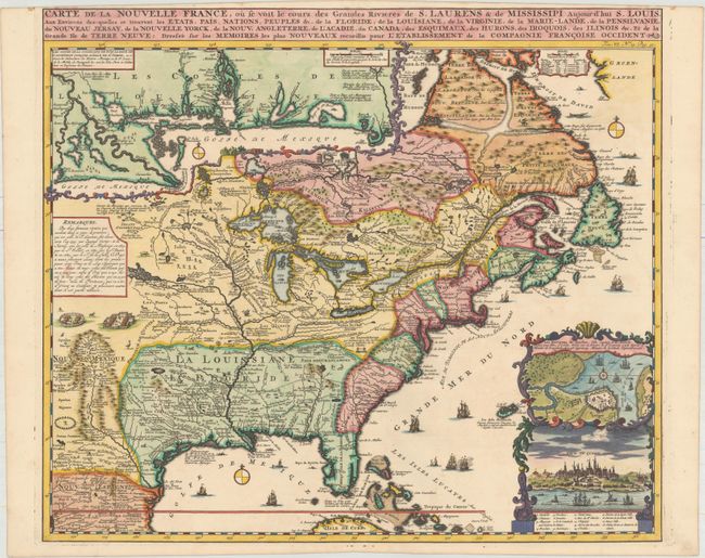
Auction 156, Lot 123
Subject: Colonial Eastern United States & Canada
Chatelain, Henry Abraham
Carte de la Nouvelle France, ou se voit le Cours des Grandes Rivieres de S. Laurens & de Mississipi Aujour d'hui S. Louis, aux Environs des-quelles se Trouvent les Etats, Pais, Nations, Peuples &c..., 1719
Size: 19.1 x 16.6 inches (48.5 x 42.2 cm)
Estimate: $2,200 - $2,500
One of the Most Informative 18th Century Maps of the French Possessions in North America
Sold for: $2,500
Closed on 2/17/2016
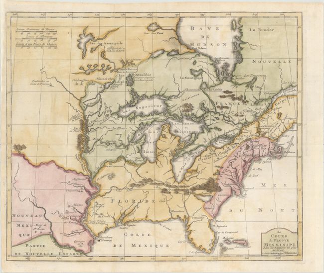
Auction 156, Lot 124
Subject: Colonial Eastern United States & Canada, Great Lakes
Bernard, Jean Frederic
Le Cours du Fleuve Missisipi Selon les Relations les Plus Modernes, 1737
Size: 17.3 x 14.7 inches (43.9 x 37.3 cm)
Estimate: $1,600 - $1,900
Scarce and Desirable Early Hennepin Variant
Sold for: $1,400
Closed on 2/17/2016
5 lots