Showing Featured Lots(remove filter)
Filtered by Category:Canada(Show All Categories)
Showing results for:Auction 154
Catalog Archive
4 lots
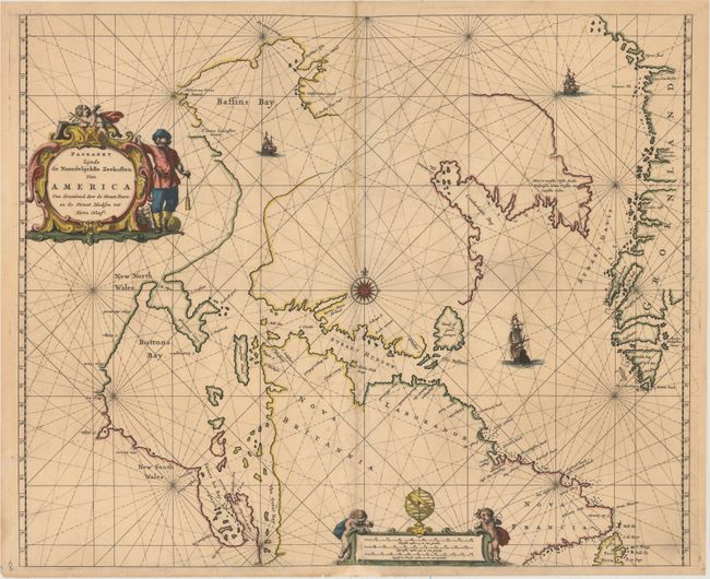
Auction 154, Lot 83
Subject: Eastern Canada and Greenland
Goos, Pieter
Paskaert Zynde de Noordelijckste Zeekusten van America van Groenland door de Straet Davis en de Straet Hudson tot Terra Neuf, 1666
Size: 21.4 x 17.5 inches (54.4 x 44.5 cm)
Estimate: $1,200 - $1,500
Goos' Uncommon Sea Chart Centered on Hudson Strait
Unsold
Closed on 9/16/2015
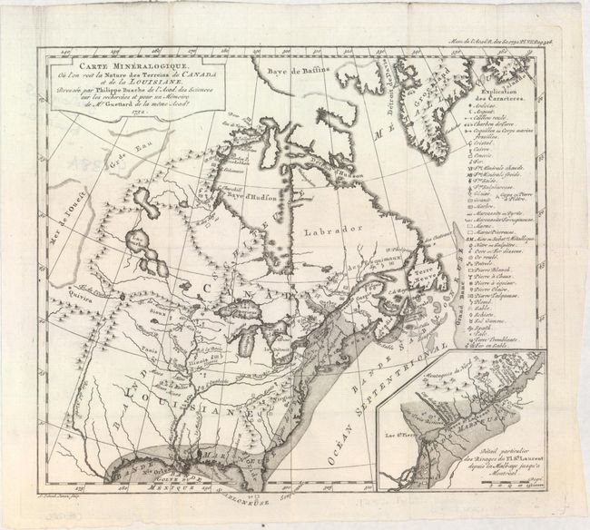
Auction 154, Lot 97
Subject: Colonial Eastern United States & Canada
Guettard, Jean Etienne
Carte Mineralogique, ou l'on voit la Nature des Terreins du Canada et de la Louisiane..., 1752
Size: 12.1 x 10.9 inches (30.7 x 27.7 cm)
Estimate: $1,200 - $1,500
First Geological Map of North America
Sold for: $900
Closed on 9/16/2015
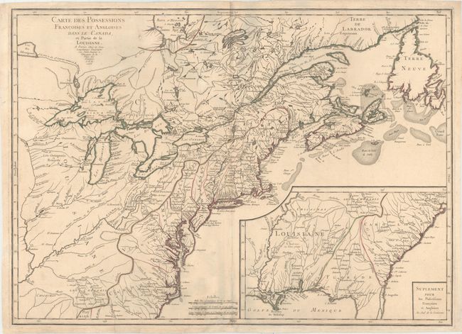
Auction 154, Lot 98
Subject: Colonial Eastern United States & Canada
Longchamp, S. G. (Sieur)
Carte des Possessions Francoises et Angloises dans le Canada, et Partie de la Louisiane, 1756
Size: 30 x 21.6 inches (76.2 x 54.9 cm)
Estimate: $1,600 - $1,900
First State of Longchamp's Map of the Theater of the French and Indian War
Sold for: $1,400
Closed on 9/16/2015
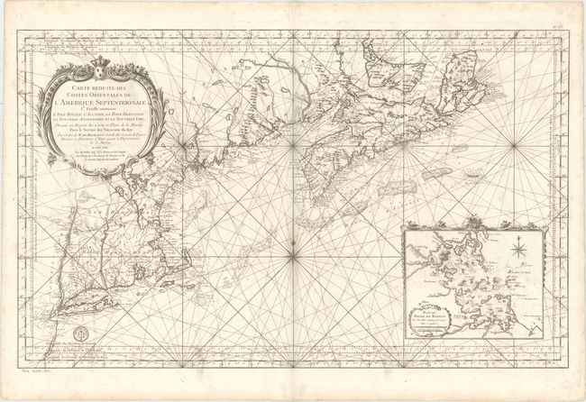
Auction 154, Lot 107
Subject: Colonial Northeastern United States & Canada
Bellin, Jacques Nicolas
Carte Reduite des Costes Orientales de l'Amerique Septentrionale 1re. Feuille Contenant l'Isle Royale, l'Accadie, la Bay Francoise, la Nouvelle Angleterre et la Nouvelle Yorc..., 1757
Size: 34.9 x 21.6 inches (88.6 x 54.9 cm)
Estimate: $2,400 - $3,000
Scarce Large-Scale Chart of the Coast of New England
Unsold
Closed on 9/16/2015
4 lots