Showing Featured Lots(remove filter)
Filtered by Category:Canada(Show All Categories)
Showing results for:Auction 142
Catalog Archive
4 lots
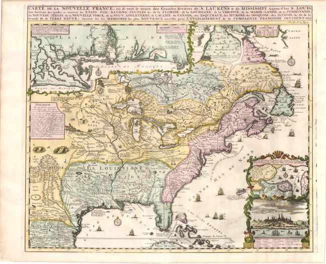
Auction 142, Lot 123
Subject: Colonial United States and Canada
Chatelain, Henry Abraham
Carte de la Nouvelle France, ou se voit le cours des Grandes Rivieres de S. Laurens & de Mississipi Aujour d'hui S. Louis, aux Environs des-quelles se trouvent les Etats, Pais, Nations, Peuples &c., 1719
Size: 19.3 x 16.5 inches (49 x 41.9 cm)
Estimate: $2,000 - $2,400
Sold for: $1,500
Closed on 11/28/2012
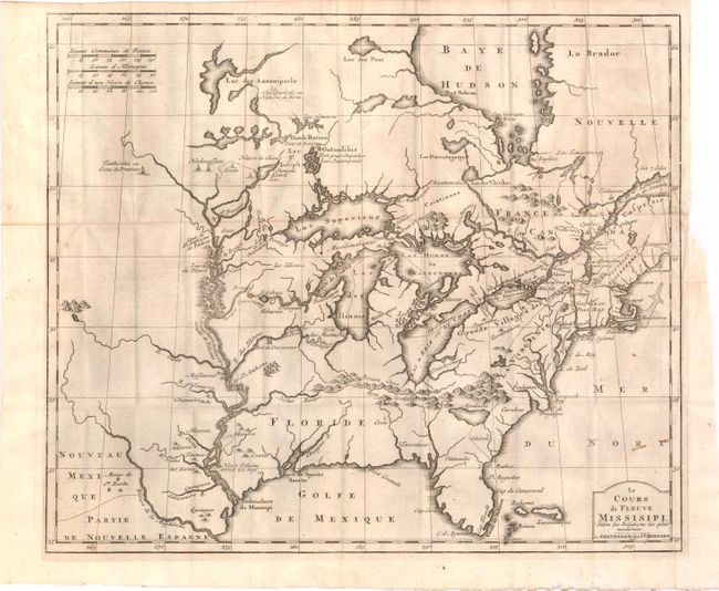
Auction 142, Lot 124
Subject: Colonial United States and Canada, Great Lakes
Bernard, Jean Frederic
Le Cours du Fleuve Missisipi Selon les Relations les Plus Modernes, 1737
Size: 17.2 x 14.6 inches (43.7 x 37.1 cm)
Estimate: $2,000 - $2,300
Sold for: $1,500
Closed on 11/28/2012
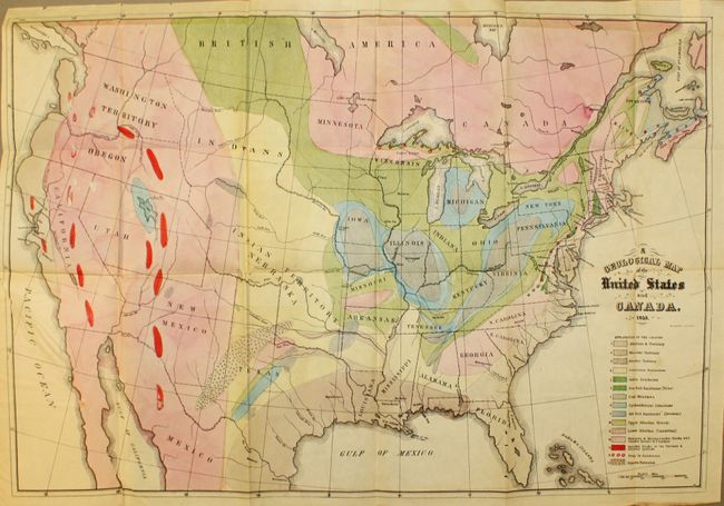
Auction 142, Lot 136
Subject: United States and Canada
Hitchcock, Edward
[Maps with Report] A Geological Map of the United States and Canada [and] Outline of the Geology of the Globe, 1853
Size: See Description
Estimate: $1,000 - $1,300
First Edition of Hitchcock's Important Maps and Report
Sold for: $1,300
Closed on 11/28/2012
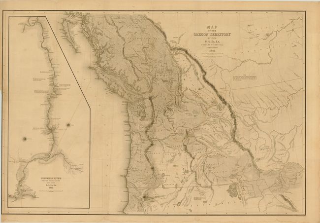
Auction 142, Lot 143
Subject: Western Canada & United States
Wilkes, Charles
Map of the Oregon Territory by the U.S. Ex. Ex., 1841
Size: 33.8 x 22.8 inches (85.9 x 57.9 cm)
Estimate: $1,500 - $2,000
Sold for: $1,100
Closed on 11/28/2012
4 lots