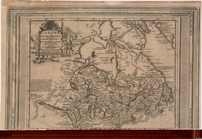
Filtered by Category:Canada(Show All Categories)
Showing results for:Auction 152
Catalog Archive
30 lots
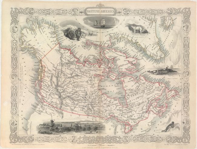
Auction 152, Lot 101
Subject: Canada
Tallis, John
British America, 1850
Size: 12.9 x 10.1 inches (32.8 x 25.7 cm)
Estimate: $240 - $300
Sold for: $150
Closed on 2/18/2015
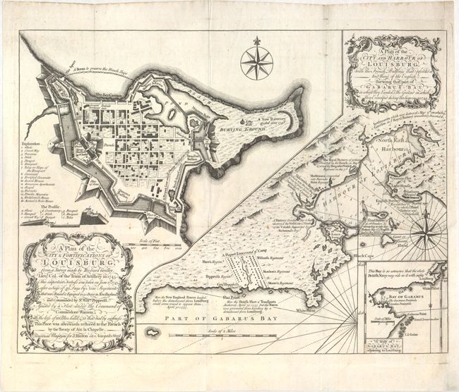
Auction 152, Lot 102
Subject: Eastern Canada, Louisburg
Gridley, Richard (Lt. Col.)
A Plan of the City & Fortifications of Louisburg… [on sheet with] A Plan of the City and Harbour of Louisburg…, 1758
Size: 14 x 10.5 inches (35.6 x 26.7 cm)
Estimate: $325 - $400
Unsold
Closed on 2/18/2015
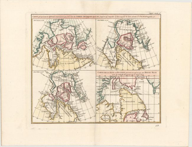
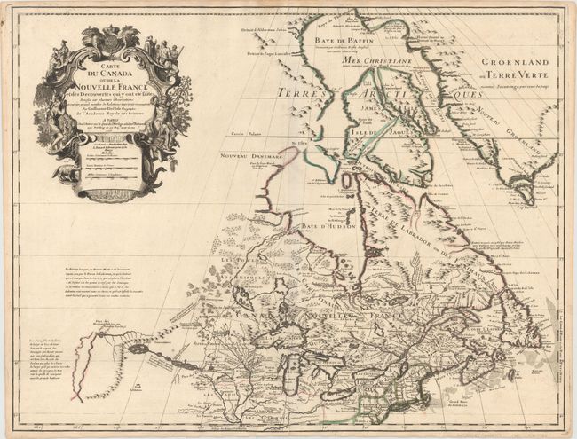
Auction 152, Lot 103
Subject: Eastern Canada
Robert de Vaugondy, Didier
Carte qui Represente les Differentes Connoissances que l'on a Eues des Terres Arctiques Depuis 1650 Jusqu'en 1747 Ausquelles il Faut Comparer la Carte Suivante, 1773
Size: 15.1 x 12 inches (38.4 x 30.5 cm)
Estimate: $140 - $170
Unsold
Closed on 2/18/2015
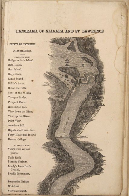
Auction 152, Lot 104
Subject: Eastern Canada, Niagara Falls
The River St. Lawrence, in One Panoramic View, from Niagara Falls to Quebec, Together with Descriptions and Illustrations of the Thousand Islands, Cities in Canada..., 1859
Size: 6 x 9.5 inches (15.2 x 24.1 cm)
Estimate: $200 - $230
Sold for: $150
Closed on 2/18/2015
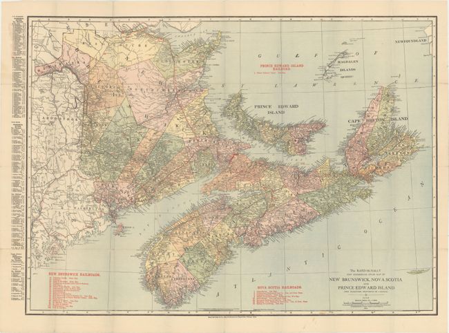
Auction 152, Lot 105
Subject: Eastern Canada
Rand McNally & Co.
The Rand-McNally New Commercial Atlas Map of New Brunswick, Nova Scotia and Prince Edward Island (The Maritime Provinces of Canada), 1914
Size: 25.9 x 18.9 inches (65.8 x 48 cm)
Estimate: $100 - $130
Unsold
Closed on 2/18/2015
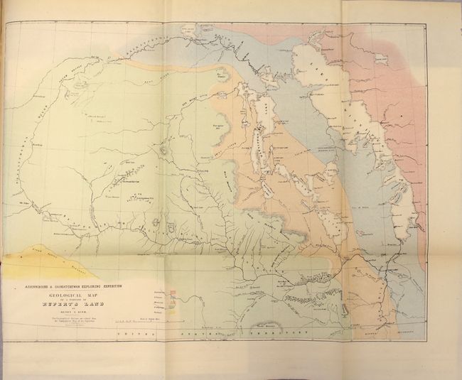
Auction 152, Lot 106
Subject: Central Canada
Hind, Henry Youle
North-West Territory. Reports of Progress; Together with a Preliminary and General Report on the Assiniboine and Saskatchewan Exploring Expedition..., 1859
Size: 10 x 13.4 inches (25.4 x 34 cm)
Estimate: $700 - $850
Unsold
Closed on 2/18/2015
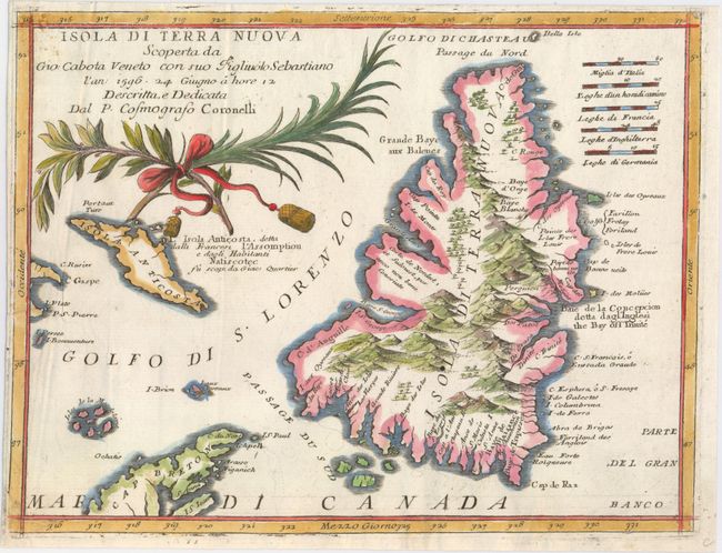
Auction 152, Lot 107
Subject: Newfoundland, Canada
Coronelli, Vincenzo Maria
Isola di Terra Nuova Scoperta da Gio: Cabota Veneto con suo Figliuolo Sebastiano..., 1696
Size: 12 x 9.1 inches (30.5 x 23.1 cm)
Estimate: $400 - $500
Sold for: $300
Closed on 2/18/2015
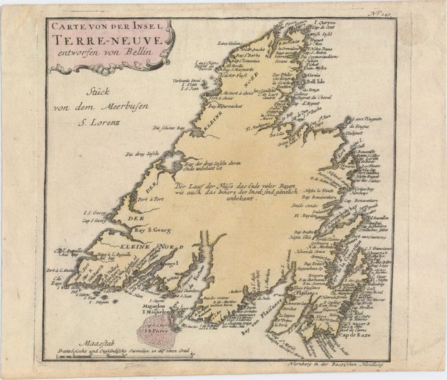
Auction 152, Lot 108
Subject: Newfoundland, Canada
Raspe, Gabriel Nikolaus
Carte von der Insel Terre-Neuve, 1763
Size: 9 x 8.9 inches (22.9 x 22.6 cm)
Estimate: $140 - $170
Unsold
Closed on 2/18/2015
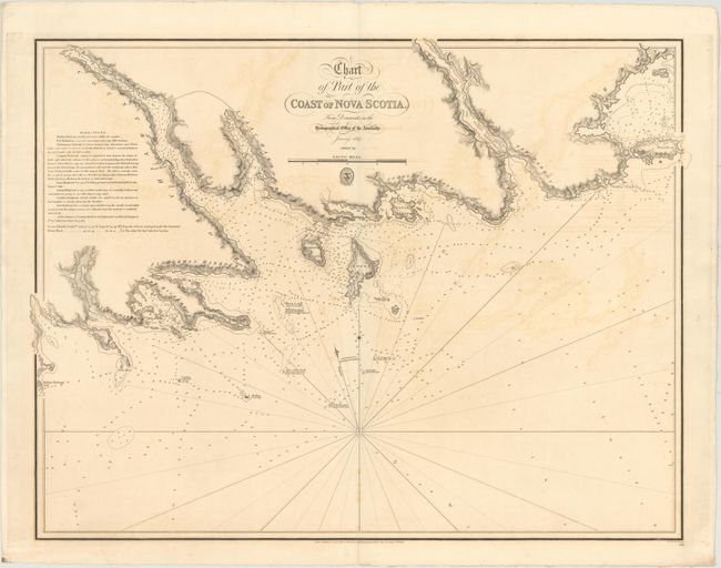
Auction 152, Lot 109
Subject: Nova Scotia, Canada
British Admiralty
Chart of Part of the Coast of Nova Scotia. From Documents in the Hydrographical Office of the Admiralty, 1827
Size: 31.3 x 23.6 inches (79.5 x 59.9 cm)
Estimate: $275 - $350
Unsold
Closed on 2/18/2015
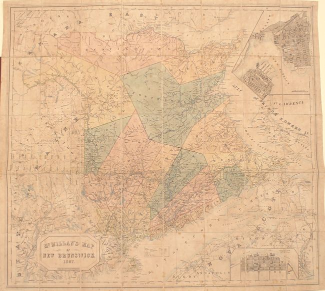
Auction 152, Lot 110
Subject: New Brunswick, Canada
Philip, George
McMillan's Map of New Brunswick, 1867
Size: 38.1 x 35.1 inches (96.8 x 89.2 cm)
Estimate: $400 - $500
Unsold
Closed on 2/18/2015
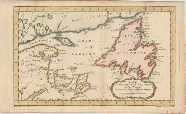
Auction 152, Lot 111
Subject: St. Lawrence Bay, Canada
Bellin, Jacques Nicolas
Carte du Golphe de St. Laurent et Pays Voisins pour Servir a l'Histoire Generale des Voyages, 1757
Size: 14.2 x 8.8 inches (36.1 x 22.4 cm)
Estimate: $110 - $140
Sold for: $80
Closed on 2/18/2015
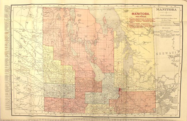
Auction 152, Lot 112
Subject: Manitoba, Canada
Rand McNally & Co.
Manitoba, 1910
Size: 19.1 x 12.7 inches (48.5 x 32.3 cm)
Estimate: $100 - $130
Unsold
Closed on 2/18/2015
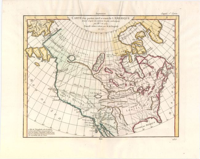
Auction 152, Lot 113
Subject: Colonial United States & Canada
Robert de Vaugondy, Didier
Carte des Parties Nord et Ouest de l'Amerique Dressee d'Apres les Relations les Plus Authentiques par M... en 1764, 1772
Size: 15.2 x 11.8 inches (38.6 x 30 cm)
Estimate: $200 - $230
Sold for: $150
Closed on 2/18/2015
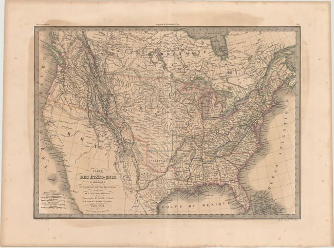
Auction 152, Lot 114
Subject: United States & Canada, Texas
Lapie/Tardieu
Carte des Etats-Unis d'Amerique, du Canada, du Nouveau Brunswick et d'Une Partie de la Nouvelle Bretagne, 1838
Size: 21.7 x 15.6 inches (55.1 x 39.6 cm)
Estimate: $200 - $230
Sold for: $150
Closed on 2/18/2015
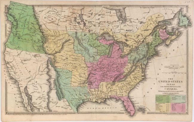
Auction 152, Lot 115
Subject: United States & Canada, Texas
Huntington, F. J.
The United States Texas & the British Provinces of the Canadas, Newfoundland, Nova Scotia, N. Brunswick & Prince Edward Island, 1838
Size: 18.3 x 11 inches (46.5 x 27.9 cm)
Estimate: $350 - $450
Sold for: $400
Closed on 2/18/2015
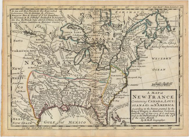
Auction 152, Lot 116
Subject: Colonial Eastern United States & Canada
Moll, Herman
A Map of New France Containing Canada, Louisiana &c. in Nth. America..., 1745
Size: 10.2 x 7.2 inches (25.9 x 18.3 cm)
Estimate: $550 - $650
Sold for: $300
Closed on 2/18/2015
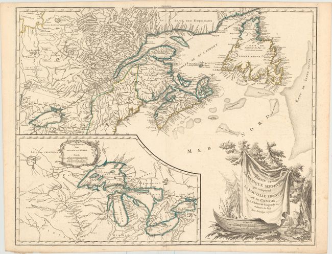
Auction 152, Lot 117
Subject: Colonial Eastern United States & Canada, Great Lakes
Robert de Vaugondy, Didier
Partie de l'Amerique Septent? qui Comprend la Nouvelle France ou le Canada, 1755
Size: 23.8 x 19.1 inches (60.5 x 48.5 cm)
Estimate: $700 - $850
Unsold
Closed on 2/18/2015
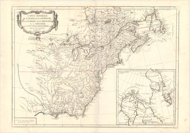
Auction 152, Lot 118
Subject: Colonial Eastern United States & Canada
D'Anville/Santini
Carte Generale du Canada, de la Louisiane, de la Floride, de la Caroline, de la Virginie, de la Nouvelle Angleterre Etc., 1776
Size: 25.8 x 18.9 inches (65.5 x 48 cm)
Estimate: $550 - $700
Sold for: $400
Closed on 2/18/2015
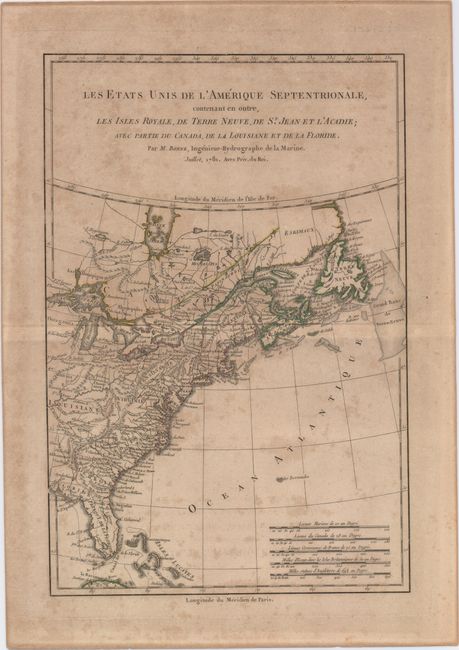
Auction 152, Lot 119
Subject: Colonial Eastern United States & Canada
Bonne, Rigobert
Les Etats Unis de l'Amerique Septentrionale, Contenant en Outre, les Isles Royale, de Terre Neuve, de St. Jean et l'Acadie; avec Partie du Canada, de la Louisiane et de la Floride, 1781
Size: 8.5 x 12.8 inches (21.6 x 32.5 cm)
Estimate: $120 - $150
Sold for: $80
Closed on 2/18/2015
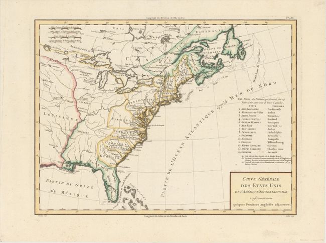
Auction 152, Lot 120
Subject: Eastern United States & Canada
Tardieu, Pierre Francois
Carte Generale des Etats Unis de l'Amerique Septentrionale, Renfermantaussi quelques Provinces Angloises Adjacentes, 1797
Size: 17 x 12.7 inches (43.2 x 32.3 cm)
Estimate: $240 - $300
Sold for: $180
Closed on 2/18/2015
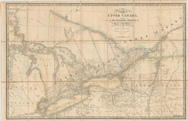
Auction 152, Lot 121
Subject: Eastern United States & Canada
Wyld, James
A Map of the Province of Upper Canada Describing All the New Settlements, Townships, &c. with the Countries Adjacent, from Quebec to Lake Huron, 1838
Size: 33.7 x 22.3 inches (85.6 x 56.6 cm)
Estimate: $450 - $550
Sold for: $450
Closed on 2/18/2015
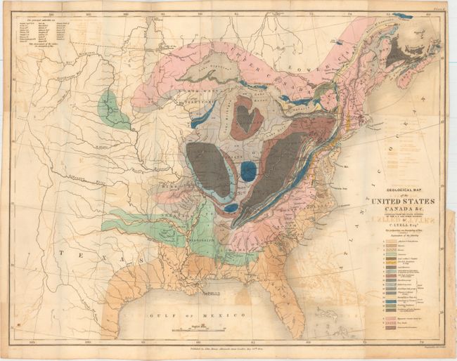
Auction 152, Lot 122
Subject: Eastern United States & Canada, Texas
Lyell, Charles
Geological Map of the United States Canada &c. Compiled from the State Surveys of the U.S. and Other Sources, 1845
Size: 19.6 x 15.1 inches (49.8 x 38.4 cm)
Estimate: $400 - $500
Sold for: $325
Closed on 2/18/2015
Auction 152, Lot 123
Subject: Colonial Northeastern United States & Canada, Great Lakes
Delisle, Guillaume
Carte du Canada ou de la Nouvelle France et des Decouvertes qui y ont ete faites..., 1703
Size: 25.7 x 19.7 inches (65.3 x 50 cm)
Estimate: $2,400 - $3,000
Delisle's Seminal Map of Canada and the Great Lakes
Sold for: $2,100
Closed on 2/18/2015
Auction 152, Lot 124
Subject: Colonial Northeastern United States & Canada
Aa, Pieter van der
Canada ou Nouvelle France, Suivant les Nouvelles Observations de Messrs. De l'Academie Royale des Sciences, etc., 1730
Size: 15.1 x 10.4 inches (38.4 x 26.4 cm)
Estimate: $400 - $475
Sold for: $400
Closed on 2/18/2015
Auction 152, Lot 125
Subject: Colonial New England & Canada
Bellin/Homann Heirs
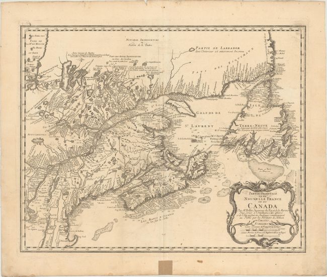
Partie Orientale de la Nouvelle France ou du Canada, 1755
Size: 21.1 x 16.9 inches (53.6 x 42.9 cm)
Estimate: $700 - $850
Sold for: $500
Closed on 2/18/2015
Auction 152, Lot 126
Subject: Colonial Central United States & Canada
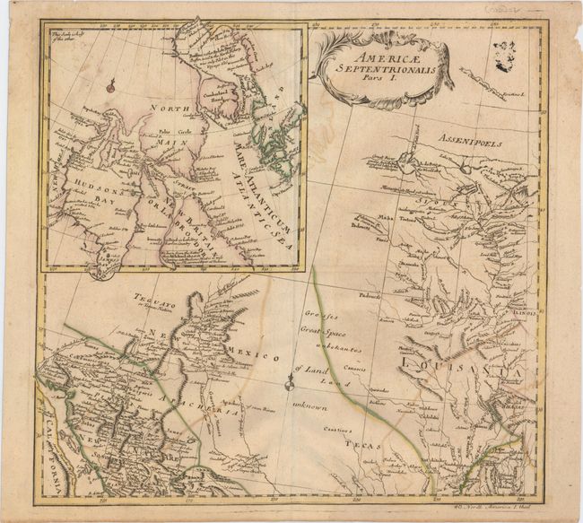
Euler, Leonhard
Americae Septentrionalis Pars I, 1753
Size: 14.3 x 13.6 inches (36.3 x 34.5 cm)
Estimate: $300 - $375
Sold for: $180
Closed on 2/18/2015
Auction 152, Lot 127
Subject: Colonial Central United States & Canada, Great Lakes
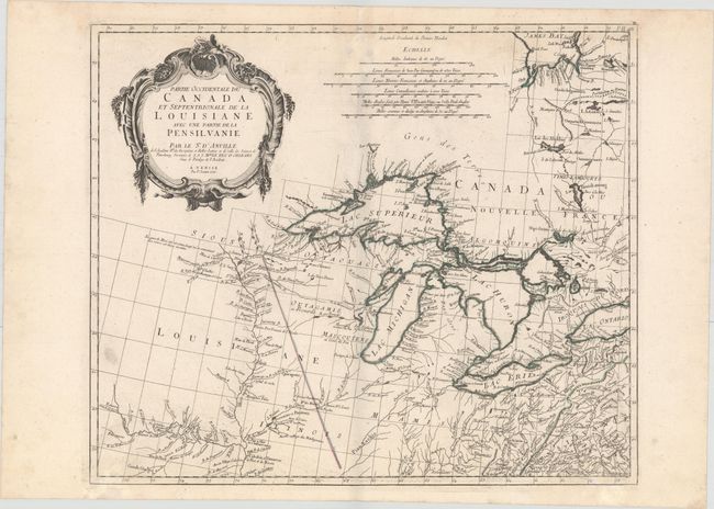
D'Anville/Santini
Partie Occidentale du Canada et Septentrionale de la Louisiane avec une Partie de la Pensilvanie..., 1775
Size: 22.5 x 19.1 inches (57.2 x 48.5 cm)
Estimate: $950 - $1,200
Sold for: $700
Closed on 2/18/2015
Auction 152, Lot 128
Subject: Western United States & Canada
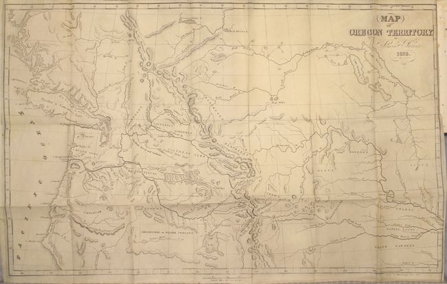
Parker, Samuel (Rev.)
Journal of an Exploring Tour Beyond the Rocky Mountains … [with] Map of Oregon Territory, 1846
Size: 5 x 7.8 inches (12.7 x 19.8 cm)
Estimate: $400 - $500
Sold for: $300
Closed on 2/18/2015
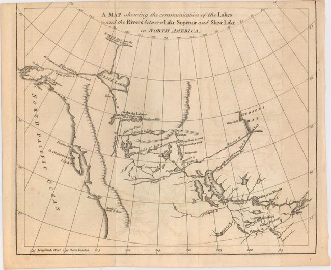
Auction 152, Lot 129
Subject: Western Canada & Alaska
Anon.
A Map Shewing the Communication of the Lakes and the Rivers Between Lake Superior and Slave Lake in North America, 1790
Size: 9.3 x 7.8 inches (23.6 x 19.8 cm)
Estimate: $200 - $250
Sold for: $140
Closed on 2/18/2015
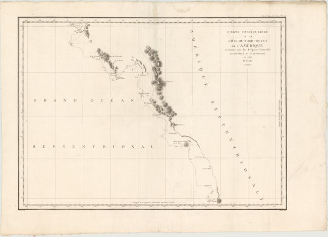
Auction 152, Lot 130
Subject: Western Canada & Alaska
La Perouse, Comte Jean F. Galoup, de
Carte Particuliere de la Cote du Nord-Ouest de l'Amerique Reconnue par les Fregates Francaises la Boussole et l'Astrolabe. En 1786 2e. Feuille, 1797
Size: 27 x 19.5 inches (68.6 x 49.5 cm)
Estimate: $160 - $190
Unsold
Closed on 2/18/2015
30 lots