A Cataloger's Perspective: Mapping South Americaby Eliane Dotson
This month we conclude our around-the-world series of "A Cataloger's Perspective" with the continent of South America. (As a reminder, you can view the previous articles in this series on maps of the world, North America, Asia, Europe or Africa in our newsletter archive.) With its riches, resources, and unexplored lands, South America was a popular destination for Europeans during the 16th to 18th centuries. As reports of the geography, natives, flora and fauna found their way back to Europe, accounts were written and maps were drawn. Of course some reports were less accurate than others, and some authors and cartographers chose to romanticize or embellish their work to make them more appealing to their patrons. As a result, maps of South America are a treasure trove of myths, misinterpretations, and evolving cartography. Here are some of our favorites. (Click on any image below to view the entire map. A few of the images are not clickable as they are items in our upcoming auction and not yet on our website.)
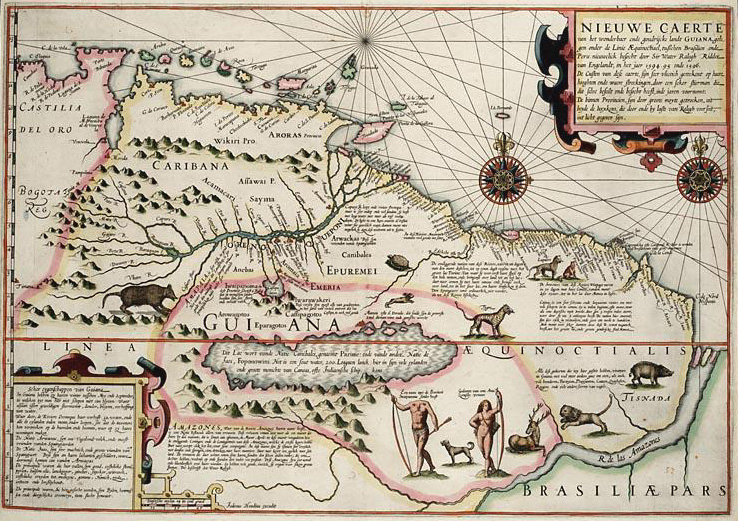
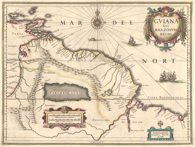
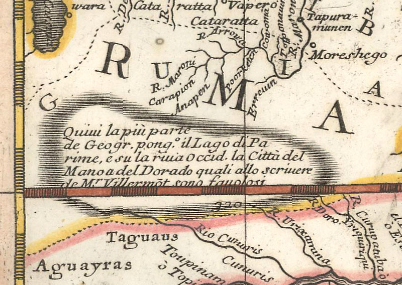
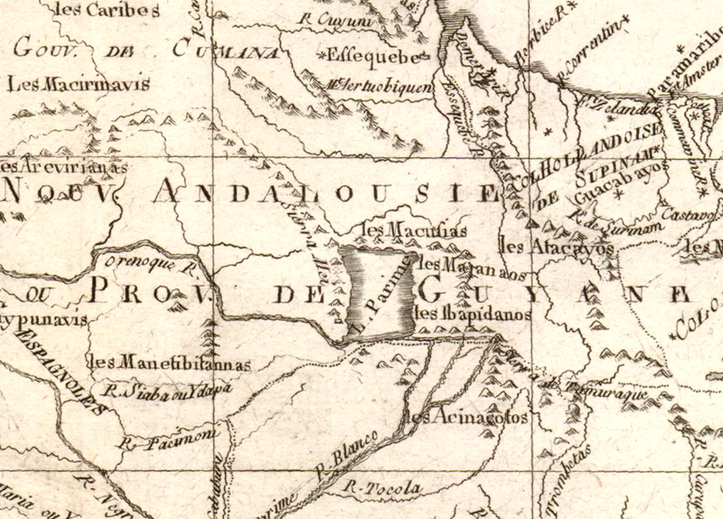
Lake Parime & El Dorado The mythical Lake Parime and golden city of El Dorado began with reports of a Chief who practiced a ritual involving gold, in which he would be covered in gold dust prior to being cleansed in the sacred Lake Guatavita. This ceremony is described in the accounts of several European explorers, including Gonzalo Fernandez de Oviedo (1541), Juan de Castellanos (c. 1588), and Juan Rodriguez Freyle (1638). The accounts of the ceremony and "the golden man" eventually transformed into the myth of a golden city, named El Dorado, which lay on the banks of a large lake. Finding this lake was key to finding the golden city, and numerous explorers led failed attempts to find either between the 16th to 18th centuries. Over time, the city of El Dorado also became known as Manoa, and the lake on which it was located became known as Lake Parime. After Sir Walter Raleigh's account of Guiana in 1596, Lake Parime and El Dorado (or Manoa) began appearing on maps of South America. Although their existence was occasionally called into question by cartographers, they appear on maps through the end of the 18th century. The legend was finally disproved by Alexander von Humboldt's expedition through Latin America from 1799-1804. (Click here to read a more in-depth article on the Lake Parime from our archives.)
This map was based on Raleigh's work and depicts an elongated Lake Parime south of the Orinoco River, with the majority of the lake positioned south of the equator, and with Manoa on the northern shore, towards the eastern half of the lake. Manoa is noted as "the greatest city in the entire world." Jodocus Hondius Sr., Nieuwe Caerte van het Wonderbaer ende Goudrycke Landt Guiana, 1596.
Blaeu's map is a close copy of Hessel Gerritsz' map of 1625, with an enormous and almost rectangular Parime Lacus just north of the equator, and "Manoa, o el Dorado" now on the northwestern shore. Willem Blaeu, Guiana sive Amazonum Regio, 1630.
Here a conjectural Lake Parime is depicted with a note explaining that although the majority of geographers place the lake with Manoa on its western shore, the account is "fantastical." Vicenzo Maria Coronelli, America Meridionale, 1691.
Bonne's map shows a rectangular-shaped Lake Parime oriented north-south and located further to the east, with no city on its shores. Rigobert Bonne, Carte du Nouv. Rme. de Grenade, 1780.
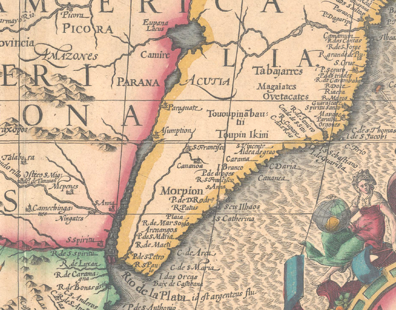
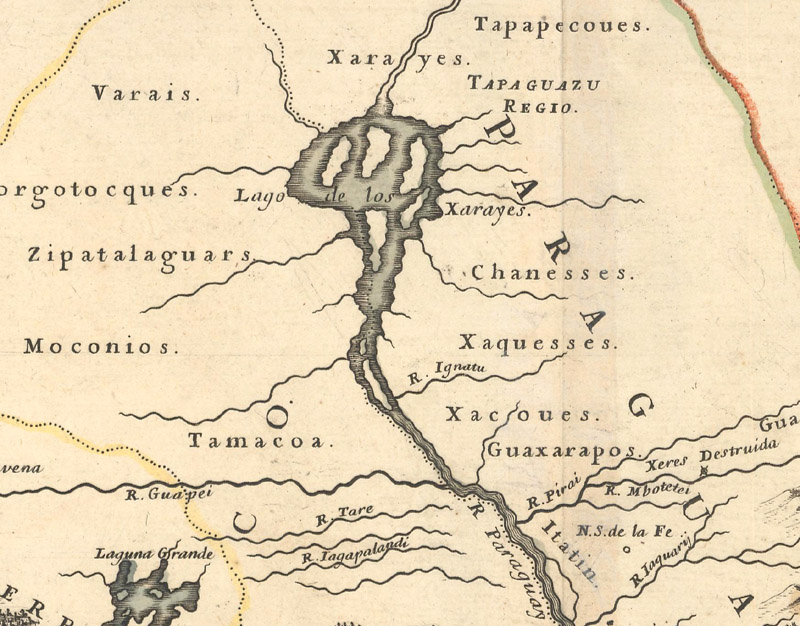
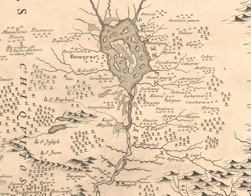
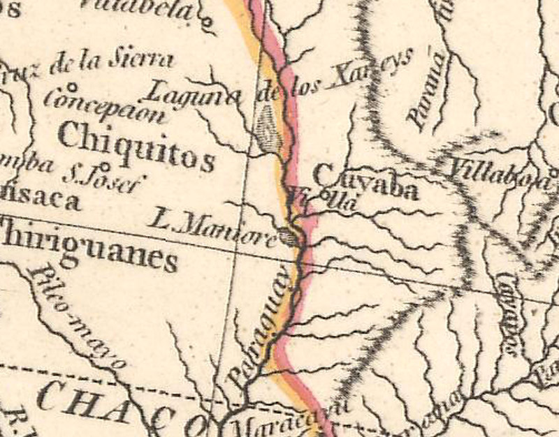
Lake Xarayes In central South America, along the present-day borders of Brazil, Paraguay and Bolivia, is a large basin that receives runoff water from upland areas. This region, known today as the Pantanal, is the world's largest wetlands and over the centuries has experienced periods of great flooding. As a result, the area was mistaken by early explorers as a lake. The lake is depicted on many maps of South America, called either Eupana or Xarayes (or alternatively Xareyes, Xaraes, or Xaraies), the latter of which was based on a local tribe of the same name. The water from this area is released into the Paraguay River and subsequently the Parana River, and the lake is typically depicted on maps as the source of one of these rivers.
Here Eupana Lacus connects to both the Amazon River and the Parana River, which is depicted too far to the east. Mercator/Hondius, America Meridionalis, 1619.
Filled with islands, Lago de los Xarayes connects to the Paraguay River. Sanson/Mariette, Le Paraguay Tire des Relations les Plus Recentes, 1668.
A large island labeled "Orejones" fills the middle of the lake, with numerous other smaller islands, and the lake is surrounded by villages. Francisco Davila, Paraquariae Provinciae Soc. Jesu cum Adjacentib. Novissima Descriptio..., 1722.
A small remnant of "Xareys" remains, although it is considered a lagoon instead of a lake. William Faden, A Map of America, or the New World, 1797.
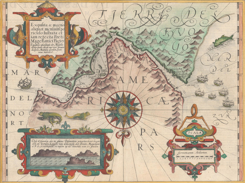
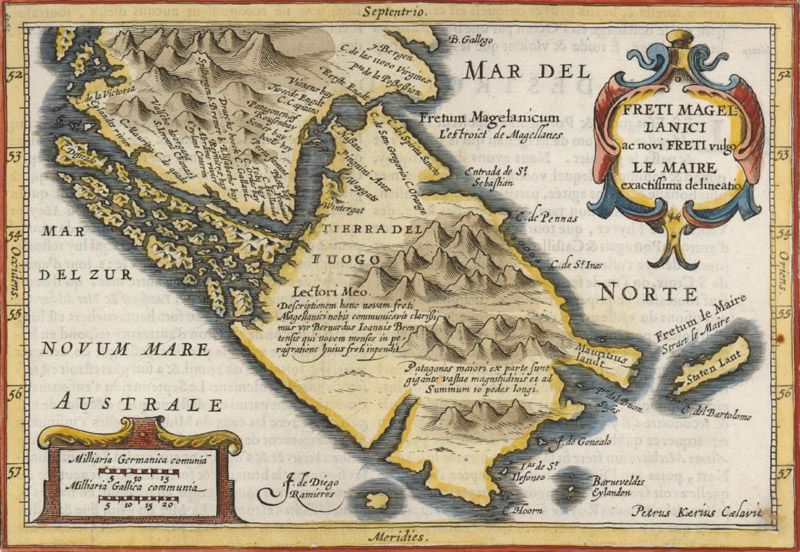
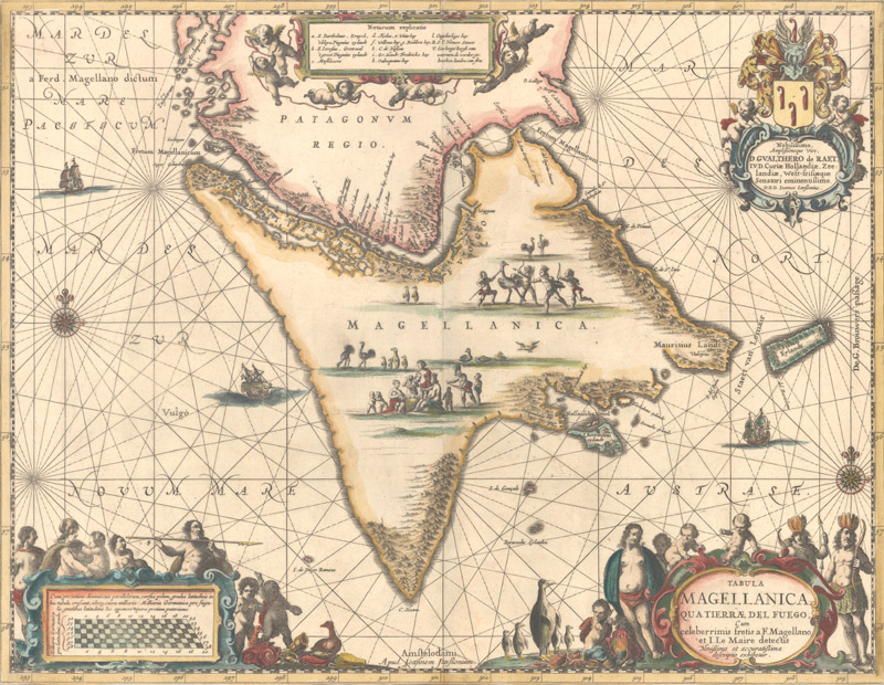
Tierra del Fuego Ferdinand Magellan's circumnavigation of the world in 1519-22 (despite his death) furthered European interest in and knowledge of South America. The name Tierra del Fuego is believed to have been coined by Magellan himself, who sighted fires built by natives that were visible from the sea. The Strait named after the explorer began appearing on maps of the world and western hemisphere as early as 1527, but did not become a common feature until a decade later. These early maps depicted Tierra del Fuego as part of the great Southern Continent (Terra Australis). Tierra del Fuego began to take shape as an island after Jacob Le Maire's circumnavigation in 1615-16, in which he and his crew sailed around the southern portion of the island and discovered Cape Horn. The Strait of Magellan, being an important passage-way for European ships sailing west to the East Indies, became the focus of many maps during the 17th and 18th centuries.
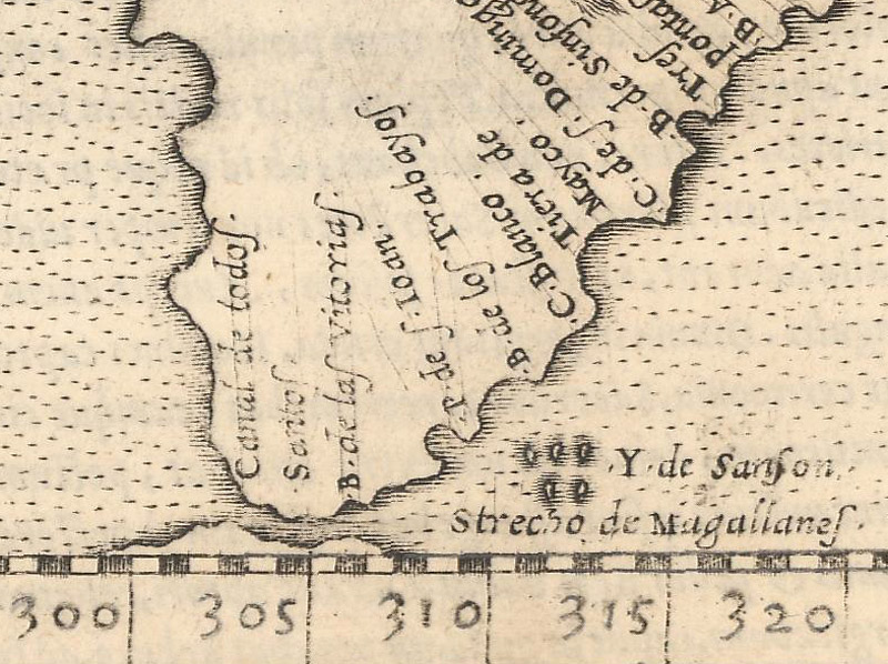
The "Strecho de Magellanes" is shown separating South America from an unnamed southern landmass. Girolamo Ruscelli, Tierra Nova, 1561.
The most decorative map of Tierra del Fuego, oriented with north to the bottom and adorned with penguins and sea lions. Mercator/Hondius, Exquisita & Magno Aliquot Mensium Periculo Lustrata Etiam Retecta Freti Magellanici Facies..., 1619.
One of the first regional maps to show Tierra del Fuego as an island and Le Maire Strait. Mercator/Jansson, Freti Magellanici ac novi Freti vulgo Le Maire Exactissima Delineatio, 1628.
Another decorative map of Tierra del Fuego featuring penguins, rheas and natives. Jan Jansson, Tabula Magellanica qua Tierrae del Fuego..., 1666.
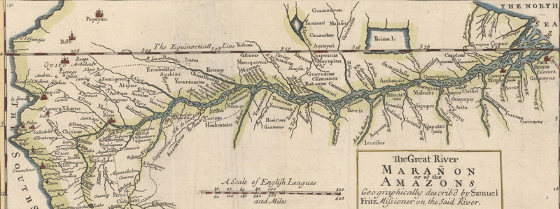
Amazon River Being the largest river in the world, the Amazon River has long interested explorers. The Spanish were the first Europeans to explore the Amazon River, with Vicente Yáñez Pinzónc credited as the first to sail up the Amazon River in 1500, and Francisco de Orellana as the first to travel from the near the origins of the river to the mouth in 1542. The river was initially called Maragnon, but was renamed Rio Amazonas by Orellana after he and his men were attacked by female warriors that reminded him of the Amazon warriors from Greek mythology. The correct source and course of the Amazon were not accurately mapped for centuries, although improvements were made based on several scientific explorations. Portuguese explorer Pedro Teixeira traveled up the river in 1637-38 and was the first to note the connection between the Amazon and the Orinoco Rivers. Czech Jesuit missionary Samuel Fritz established numerous missions along the river and produced the most accurate map to date of the river's course in 1707, with the source identified as the Marañón River. Other explorers further refined the mapping of the Amazon, including Charles Marie de La Condamine, Alexander von Humboldt, and William Lewis Herndon.
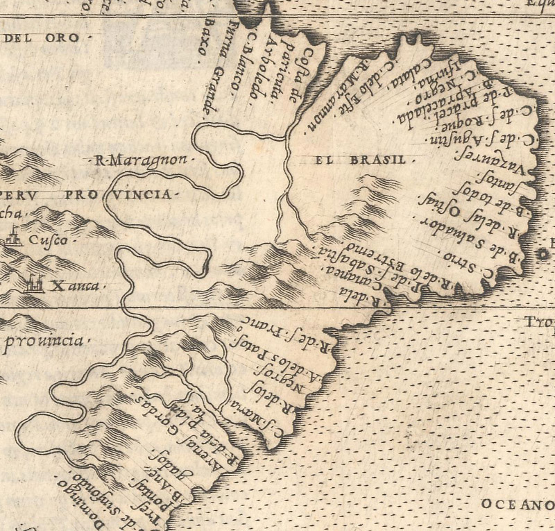
The Amazon is named "R. Maragnon" and winds its way north from present-day Argentina, south of the Rio de la Plata. Girolamo Ruscelli, Tierra Nova, 1561.
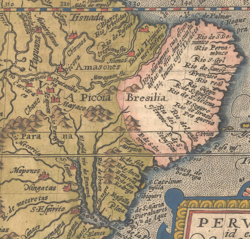
The Amazon now flows correctly to the east, and is named both Maragnon and Amazonis. Matthias von Kinckelbach Quad, Peruvia id est, Novi Orbis Pars Meridionalis..., 1598.
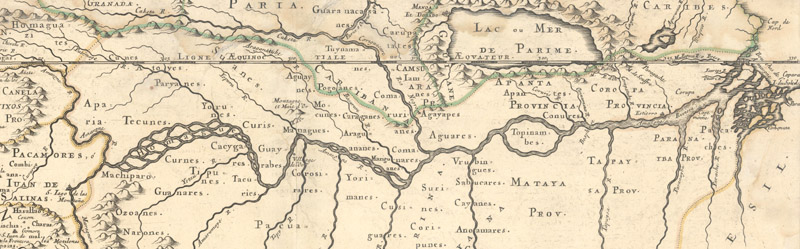
Teixeira's discovery that the Amazon connects to the Orinoco is shown in this map. Sanson/Mariette, Le Perou et le Cours de la Riviere Amazone, 1656.
Based on Fritz' original map, this English example shows great improvements in the course of the Amazon. Samuel Fritz, The Great River Maranon or of the Amazons..., 1717.
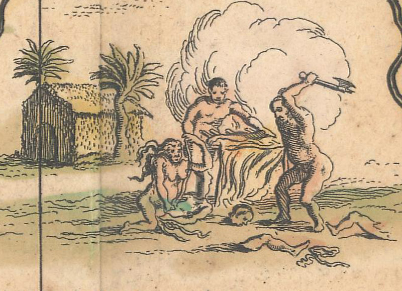
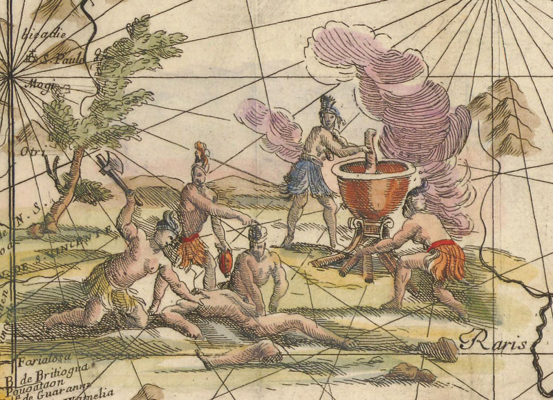
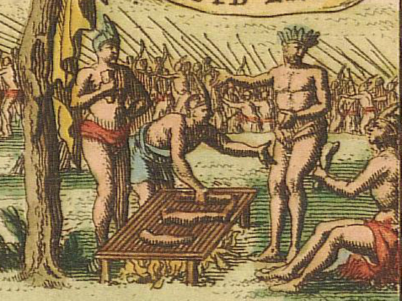
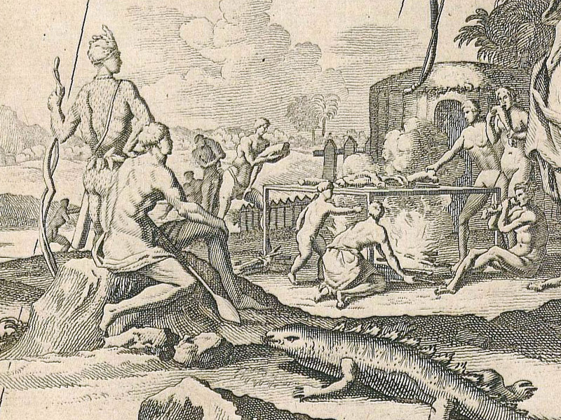
Cannibals The term cannibalism was originally derived by the Spanish to describe the Island Carib people, a West Indies tribe that was believed to practice cannibalism. The term was used by numerous explorers to describe various tribes of natives in South America, although cannibalism was most commonly associated with Brazil and the Tupinambá people. Despite the fact that archaeological and written evidence exists to support certain instances of cannibalism, unfounded accusations of cannibalism were also used by Europeans to infer cultural superiority and to justify attacks on indigenous people.
Hondius/Blaeu, Novus Brasiliae Typus, 1640.
Andreas Antonius Horatius, Il Regno del Brasile Parte Novilisima del Mondo Nuouo..., 1698.
Pieter van der Aa, P. Carders Zee en Land Reyse na Brasil..., 1706.
John Senex, South America Corrected from the Observations Communicated by the Royal Society's of London & Paris..., 1710.
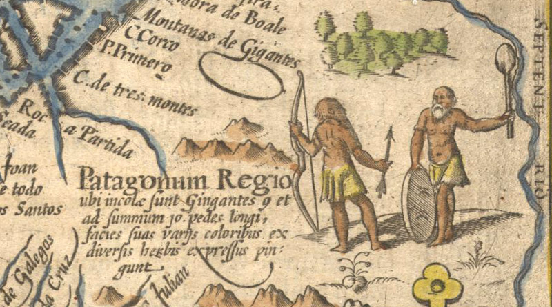
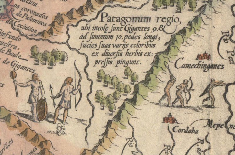
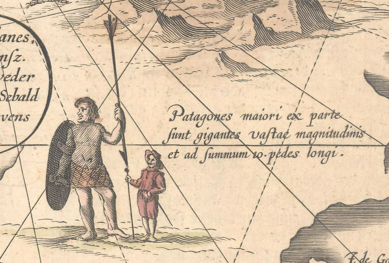
Patagonian Giants The first mention of giants sighted in the present-day region of Patagonia came from the account of Ferdinand Magellan's circumnavigation of the world in the 1520's. The account, written by one of the survivors of Magellan's crew, Antonio Pigafetta, claimed that Magellan had named the giants "Patagoni." Many assumed that the term was derived from the Portuguese word for foot ("pata") and translated Patagonia as "Land of the Bigfeet." Although the etymology of the name Patagoni is unclear (as others claim it is derived from the 1512 novel Primaleón by Francisco Vázquez that features a monstrous character named Patagón), the name became used widely in both historical accounts and on maps with claims that the giants were anywhere from 7 to 10 feet tall.
Petrus Kaerius, Fretum Magellanicum, 1598.
Linschoten/Langren, Delineatio Omnium Orarum Totius Australis Partis Americae..., 1596.
Hondius/Blaeu, Freti Magellanici ac Novi Freti Vulgo Le Maire Exactissima Delineatio..., 1635.
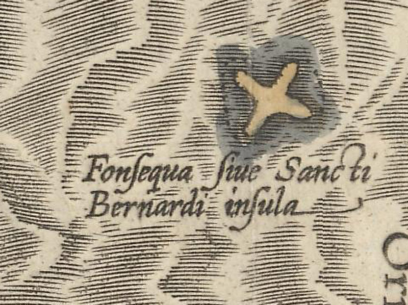
Imaginary islands Numerous islands surround South America, but on maps of the past, not all of the islands depicted actually existed. As explorers sailed the seas, they made note of islands, outcroppings of land, and navigational hazards. Of course measuring the exact location of these sightings with the instruments available at the time was a challenge when at high sea, leading to mistakes and misinterpretations. Below are some of the more notable imaginary islands that can be found surrounding South America.
Although the origin of the fictional Fonseca Island (also called S. Bernaldo) is unclear, it appeared on maps northeast of Venezuela beginning in 1544. Cornelis Wytfliet, Residuum Continentis cum Adiacentibus Insulis, 1598.
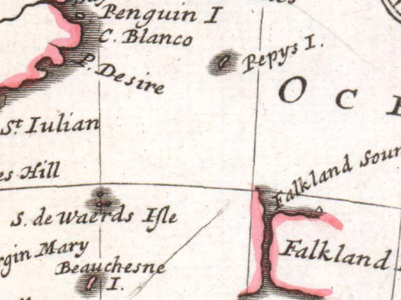
Pepys Island, just north of the Falkland Islands, was fabricated by William Hacke to please Samuel Pepys, the secretary of the Admiralty, and ended up appearing on over 100 maps. Herman Moll, A Map of Chili, Patagonia, Part of La Plata &c., 1740.
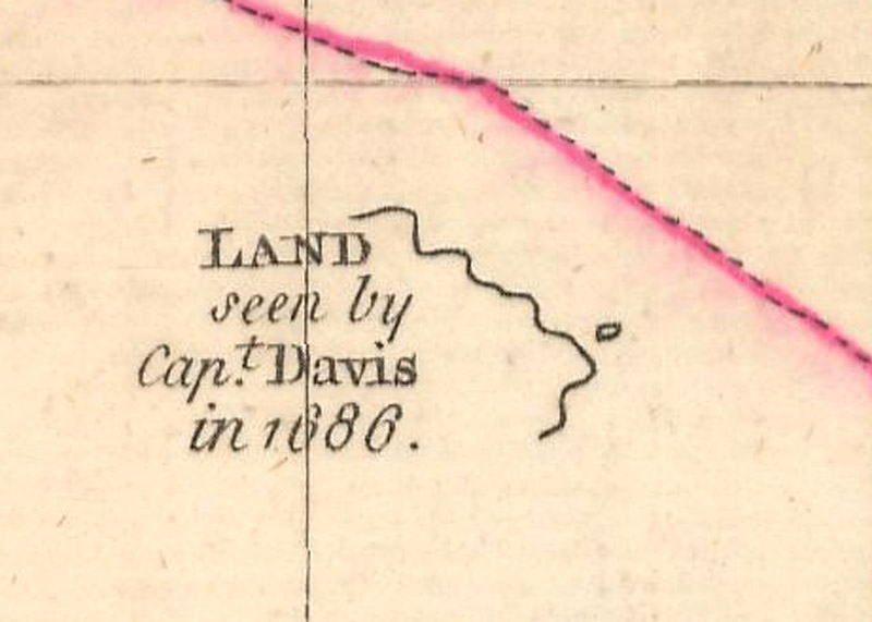
William Dampier and Lionel Wafer wrote accounts of their voyage aboard Edward Davis' ship and the sighting of Davis Island 1500 miles off the coast of Chile in 1686. Thomas Jefferys, Chart of South America, Comprehending the West Indies, with the Adjacent Islands, in the Southern Ocean, and South Sea, 1753.
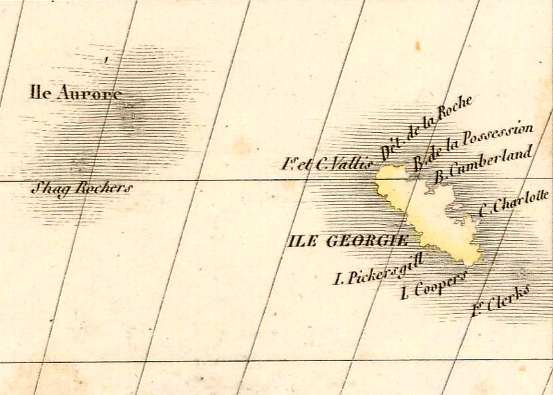
Located between the Falkland Islands and South Georgia, the Aurora Islands were "discovered" by a Spanish merchant ship of the same name in 1762. Alexander Emile & Pierre Lapie, Carte de la Plata du Chili et de la Patagonie, 1828.
Conclusion We hope you have enjoyed this whirlwind tour around the world. These brief guides of the world and each of the continents are intended to help you appreciate maps and their intricate details even more. Although we've highlighted some of the key features and cartographic misconceptions to be found on each continent, there are many more to be discovered. For an in-depth account/description of the mapping of the world or continents, we encourage you to review one of these excellent reference works:
World: Shirley, Rodney, The Mapping of the World Early Printed World Maps 1472-1700, Holland Press Limited, London, 1987.
North America: Burden, Philip, The Mapping of North America (Volumes I and II), Raleigh Publications, Herts, England, 1996-2007.
Africa: Betz, Richard L., The Mapping of Africa: A Cartobibliography of Printed Maps of the African Continent to 1700, Hes & De Graaf Publishers, t’ Goy-Houten, the Netherlands, 2007.
Asia: Davison, Dr. Julian & Tan Lay Kee, Mapping the Continent of Asia, Antiques of the Orient Pte. Ltd., Singapore, 1994.
Europe: Heijden, H.A.M van der, De Oudste Gedrukte Kaarten van Europa, Alphen aan de Rijn: Canaletto, 1992.
South America: Dym, Jordana & Karl Offen, Mapping Latin America, University of Chicago Press, Chicago, 2011.
References
Baynton-Williams, Ashley, Lake Parime, MapForum Issue 2, London, Summer 2004.
Brooke-Hitching, Edward, The Phantom Atlas, Chronicle Books, San Francisco, 2018.
Dym, Jordana & Karl Offen, Mapping Latin America, University of Chicago Press, Chicago, 2011.