Subject: South America
Period: 1780 (circa)
Publication:
Color: Black & White
Size:
12.3 x 8.3 inches
31.2 x 21.1 cm
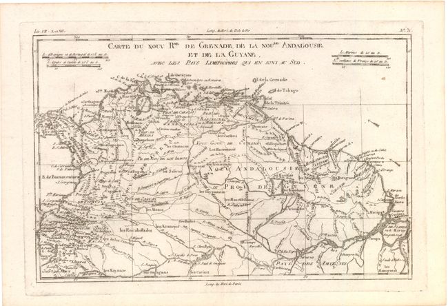
A) Carte du Nouv. Rme. de Grenade, de la Noule. Andalousie, et de la Guyane, avec les Pays Limitrophes qui en sont au Sud, (12.3 x 8.3). Detailed copper engraved map of the northern part of the continent. A remnant of the mythical L. Parime is shown in Guyana. There is very good detail of settlements and topography, and the direction of the trade winds are shown in the Atlantic.
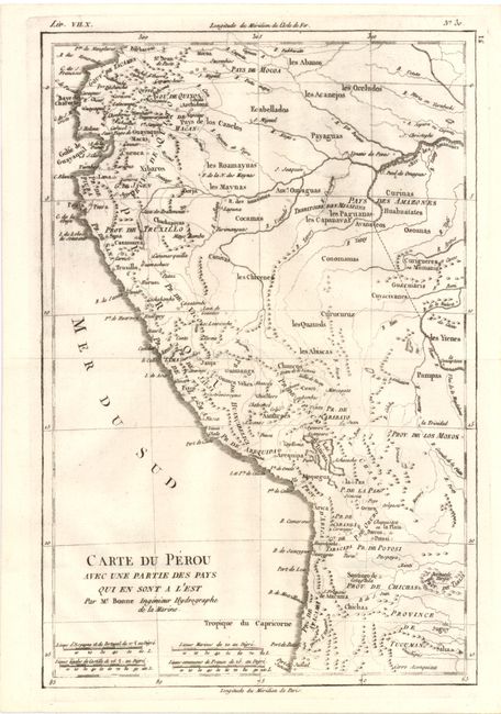
B) Carte du Perou avec une Partie des Pays qui en sont a l'Est… (8.5 x 12.5"). Attractive regional map of the western coast of South America extending from Ecuador, through Peru and present-day Bolivia, into northern Chili. There is nice detail with the locations of numerous missions and many other place names throughout.
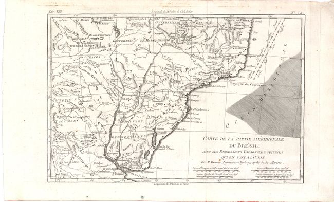
C) Carte de la Partie Meridionale Du Bresil (12.5 x 8.3"). This map depicts southern Brazil from Porto Seguro to the mouth of the La Plata River. The direction of trade winds are shown in the Atlantic. The interior is sparsely detailed except for Indian tribes and the locations of Jesuit missions.
References:
Condition: A
Some areas of light printer's ink residue. Map C has light soiling in upper blank margin.