Catalog Archive
Auction 98, Lot 63

"Carte de l'Amerique Corrigee et augmentee; dessus toutes les aultres cy devant faictes par P. Bertius", Bertius/Tavernier

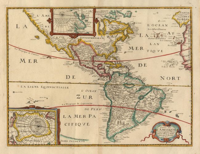
Subject: Western Hemisphere

Period: 1662 (dated)

Publication:

Color: Hand Color

Size:
14.1 x 10.7 inches
35.8 x 27.2 cm
Download High Resolution Image
(or just click on image to launch the Zoom viewer)

Scarce derivative of the Bertius/Tavernier (1627) map that was in turn based on Hondius' seminal map of the Americas. This reduced version, probably published in Pierre d'Avity's "Description generale de l'Amerique", does not include the embellishments in the seas of the 1627 version. The map was first issued in 1639, this being the third state. The most interesting feature is a fascinating variation on the Island of California theory by insertion of a spurious river that bisects the peninsula. Insets of the North and South Poles, scenes engraved in South America and a strapwork title cartouche.

References: Burden #256, state 3.

Condition: A

Fine crisp impression with attractive later coloring. Couple of tiny wormholes at lower fold.

Estimate: $1,600 - $1,400

Unsold

Closed on 3/6/2002

Archived