Catalog Archive
Auction 98, Lot 347

"Melita", Munster, Sebastian
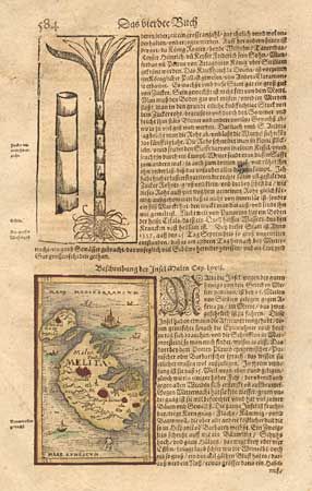
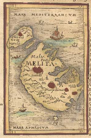
Subject: Malta

Period: 1560 (circa)

Publication: Cosmographia

Color: Hand Color

Size:
3 x 4.8 inches
7.6 x 12.2 cm
Download High Resolution Image
(or just click on image to launch the Zoom viewer)

This tiny map, set into a sheet of text, is one of the earliest available maps of the strategically important Mediterranean islands of Malta and Gozo. The woodblock map shows the ports and cities and is surrounded by several ships.

References:

Condition: A

Toned with some light foxing in text.

Estimate: $275 - $300

Sold for: $160

Closed on 3/6/2002

Archived