Catalog Archive
Auction 98, Lot 218

"Railroad and Sectional Map of Wisconsin", Harrison & Warner
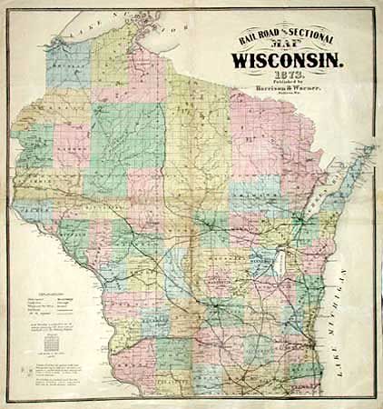
Subject: Wisconsin

Period: 1873 (dated)

Publication:

Color: Hand Color

Size:
24.7 x 26.2 inches
62.7 x 66.5 cm
Download High Resolution Image
(or just click on image to launch the Zoom viewer)

Great railroad map of the state showing existing and proposed lines in great detail. Other features include roads, counties, villages, towns and county seats, watershed, and townships. Harrison and Warner created county atlases of Wisconsin, Iowa and Missouri in the 1870's. No direct reference found, but Phillips 2638 indicates that this map was likely included in every County Atlas.

References:

Condition: C

Crisp impression and good coloring. Surface abrasion along some folds associated with tiny areas of loss. Folding as issued.

Estimate: $200 - $250

Sold for: $110

Closed on 3/6/2002

Archived