Catalog Archive
Auction 98, Lot 191

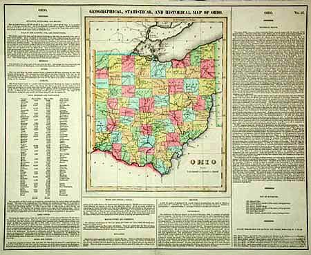
"Geographical, Statistical, and Historical Map of Ohio", Carey & Lea
Subject: Ohio

Period: 1822 (circa)

Publication: American Atlas

Color: Hand Color

Size:
9.6 x 12 inches
24.4 x 30.5 cm
Download High Resolution Image
(or just click on image to launch the Zoom viewer)

Beautiful drawn and engraved by F. Lucas. Shows the state with only 59 counties and a population of less than 6% of the present. Cleveland is a tiny burg, indistinguishable from other towns along the shoreline. Toledo, Akron, Youngstown and other cities are missing. At least 20 forts are located, many near the several Indian Reserves. A most handsome example of this map on a full folio sheet with surrounding historical text.

References: Phillips (A) 1373a-26.

Condition: A

Good impression and fine coloring. Short split at lower fold now closed with archival tape.

Estimate: $200 - $250

Sold for: $210

Closed on 3/6/2002

Archived