Catalog Archive
Auction 98, Lot 160
"Map of Part of the Island of Hawaii, Sandwich Islands Shewing the Craters and Eruption of May and June 1841", Wilkes, Charles
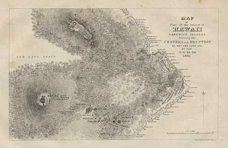
Subject: Hawaii
Period: 1845 (published)
Publication: Narrative of the United States Exploring Expedition, Vol 5.
Color: Black & White
Size:
7.1 x 4.5 inches
18 x 11.4 cm
Download High Resolution Image
(or just click on image to launch the Zoom viewer)
(or just click on image to launch the Zoom viewer)