Catalog Archive
Auction 97, Lot 96

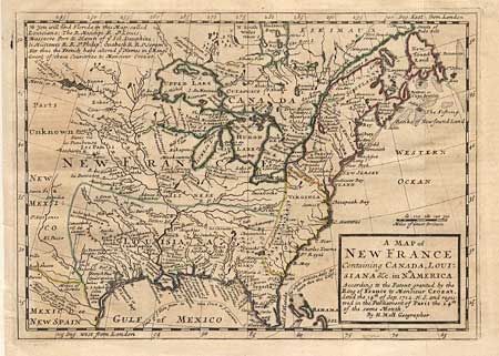
"A Map of New France Containing Canada, Louisiana &c. in Nth. America…", Moll, Herman
Subject: Colonial United States and Canada

Period: 1745 (circa)

Publication:

Color: Hand Color

Size:
10.2 x 7.2 inches
25.9 x 18.3 cm
Download High Resolution Image
(or just click on image to launch the Zoom viewer)

Interesting map depicting the European possessions in the eastern part of North America. France controls Canada and the Great Lakes region, the British colonies stretch from Carolina to Newfoundland, and Spain controls New Mexico, Louisiana and Florida. Filled with Indian place names and forts. In "New Mexico", Santa Fe, St. Antonio, and El Paso are named.

References: McCorkle #717-1

Condition: B

Light offsetting and short binder's tear into border, repaired.

Estimate: $450 - $500

Sold for: $325

Closed on 12/5/2001

Archived