Subject: Antarctica
Period: 1757-63 (published)
Publication: Gentleman's Magazine
Color: Black & White
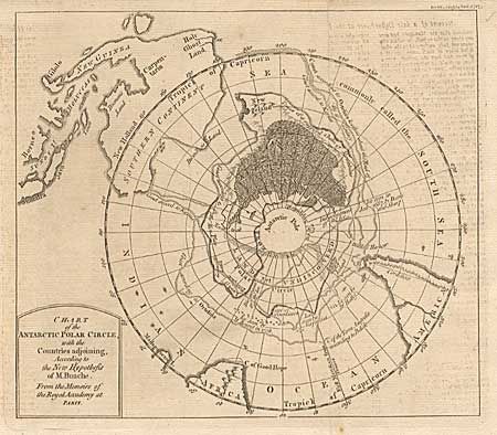
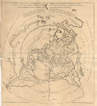
Two great Antarctic maps: "Chart of the Antarctic Polar Circle with the Countries adjoining, According to the New Hypothesis of M. Buache. From the Memoirs of the Royal Academy at Paris", 1763 (8.8 x 7.8"); and "A Physical Planisphere wherein are represented all the known Lands and Seas with the Great Chains of Mountains which traverse the Globe from the North Pole..", 1757 (11.5 x 12.3"). The maps give an interesting insight into Buache's imagination. In the former map, New Zealand is connected to the southern continent. Many notations including: "C. of the Terra Australis according to Delisle," "Land seen by M. Bouvet in 1738," several "Ice seen by..." comments, "Disgorgement of the Ice" and more. Australia and New Guinea are connected. The later depicts Buache's famous north polar projection showing his theory that the mountain ranges of the world are connected across the ocean basins.
References: Jolly GENT-104; GENT-166 & Marshall I-201-1-2 .
Condition: B
Former with some faint text offsetting (B). Later close trimmed at binder side with some loss and long tear into map repaired from back with tape (C).