Catalog Archive
Auction 97, Lot 187

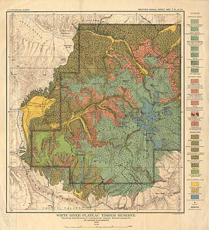
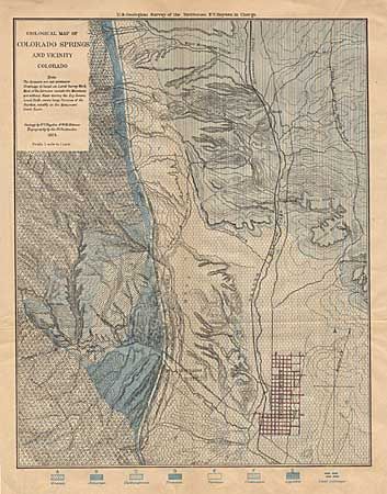
"Geological Map of Colorado Springs and Vicinity [together with] White River Plateau Timber Reserve", U.S. Geological Survey (USGS)

Subject: Colorado

Period: 1874-98 (dated)

Publication:

Color: Printed Color

Size:
See Description
Download High Resolution Image
(or just click on image to launch the Zoom viewer)

Pair of interesting Colorado maps. First (9 x 12") was prepared by F.V. Hayden, W.H. Holmes & G.B. Chuttenden during the Geological Survey of the Territories. It shows the various rock formation in the vicinity of Colorado Springs, Colorado City and Manitou. Second (14.2 x 16") was prepared for the Twentieth Annual Report, Part V, Pl. XLVIII. It is a fascinating and beautiful map showing the distribution of commercial timber, "burned areas" brush land, and agricultural land in northwestern Colorado.

References:

Condition: A

Both issued folded and now pressed for framing.

Estimate: $110 - $130

Sold for: $60

Closed on 12/5/2001

Archived