Catalog Archive
Auction 97, Lot 152
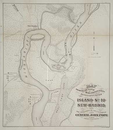
"Map Showing the System of Rebel Fortifications on the Mississippi River at Island No. 10 and New Madrid Also the Operations of the U.S. Forces under General John Pope Against these Positions", U.S. War Dept.
Subject: Missouri and Tennessee
Period: 1866 (published)
Publication: Report of Maj. Gen. Pope to the Committee on the Conduct of the War
Color: Black & White
Size:
17.2 x 20 inches
43.7 x 50.8 cm
Download High Resolution Image
(or just click on image to launch the Zoom viewer)
(or just click on image to launch the Zoom viewer)