Subject: North America
Period: 1830 (circa)
Publication:
Color: Hand Color
Size:
21.7 x 18.2 inches
55.1 x 46.2 cm
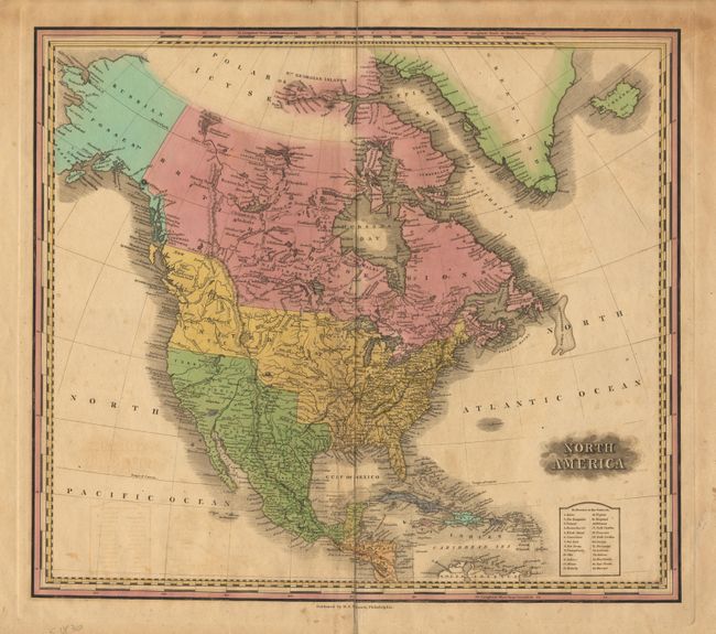
One of Tanner's more desirable and infrequently seen maps. Texas is shown as a part of Mexico, Oregon includes all of the Midwest to the east of the organized territories. Northwest Territory, Arkansas and Missouri are shown with Arkansas extending to the panhandle of Texas. The U.S./Canadian border in the west extends far north into British Columbia. Inset table names 26 states and territories. Crisp impression, strong color and full margins.
References:
Condition: B
Light scattered foxing and a little offsetting. Split at top into image and short tear at centerfold, both with no loss. One 1/4" spot of purple color in Atlantic. Attractive map in better condition that the description would indicate.