Catalog Archive
Auction 96, Lot 50

"Septentrionalium Terrarum Descript.", Jansson, Jan
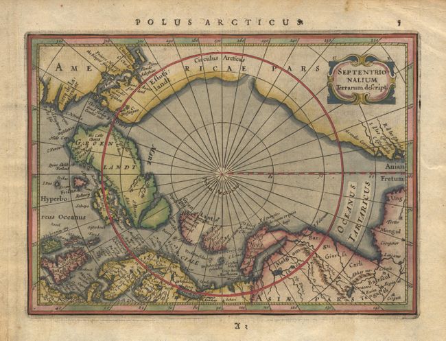
Subject: North Pole

Period: 1628 (published)

Publication: Atlas Minor Gerardi Mercatoris

Color: Hand Color

Size:
8 x 5.7 inches
20.3 x 14.5 cm
Download High Resolution Image
(or just click on image to launch the Zoom viewer)

This map is the first state of this copper-plate map of the North Pole first issued in 1628. Jansson's map does not follow Mercator, but used the knowledge of the many recent voyages of explorations that attempted to locate a northern route to Asia. Several fictitious islands, including Frisland, appear in the North Atlantic. Strapwork title cartouche. German text on verso.

References: Burden #222

Condition: A

Beautifully colored. Minor printer's crease and soil in margins.

Estimate: $200 - $275

Sold for: $325

Closed on 9/12/2001

Archived