Catalog Archive
Auction 96, Lot 277

"A Plan of the City's of London, Westminster and Borough of Southwark; with the new Additional Buildings: Anno 1720", Senex, John
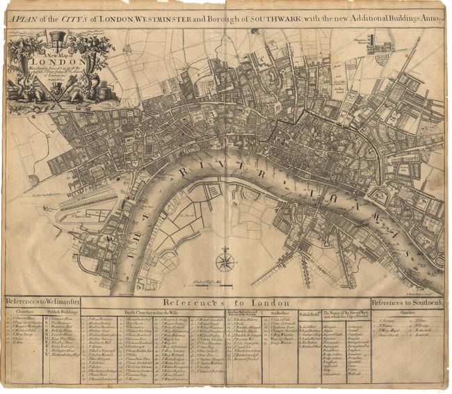
Subject: England

Period: 1720 (dated)

Publication: A New General Atlas…

Color: Black & White

Size:
23 x 19.8 inches
58.4 x 50.3 cm
Download High Resolution Image
(or just click on image to launch the Zoom viewer)

Scarce & detailed map of London drawn & engraved by Samuel Parker. The extents are "Buckingham House" in the west, Lambeth (with the Horse Ferry) in the south, Whitechapel in the East and Clerkenwell in the north. The decorative title cartouche contains the title "A New Map of London…" with a dedication to Sir Peter Delme who was an Alderman in 1720 when the map was made. Delme was extremely wealthy and influential and one of the first home-owner's in London's famed Grosvenor Square. He became Lord Mayor in 1723. Key at bottom of map.

References: Howgego 65.

Condition: A

Fine crisp impression. A few unobtrusive spots and surface soil. Professional repair of fold splits in text section. Close margins, as issued, with a couple of tiny chips expertly repaired.

Estimate: $1,600 - $1,800

Sold for: $1,000

Closed on 9/12/2001

Archived