Catalog Archive
Auction 96, Lot 251

"Carte de la Partie de l'Ocean Vers l'Equateur entre les Cotes d'Afrique et d' Amerique… [on sheet with] Plan de l'Isle de Fernand de Noronha…", Buache/Dezauche

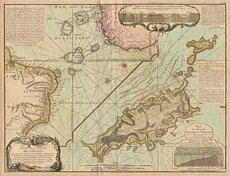
Subject: Atlantic Ocean

Period: 1780 (circa)

Publication: Atlas Geographique

Color: Hand Color

Size:
25 x 19 inches
63.5 x 48.3 cm
Download High Resolution Image
(or just click on image to launch the Zoom viewer)

An important early geological map in two sections. The left side is a chart of the South Atlantic with detailed coastlines of Africa and Brazil with the islands in between. The right side features a detailed chart of the Island Fernand de Noronha off the coast of Brazil. This map was issued in a series drawn by Philippe Buache to illustrate his theory of the continuity of mountain chains under the sea. At top is a cut-away plan, enclosed in a cartouche, showing these mountain ranges between the two continents. Another similar plan is incorporated into the cartouche for the Plan of Fernand de Noronha. Imprint of Dezauche who succeeded Buache in about 1780.

References:

Condition: B

Moderate foxing.

Estimate: $600 - $750

Sold for: $400

Closed on 9/12/2001

Archived