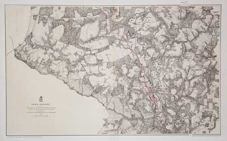
Subject: Virginia
Period: 1867 (dated)
Publication: Maj. J.E. Weyss
Color: Hand Color
Size:
32.5 x 19.8 inches
82.6 x 50.3 cm
Map of the Civil War battlefield of Cold Harbor. From surveys under the direction of Bvt. Brig. Gen. N. Michler, Maj. of Engineers and Bvt. Lieut. Col. P.S. Michie, Capt. of Engineers. By Command of Bvt. Maj. Gen. A.A. Humphreys, Brig. Genl. & Chief of Engineers. Scale 3 inches = 1 mile. Lithographed by Julius Bien with full-wash burnt umber background and the Union and Confederate entrenchments colored in strong blue and red. Shows roads, Virginia Central RR, houses, fences, names of inhabitants, vegetation, drainage, and relief hachures. One of the better maps of the area printed on heavy paper.
References: Stephenson #531.2.
Condition: A